PEOPLES OF SOUTHERN MÉRIDA
Nestled in the Venezuelan Andes, the Southern Towns are a region of Merida geography, covering thirty-five percent of its territory, with different climatic levels, from the warm climate of flat land to Barinas, the temperate zone, the cold earth and the moor zone near the Andean peaks.
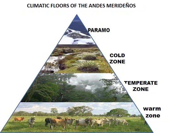
Source: mmp infographics
The region has three watersheds. To the north, the Chama Basin, which includes the Nuestra Señora River and the San Pablo, on its banks are the towns of El Morro, Los Nevados, Acequias, San José and Pueblo Nuevo, being the most arid slope. On the southern slopes of the Andean mountain range is the Caparo river basin, where the towns of Aricagua, Canaguá, Mucutuy, Mucuchachí, Chacantá and Santa María de Caparo are located. In the river basin of the Uribante are the populations of El Molino, Guaraque, Río Negro, Capurí, Mesa de Quintero.
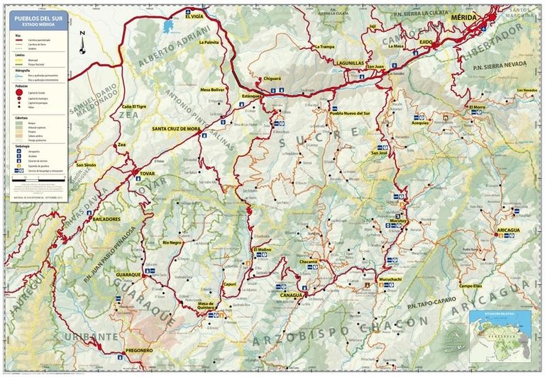
Map of the Peoples of the South
Source: Southern Towns map in PDF: http://destinopueblosdelsur.com/ingles/maps/
Many of the Indians who inhabited the territories that today make up the southern towns, were of Arawak origin, had reached these remote regions, sailing from the Orinoco river and up the river Apure, from the plains of Barinas, ascended by the foot of Andean mountain to settle in the foothills of the mountains of the mountains.
In the year 1558, an unexpected event occurred to these settlers. The Spaniards arrived from Nueva Granada, they came looking for gold, silver and precious stones, but in these territories they did not get the gold they expected, so for the conquistador, this region was considered a poor colony.
Beginning in 1570, the crown began to designate encomenderos and the founding of many towns began, among them the southern towns of Mérida: Guimaral, Canaguá, El Rincón, Acarigua, Acequias, Acarigua, Chacantá, El Molino, El Morro, Guaraque, Mesa Quintero, Mucuchachi, Mucutuy.
The Spanish occupation changed the territory, subdued the Indians and the crown began the regime of repartimientos and encomiendas, imposed a new god, a foreign language and slave labor methods, this iniquitous domination, did not annul their ancestral customs, grew the miscegenation and in time, the various Andean cultural manifestations, a religious syncretism that began during the colonial period and remained in spite of the permanent vigilance of the Church, continued to be combined in a surprising continuity and continue to be expressed through oral tradition. the presence of Spanish law and the hunting of rebellious Indians. In this time the zone of Lagunillas, was an economic and religious center of great reputation in the Andean mountain range.
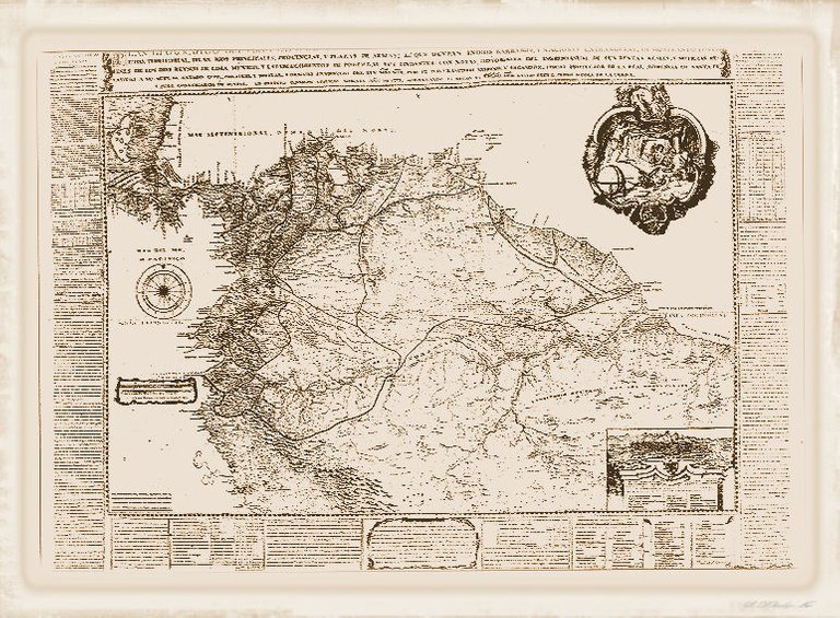
Viceroyalty of New Granada (1717-1819)
Source: Geographic Plan of the Viceroyalty of Santafé de Bogotá New Kingdom of Granada
http://www.colombiaaprende.edu.co/html/mediateca/1607/article-239552.html
In the colonial period the region was part of the Real Audiencia de Santafé de Bogotá, after independence it was part of the Gran Colombia, and from 1830 onwards, the Republic of Venezuela. At this time the backbone of communication in the territory was through the Camino Real, which linked all the populations of the Andean mountain range, from Trujillo to Santa Fe de Bogotá, the royal road ran from the páramos merideños, it was a journey cold and difficult, passing through banks of mist, which sometimes made the path lose travelers who went down to hot land. In order to arrive at the real road the inhabitants of the towns, they began making their crossing traveling by paved ways, these roads constructed according to the Spanish custom, of bridleways, these routes settled down in old indigenous paths, were narrow, made ways to peak and shovel by the inhabitants of the region, the paved roads were covered by mule trains, which climbed the mountain, while their muleteers whipped them with shouts and whistles.
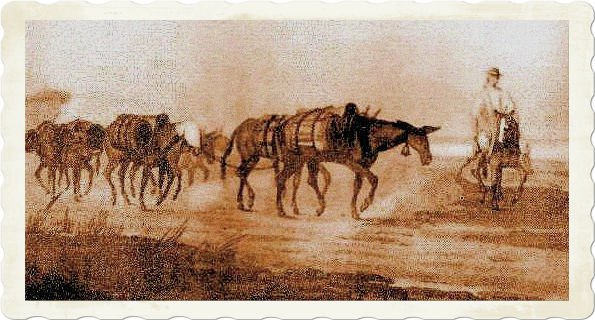
The mules in the colonial time and the feat of independence
Source: https://fuegocotidiano.blogspot.com/2011/10/las-mulas-en-los-llanos-en-el-tiempo.html
The roads along the northern slope of the southern towns were connected by Estanques, to reach Bailadores, Tovar, Santa Cruz de Mora, the valleys of the Rio Chama, and the Lake of Maracaibo, this gigantic body of water was at the time of Colonia is an excellent means of communication, land, New Granada and the Caribbean Sea.From the rural areas, the peasants came down the southern slopes of the mountain, communicating with the southern towns through Santa Bárbara, with the plains of Barinas, transporting the agricultural products they harvested by mule; potatoes, celery, wheat, coffee, tobacco.These roads survived earthquakes, rains, floods and landslides. In rainy seasons, as the rivers grow, they cross them through suspension bridges, tarabitas, sometimes the road becomes impassable due to the mudslides that were formed, but there was always the way to overcome the obstacle.
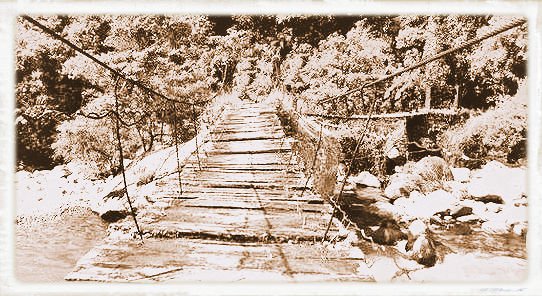
Suspension bridge. Camino Real del Carrizal: a reconnection trip
Source: http://www.estampas.com/entretenimiento/170402/camino-real-del-carrizal-un-viaje-de-reconexion
Beginning in the twentieth century, during the government of Juan Vicente Gómez, oil Venezuela began, and the first automobiles arrived in the country. The construction of the first roads was undertaken, including the Trans-Andean highway to the border with Colombia in the State of Táchira. The trans-Andean movement completely displaced the royal road and contributed to breaking the internal isolation of the country, causing a great impact on the population, because it managed to unite the Andean states with the rest of Venezuela.
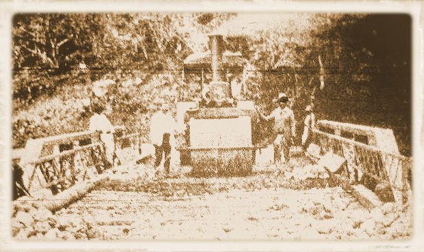
ExPart. Construction of the Trasandina Highway (1923)
Source: https://bitacorasamisan.blogspot.com/2016/09/el-gran-ferrocarril-del-tachira-un.html
The commercial route of the region flowed through the trans-Andean region, the Southern Peoples were geographically isolated for several decades, the mountainous topography of these places contributed to isolation in their rural world and paradoxically, this exclusion protected the region, its inhabitants continued to live its rhythm, according to the customs inherited from its indigenous and Spanish ancestors, living in an authentic way, respecting its traditions, in a mythical and remote world, with evocative panoramas of the beautiful Merida regions.
Beginning in the fifties of the last century, following the tradition of the founding settlers, construction began following the mule trails and opening new path to peak and shovel, without heavy machinery. Settlers and under the direction of enthusiastic priests and pioneers called, the road custos: Vicente Alarcón in Guaraque and Boanerges Uzcátegui of El Morro and Eustorgio Rivas took to this town of Canaguá, the first Jeep in 1954. It was the first road that connected through of rustic vehicles the Chama River basin of the northern slope with the nearby farmhouses and the rural areas of the southern towns.
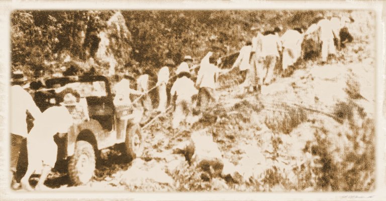
South Mail - Merideño. Honot to whom Honor Merece - Juan Francisco Mora "Correo"
Source: http://surmeridenocanagua.blogspot.com/2014/03/don-abdon-carrero-protagonista-de-la.html
At present there are two roads to reach the southern towns, one following the Chama basin of Merida State entering from Tovar, passing through the town of San Francisco, up the slope to the National Park of the Páramos de Batallón and La Negra , when you go down, you get to Guaraque. A town located on a branch of the Andes mountain range, in the Capurí river basin, stocked by the El Molino rivers and the Guaraque stream, these waters converge with other tributaries on the Uribante river, which flows into the Leonardo dam Ruiz Pineda, along this hydrographic basin are the populations of Rio Negro, Mesa de Quintero, El Molino and Capurí.
The rustic wagons that travel these localities, did not eliminate the animals of load like means of transport of more rural zones to the near towns. In recent years came the bikes, the iron horses. Most of the people of the Southern Towns are engaged in agricultural activities, practice traditional agriculture, have generated a very diverse social and cultural fabric, which allowed them to balance community development and environmental conservation, schools have to form to the new citizens.
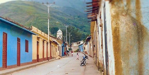
Street of Guaraque - Photo: mmp
As of today, the winding roads through the mountains have allowed vehicle traffic, the incorporation of electric, telephone and health services, and updating their agricultural activity. In recent years, tourist lodge projects have been implemented to offer visitors to the region accommodation, food, the human quality of its inhabitants and unforgettable landscapes.In the Peoples of the South its inhabitants, have lived through the years a peaceful existence, they are peoples of Catholic tradition, they live a syncretism in mythical worlds of other times, a universe of evocative images that insinuate themselves in the natural environment anchored to your reality The inhabitants have adopted self-sufficient forms of rural life, where time revives and adapts to a rhythm of life very distant from urban life.
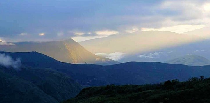
Cerro Babilonia
Source: http://destinopueblosdelsur.com/ingles/what-to-do/in-mesa-de-quintero/route-babilonia-hill/
- Electronic sources used images
Pueblos del Sur mapa en PDF
Fuente: http://destinopueblosdelsur.com/mapas/mapa-en-pdf/
Plan Geográfico del Vireynato de Santafé de Bogotá Nuevo Reino de Granada
Fuente: http://www.colombiaaprende.edu.co/html/mediateca/1607/article-239552.html
Las mulas en los llanos en el tiempo colonial y la gesta de independencia
Fuente: https://fuegocotidiano.blogspot.com/2011/10/las-mulas-en-los-llanos-en-el-tiempo.html
Puente colgante Camino Real del Carrizal: un viaje de reconexión
Fuente: http://www.estampas.com/entretenimiento/170402/camino-real-del-carrizal-un-viaje-de-reconexion
Construcción de la Carretera Trasandina (1923)
Fuente: https://bitacorasamisan.blogspot.com/2016/09/el-gran-ferrocarril-del-tachira-un.html
Correo sur merideño. Juan Francisco Mora
Fuente: http://surmeridenocanagua.blogspot.com/2014/03/don-abdon-carrero-protagonista-de-la.html
Cerro Babilonia
Fuente. http://destinopueblosdelsur.com/que-hacer/en-mesa-de-quintero/ruta-cerro-babilonia/ - Revised online texts
De arrieros, caminos de herradura y troncales del Camino Real.
http://vamonosalbable.blogspot.com/2016/02/de-arrieros-caminos-de-herradura-y.html
La vialidad Prehispánica y Colonial (siglos XV - XVI - XVII) y el poblamiento de la cuenca alta del Rio Chama. Tesis de Rubén Hernández y María Santos. Escuela de Historia. ULA. 2004
http://www.colombiaaprende.edu.co/html/mediateca/1607/article-239552.html - Consulted books
Jacqueline Clarac de Briceño. Dioses en Exilio. Fundarte. Caracas. Venezuela. 1981
Jacqueline Clarac de Briceño. Etnografía Cronológica de los Andes Venezolanos. Talleres Gráficos ULA. Mérida. Venezuela. 1985 - Infographics & Photographs:
Marino Márquez Pineda –mmp-