WARNING: The use of images that are not your own on which you claim the ownership will be flagged and/or reported to @steemcleaners - HELPING TO STOP PLAGIARISM ON STEEMIT
Hello fellow Steemians!
Welcome to my 7 World’s Continents Photo Challenge - South American Saturday - where the winner of the weekly round will be able to participate for the total of 200 SBD! Today, you can participate by submitting your personal pictures from your travels to the continent of South America.
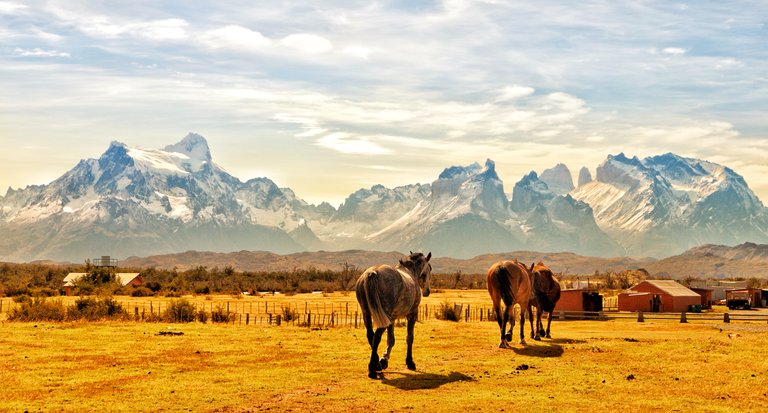
See the winner of the last week´s South American Saturday @itchyfeetdonica with the following entry:
Unlike most travelers who reached Torres del Paine National Park by land transportation from Puerto Natales of Chile, I arrived there through Rio Serrano by a ship and a small boat, and after a short hike upon landing, I captured this amazing view:
Click on the image for a large view
Your entries need to be submitted by 8 AM Central European Time in order to be considered for the challenge with a description of approximately 30 to 50 words. Only use of personal images will be accepted and only one picture can be submitted for a daily photo challenge. Ten winning photos will receive a bigger upvote from me and ten runners-up will get a smaller one.
Chosen from the ten winning entries, the absolute winner of the day will receive extended publicity in my post tomorrow morning. I will also visit his/her blog to upvote one of the most recent posts. The winning picture of the daily challenge will then automatically enter other rounds with the absolute winner gaining approximately 200 SBD in total.
Please see the winners of the previous contests of the week and give them your support if you like their images to be the one winning the weekly price and entering the other stages of the 7 World’s Continents Photo Challenge. You can vote for them by upvoting their winner announcement posts below:
7 World’s Continents Photo Challenge - Asian Sunday week #37 - winner announcement!
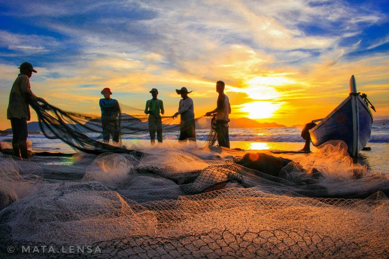
@mata.lensa Asian Sunday entry:
Activities that have been hereditary since the past until now and still done traditionally to this day."Tarek pukat" Is a daily tradition for local people living on the coastal periphery. Uniquely this activity is done mandatory in men and performed 6 to 9 men.
Click on the image for a large view
7 World’s Continents Photo Challenge - Australian Monday week #37 - winner announcement!
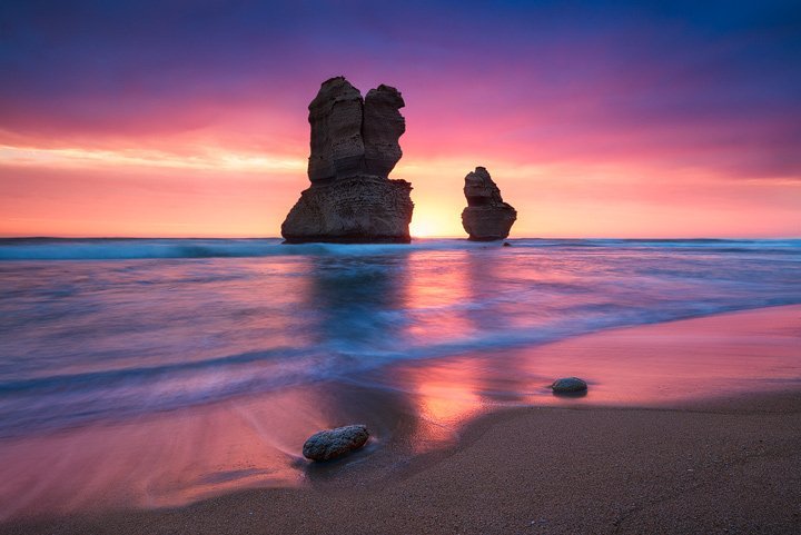
@mibreit-photo Australian Monday entry:
When I was travelling through Australia I spent two days on the Great Ocean Road. The weather was quite grey and I didn't get good light for the first day and a half. And also the last evening didn't look different. I still went down to the Gibson Steps and waited. This light was the reward.
Click on the image for a large view
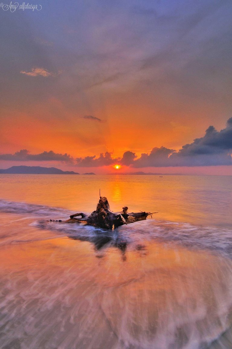
@amyalfatasya Tuesday of Antarctica and World´s Oceans entry:
This is a panorama of sunset on the beach "Gampong Jawa" Aceh Indonesia. Different beaches at the "Banda aceh" edge area are also the lane of the ship that passes into the "Sabang" area Every day many ships pass through these oceans. This beach is also more and more visited by residents of "banda Aceh" and its surroundings because of its beauty and cleanliness.
Click on the image for a large view
7 World’s Continents Photo Challenge - African Wednesday week #37 - winner announcement!
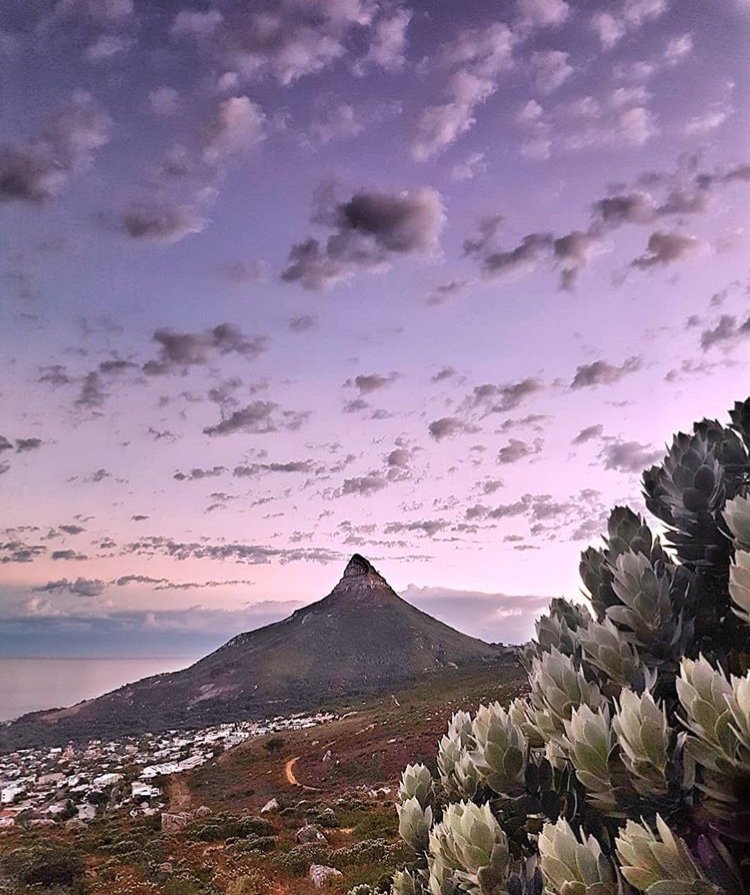
@michaeljn African Wednesday entry:
Photo taken during a hike: View of Lion's Head with our favourite flower the Protea in the foreground - Cape Town South Africa. "Lion's Head is a mountain in Cape Town, South Africa, between Table Mountain and Signal Hill. Lion's Head peaks at 669 metres above sea level. Protea is both the botanical name and the English common name of a genus of South African flowering plants, sometimes also called sugarbushes or Fynbos. In local tradition, the Protea flower represents change and hope."
Click on the image for a large view
7 World’s Continents Photo Challenge - European Thursday week #37 - winner announcement!
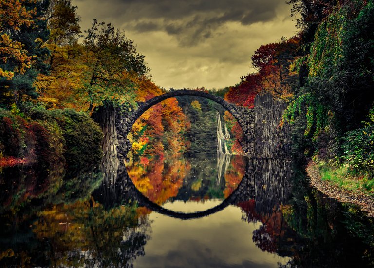
@davedavis91 European Thursday entry:
European?! Well let's see what I have. I took this shot about a year ago in Saxony, Germany, very close to the Czech Border. A well hidden treasure that got famous through RedBull and Instagram. A park in which a half round Bridge forms a perfect circle in its own reflection. Surrounded by Trees and abstract rock formations. Magical place. The autumn colors round it up to a perfect frame!
Click on the image for a large view
7 World’s Continents Photo Challenge - North American Friday week #37 - winner announcement!
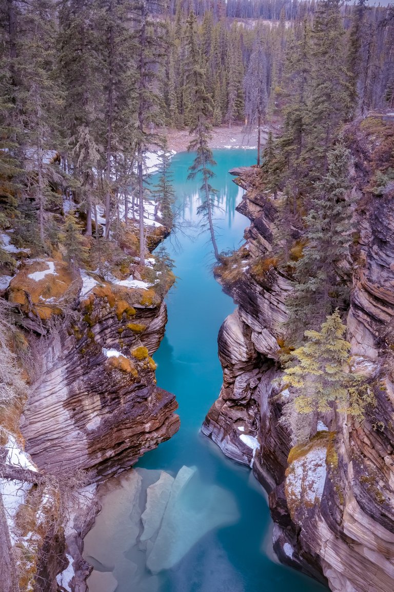
@intrepidphotos North American Friday entry:
It's not often you get a sense of stillness at Athabasca falls. This shot was taken last spring looking through the canyon downstream of the falls. The shoulder seasons are nice in places like Athabasca so one can experience them without the crowds. People fall into this canyon almost every year and most don't live to tell the tale. Athabasca Falls, Jasper National Park, Alberta, Canada.
Click on the image for a large view
For more information about the 7 World’s Continents Photo Challenge and conditions see my original post: 200 SBD 7 World's Continents Photo Challenge - 2018 guidelines – 09/05 update.
Please feel free to check out some of my other recent posts.
Prague Museum Night starts tomorrow, entrance and transportation is free!
7 World's Continents Photo Challenge - week #36 - vote for your favorite picture of the week!
ColorChallenge - Blue Friday - @jumartphoto in 7 World's Continents Photo Challenge!
Tomas
CEO & Founder of CGH


Thanks ever so much for your wonderful entry!
Beautiful shot! The name sounds scary, haha... Are the mountains always in clouds?
Thank you for your comment, it was an extraordinary but exhausting experience, it was 5 days walking to reach the summit of the mountain on the right. Yes, clouds usually surround the mountains, but that day was especially clear and beautiful.
Wow. This is so cool. I like that trail leading up in your shot.
I shot this photo when trekking in the breathtaking Cordillera Vilcanota in the Peruvian Andes. I got up at 3am and hiked a whole day in the thin air to the peak of 5200 metres. As one of the few remaining pastoralist societies in the world, the herders here use the high mountain trails to trade with agricultural communities at lower elevations.
Yet another mind-blowing image!
Beautiful photo, it has always seemed to me that the Peruvian indigenous people live with an inner peace that is very difficult to describe.
Thanks Jose! :) You mean the highlanders right? Perhaps because of the deep mountains... The people from the jungle or the seaside of the country seem to be different.
Holy crap. You are throwing out some amazing landscapes. That outfit is pretty cool.
Our last day in Uyuni, Bolivia we got up early to watch the sunrise over the salt flats. The sunrise was nothing special but we were early enough to see the moon setting behind some hills. A couple minutes after this picture the moon was completely gone.
That is truly spectacular! Thank you.
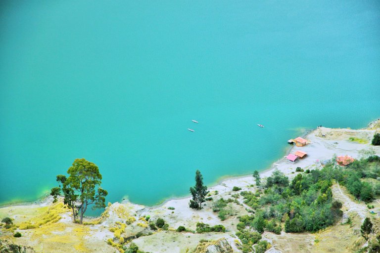
Quilotoa, Ecuador
Quilotoa is a spectacular crater lake in the Ecuadorian Andes. I had planned on doing a multi-day hike in the region, but got unlucky with the weather. When seeking for shelter from the purring rain on my hike, I was invited by a local family, so it turned out as a great experience in the end!
1/250s; 40mm; f/9.0; ISO 100
I have also posted this photo on my blog.
Thank you so much for your wonderful entry. Enjoy your Sunday. Tomas
Thanks Tomas, you too!
Love the unique perspective and composition of your photo. I also posted shots of Quilotoa here before, such a gorgeous place! =)
And it's another photo of the same place I posted in Whereisit Photogames, in the comment you said "the vegetation looks a bit like somewhere in the Southeast of Australia." ;) Now I see why since you had totally different weather in Quilotoa.
Haha, Quilotoa looks so different in your photo! Great shot!
Camera: Kool Digital
What a gorgeous sunset!
Sierra Nevada National Park (Mérida, Venezuela)
The Sierra Nevada National Park (PNSN) is a national park of Venezuela located between the states of Merida and Barinas in the west of the country. Founded on May 2, 1952 by decree 393 of President Germán Suárez Flamerich, with the objective of protecting the Sierra Nevada de Mérida within the Andean mountain range.
With its creation, it became the second National Park decreed, after the Henri Pittier National Park, which would begin the history of Venezuela's national parks 15 years earlier.
The Sierra Nevada is an area of great ecological importance for Venezuela, as it ensures the preservation of the highest ecosystem in the country, where the highest mountain ranges of the Venezuelan Andes are located, including Pico Bolívar, the highest geographical feature. of Venezuela with 5007 ms. n. m.
What a great image! For you next entry try to keep the description just bit shorter - around 50 words.
The Pululahua Crater, Quito Ecuador
The Pululahua volcano crater is located on the edge of the Manuel Cordova Galarza highway. Following the road is very easy to reach because you only need to pass by or return to the road after the monument that remembers the passage of the Equator through the country. The crater is a natural formation product of ancient eruptions of a large volcano. According to data from the Geophysical Institute of the National Polytechnic School, the last activity of the colossus occurred approximately 2,200 years ago. This process is attributed to the migration of the members of the Cotocollao culture. Contrary to what is believed, the volcano is not extinct, it is classified as potentially active within the classification of the Geophysicist. However, after the eruption of the domes formed around 2,400 years ago, the Pululahua has remained inactive until now.
What a wonderful image! Thank you so much for your participation. Tomas
The state of Sucre is part of the northeastern region of Venezuela and has beautiful and representative beaches. Walking along some beaches I could see this view of the sea with the boats, something totally relaxing. The waters of this beach were calm and serene, ideal to share a pleasant moment with the family.
That looks so peaceful and relaxing, I would love to transfer myself just right out there.
This is the lighthouse of the Bay of Charagato, on the island of Cubagua, in Venezuela. An excellent place to take a boat ride, snorkel, and learn more about the wonders of this beautiful country. This is an island where many of the scientific investigations of the sciences applied to the sea are carried out, due to their biological diversity.
Thank you for your entry. Kindly stay tuned for the winner announcement coming later on today. Tomas
The mangroves are one of the natural beauties that you will find in the "Peninsula de Macanao", located on the Margarita island-Venezuela. This is a small take from the outskirts of the National Park "Laguna de la Restinga" in the town of "Boca del Río".Besides being a tourist attraction, it is also a source of life for fishermen, since in this lagoon oysters are captured that are sold on the beaches of the area.
This photo was taken on the peninsula of Macanao. State Nueva Esparta , in Venezuela, This sector would be part of the land that makes up the University of the East, dedicated to the study of the sea, the pier shows the boats used for field trips for the investigation.
Location: Merida, Venezuela.
Camera: Fujifilms JX-200
Orinoco Delta - Venezuela. It is a MAGICAL PLACE, it has a great richness not only of landscapes but of flora and fauna. It is a zone of water and jungle, there are also lakes of quicksand. It is divided into 40 channels that carry water to the Atlantic.
View from a viewpoint on the beach "Los Cachicamos" in the state of Sucre (Venezuela) this photo was difficult to take because the viewpoint was made of sticks and palm trees moved by the wind and gave the feeling that you were falling, besides the difficulty to get down from there. However, the result was lovely.
Cuyagua, Aragua State - Venezuela
Well, this photo was taken from a place known as "the viewpoint" on a surfer beach in my country called Cuyagua, located on the coasts of Aragua State, inside the country's largest and oldest national park: Henri National Park Pittier.
To access this site you have to walk the entire shore of the beach until you reach the rocky mountains, where you start to climb the mountain by the paths of the edges until you reach the viewpoint, where you have to be very careful because this is a cliff with a fall to the sea where the waves lap with the mountain, whoever falls there, no god saves him.
Thanks ever so much for your participation! Have a great day and keep on steeming. Tomas
Thank you for paying attention to my photo. regards
Click to enlarge the image
The legendary tepuyes; the preservation of indigenous settlements, rich in history and tradition, the impressive waterfalls, the range of colors and natural textures, catapult Canaima National Park as a first class tourist option for Venezuelans and foreign tourists.
The capital of Chile is Santiago's Chile, where it is very common to see all its inhabitants walking its long streets or by bicycle to save time, this is a dream city, and where there are many working people who leave early to meet their needs. daily obligations. It is a beautiful country with incredible people.
Peru, country where these animals are their representative icon, llamas, I have found these two beauties of llamas where it seemed that they were a couple or very close to each other. What I like most about this country is the care they have for these animals, where you can find them all over Machupichu.
Quito is the capital of Ecuador and destination of many Venezuelans in the current crisis, this picture was taken in 2015 on a family trip, impossible to imagine that a short time later these squares are full of people looking for a better quality of life, Speaking of the photo, highlight that the historic center of this city is national heritage and its remodeling is forbidden, however, these colonial structures fall in love with those who visit the center of the world
The best contest photography
.
I think you probably need to write the description in English. I might be wrong though!
Yep, English only....
wowww the picture from @itchyfeetdonica was so beautiful !
Thanks Rina! Long time no see! =)