Ok, I thought I might do my own video about this hurricane since I now know what tools to use. So here is the video:
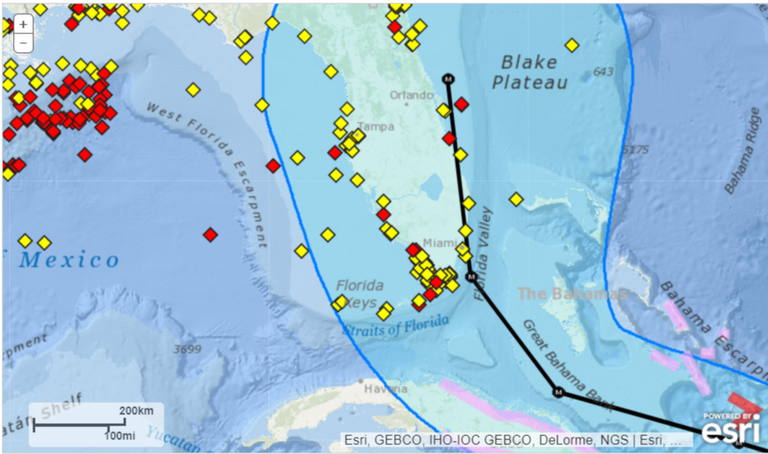
This is the latest path according to Noaa:

Comment: This would be extremely devastation since the hurricane will slam through 3 highly populated cities along the Florida coastline. Im talking about Miami, Fort Lauderdale and West Palm Beach and this is an area with a population of 4-5 million and the worst thing is that there will probably we swells of up to 32 feet or 10 meter waves coming in. Imagine what kind of floods that could cause.
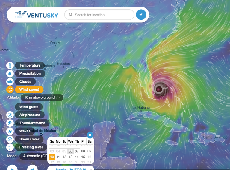
And this is path according to Ventusky:
Image 1 (first hit)

Comment: This would actually be a better path since it will only touch the Florida coastline, and that will most likely cause less damage.
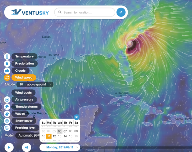
Image 2 (second hit)

Comment: As soon as Hurricane Irma leave the Florida coast it will go back to the Atlantic and then slam into either Georgia and/or South Carolina where it will make landfall. The winds will not be as strong up there, only 120 mph, but that is still a Category 3 Hurricane.
There you have it, I will keep you updated and if you want to go and check out Ventusky you can go right here:
https://www.ventusky.com/?p=26.1;-72.5;4&l=wind&t=20170910/18
Here is also the link to Noaa:
https://steemit.com/hurricane/@nx4440/hurricane-please-help-together-steemit-charity-steemit-and-bitcoin
Good report.
thx
god bless and have mercy