Africa’s coastline has few deep gulfs and penetrating estuaries and no extensive deep fiords. The old sailing ships found few good harbors which offered natural protection instead there were river mouths blocked by sandbars, hazardous coral reefs, shallow lagoons and beyond, the desert, rain forests or mountain ranges.
(I) SANDBAR AND LAGOON COASTS
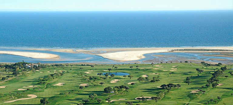
The stretch 900km along the West Africa Coast from Cape St.Ann to a point just East of Lagos. The shallow water just off-shore breaks the rotation motion of approaching waves which deposit long lines of sand a short distance from the coast, to form bars backed by shallow lagoons. While these lagoons form a natural inland waterway for light craft, they are too shallow for large Ocean-going vessels which have to anchor in the deeper open sea.
Many of these lagoons are being gradually filled with river silt and will eventually become marshy strips. Occasionally the line of sand spits are bars is broken by prominent rocky headlands.

image source
(II) RIA COASTS
These extend in a 1000 km long strip from Dakar to Sherbro Island including the coasts of Sierra Leone, Guinea and Guinea Bissau.
Lowlands and river valleys have been submerged by a rise in sea-level to produce ajigsaw pattern of deep inlets and small islands. The Sierra Leone estuary is an example

image source
(III) RAISED BEACHES
Similar to those of the Pleistocene coral raised beaches of the East African Coast are found elsewhere in Africa. Such beaches are due to isostatic uplift to the continent.

(IV) DELTAS
Deltas are the usual features of Africa’s river mouths and the Niger and Nile form outstanding examples. The Niger delta is acuspate or arcuate type, its curved shores extending 480km from near the Basin River to Opobo, 80km West of the cross river outlet
(V) LONG SHORE DRIFT
This occurs a long various stretches of the African coast, where there are strong currents and wind. Sand accumulation in bays and the development of sand spits are the results eg Bathurst stands on hooked sand spit which ends at banyan point and is backed by low swampy st.Mary’s island.
Superb, Excellent information you have shared.