South Africa counts among the world’s most biodiverse countries, after Brazil and Indonesia. Its scenic beauty must surely put it right up there with the best as well.
These are just a few randomly selected photo’s I have taken on my travels around the country as a tourism and environmental journalist.
 !
!
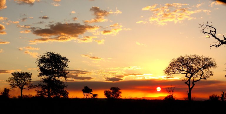
Kruger National Park, with a wealth of game and plant life, is South Africa’s flagship nature reserve. Its scenic beauty is no less arresting, particularly so in the early morning and late afternoon when the sun adds its spell. This picture was taken at sunset in the southern section of the park.
With origins going back to the 1890s, the 20 000 square kilometre park has a rich variety of habitats, created and supported by a varying geography, different climates producing different rainfalls along its 350 kilometres stretch from its south-eastern end to its north-western tip, and a wide range of natural features. The topography switches from plains to the low mountains of the Lebombo range, to rocky outcrops, and from gentle valleys to dramatic gorges. Five big rivers cut through it. It is crisscrossed by many smaller river courses, some mostly dry and others with more constant streams and pools.
It has no less than 2 000 plant species, and among this wealth of grass and brush and trees move about no fewer than 140 mammals, and slithers and wiggles around something like 114 reptile types. An astonishing 500 bird species occur within its boundaries. Its streams and pools are home to about 40 species of fish, and are a basic abode for at least 33 amphibians. And at a certain point, probably revised by now, as with most other species, there were known to be 227 species of butterfly flitting about its flowers and leaves.
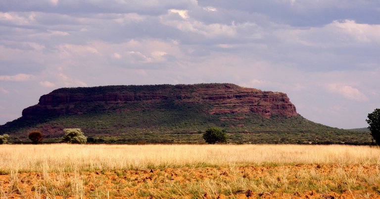
This flat-topped hill off the Great North Road from Johannesburg to the Zimbabwe border was once mistaken for a pyramid. It happened back in the 1830s when a group of European (mainly Dutch) zealots packed their ox wagons and left the Cape in disgust with the British rulers that had taken charge of their former Dutch settlement. They called themselves the Jerusalemtrekkers, meaning they were headed for the Holy Land.
Their journey took them through the vast semi-desert known as the Great Karoo, with its fierce landscape and extremes of heat and cold. Past what would later become the goldmining town of Johannesburg, they got to a mountain stream that had them convinced they had got to the start of the Nile River, so clear it was. They called it the De Nyl Zyn Oog, meaning The Eye of the Nile. They similarly thought the nearby flat-topped hill, now named Kranskop, was an overgrown and weathered pyramid.
As it turned out, the trekker known as Johan Enslin and his party were still about seven-thousand kilometres short of Egypt. But religious zeal was their strong point, not geography. So beautiful is the landscape, it is no wonder they got carried away a bit.
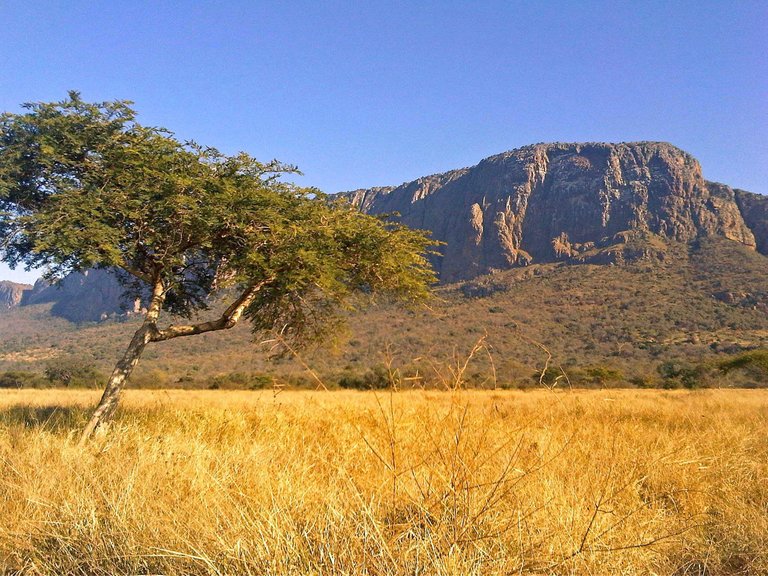
Blouberg Park is a small park with a big heart. Situated in the north-western part of South Africa it was proclaimed as a reserve back in 1983 mainly for the purpose of protecting the world’s biggest breeding colony of Cape vultures. The increasingly endangered species nest along the soaring southern cliffs of the inselberg from which the park takes its name, meaning Blue Mountain. There are only about 6 000 Cape vultures left. The number of breeding pairs using Blouberg is put at about a thousand, which heavily underscores its national, indeed global, worth as a reserve.
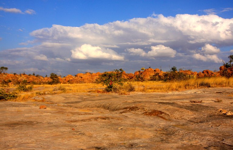
Dinosaurs once roamed this rocky landscape, stone-age beings chipped their way into mankind’s ancestry and the old San people painted their haunting pictures on rock walls, all adding to the region’s mystique. But what brought Mapungubwe National Park, in the far north-west of South Africa, to global attention was the archaeological discovery of the remains of an African kingdom that a thousand years ago was governed from a flat-topped hill among the region’s rocky mountains.
The park is called after the hill. The odd thing about it is that the name is variously given to, in the old indigenous language of the region, mean Place of the Stone of Wisdom, or Place of Jackals. What lends it particular significance is the discovery a gold-plated rhino, a golden sceptre and beads on the site. The idea is that, ensconced as they were on the hilltop, the old kings presided over a remarkably structured community. It proved wrong any idea that African people had only arrived in South Africa several centuries later. The legacy of that old community helped get the region declared as a World Heritage Site.
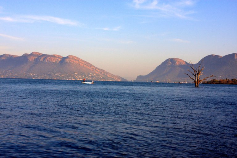
The Hartbeespoort Dam (Lake) north-west of Johannesburg strikes a pretty picture against the Magaliesberg in the background. The mountain range stretches from east of South Africa’s capital city of Pretoria in a slow S-bend westward where finally it levels out into what is known as the Bushveld.
The mountain range is said to be a hundred times older than Everest. It started to take shape 2 300 million years ago when Planet Earth was still at great odds with itself. It rose through tumultuous geological and seismic events from the retreating shallow sea that at first covered those parts.
Experts describe it as being at the interface of Africa’s two mighty biomes, the grassland pushing from the south and savannah reaching in from the north. In-between are montane forests in kloofs where they are protected from the elements and nourished by constant streams. There are also some endemic species which evolved with the mountain over the ages.
It recently got declared a World Biosphere Reserve. This includes the Cradle of Humankind which is situated across a valley from the Magaliesberg. It has a 58 000-hectare core protection area, the Magaliesberg part of which spans the length of its crest, taking in its high southern cliffs where Cape vultures breed and its extensive northern slopes that are interspersed with deep folds and ravines in which leopards may still be found prowling among high forest trees.
Nice place! i want to visit, thank for sharing!
Thanks. Do visit. It is a beautiful country.