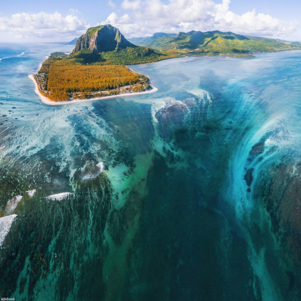
Le Morne Brabant is one of the most iconic hikes on the island with spectacular views of southwestern corner of the island. It was named a UNESCO World Heritage Site in 2008 in recognition of its function as a refuge for freed slaves in the 19th and early 20th century. It served as a vibrant hub for Creole culture for over two centuries.

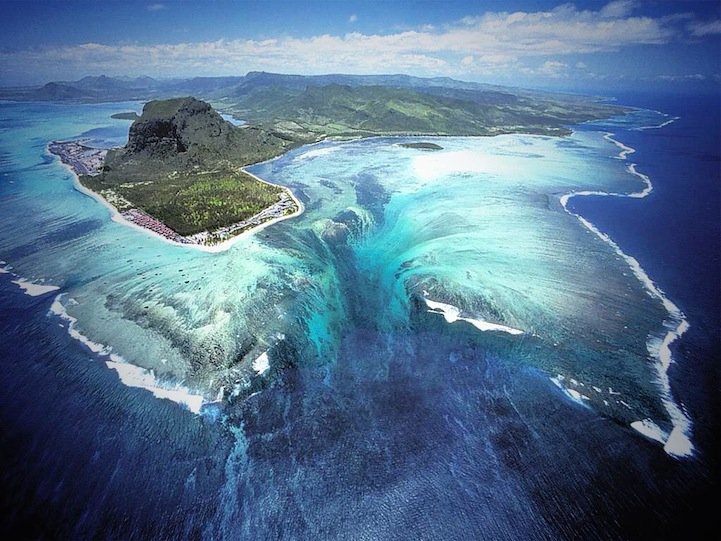
From an aerial view just off the island of Mauritius, there is what appears be an underwater waterfall. The picture below illustrates this visual phenomenon. THIS IS NO WORK OF PHOTOSHOP or visual modification.

The cause for this phenomenon is sand and silt moving down an underwater cliff as you guessed. The geography that makes this possible is as follows. The island of Mauritius is located on a giant plateau that was created by seafloor spreading a few million years ago. Most of which is under 8-150 meters of water. Where the waterfall effect occurs there is a huge drop-off which drops down thousands of meters. Because of the islands angle when the waves beat upon the shore and displace sand, the drawing out of the waves creates, you could say, a down pulling effect. This motion pulls the sand and silt down the drop-off, thus creating the underwater waterfall illusion. Because waves constantly bring sand and weathering and erosion keep making sand and silt, is not very probable that this illusion will stop for a long time, if it stop at all.
#Mauritius ... Our Paradise Island <3
Awesome place- perhaps in the running for the 10-year anniversary trip my husband and I are planning, thanks to this post! Oh, and a reason to splurge on a drone!
Most welcome to our island ... you will very like it.
haha a drone ofc will you get you amazed ... come and enjoy .
Thank you for sharing! I gave you a vote!!
Hi! I am a robot. I just upvoted you! I found similar content that readers might be interested in:
https://earthscience.stackexchange.com/questions/522/what-is-responsible-for-the-underwater-waterfall-illusion-of-mauritius-island