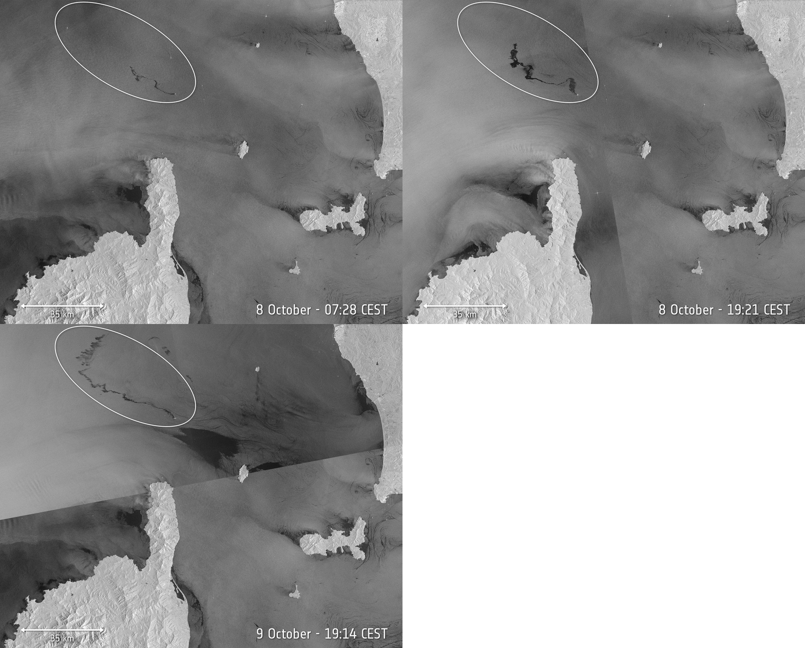
On 8 October 2018 at 05:28 GMT (07:28 CEST), the Copernicus Sentinel-1 mission captured its first images of the oil spill from a collision between two ships that had occurred the day before in the Mediterranean Sea, north of the French island of Corsica. This first image shows that the oil slick was about 20 km long. By the evening at 19:21 CEST, however, imagery shows that the slick had lengthened to about 35 km. And 24 hours later, on 9 October at 19:14 CEST, the slick had grown to about 60 km long.