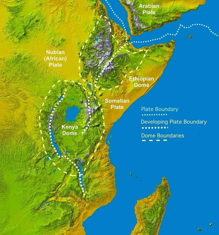
A big crack emerged in Kenya and it is growing. On March 29, 2018, a major fissure a few kilometers in width emerged in southern Kenya. The ongoing cracking caused the Mairobi Narok highway to collapse, accompanied by earthquake movements in the region. While changes in some aspects are almost invisible to us, the Earth is a constantly changing planet. Plate tectonics is a good example of this. But there are occasional influences and new questions about the division of the African Continent into two. Earth's lithospheres (formed by the upper side of the shell and shell) were divided into a series of tectonic plates. These plates are not static, but move in a "slip" sticky asthenosphere, attached to each other at various speeds. It is not yet certain exactly what the mechanisms or mechanisms behind the movements are, but it probably involves convection currents in asthenosphere and forces generated at the boundary between the plates. These forces do not simply move around the plates, but can also lead to the breakage of the plates, the formation of cracks, and the formation of potential new plate boundaries. The East African Rift system is an example of where it is nowadays. Most African Slit Valley lies 3,000 km south of Aden Gulf in the north towards Zimbabwe and divides the African plate into two unequal divisions: Somali and Nubian plates. When a large crack develops in the south-western part of Kenya, activities along Ethiopia, Kenya and Tanzania along the eastern flank of the slit become apparent.

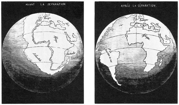
Why does the crack occur? : The lithosphere is stretched and examined when exposed to a horizontal expansion force. Eventually, it breaks, causing a cleft valley to form. It is accompanied by volcanism and seismic activity along the slope valley along with the surface expression. Cracks are the first step in breaking the continent and if successful it could lead to the formation of a new ocean basin. An example of this happening in the world that resulted in the separation of South America and Africa years ago is the South Atlantic Ocean. Have you ever noticed how your borders match like pieces of the same banner? Continental ruptures require the presence of expansion forces that are large enough to break the lithosphere.

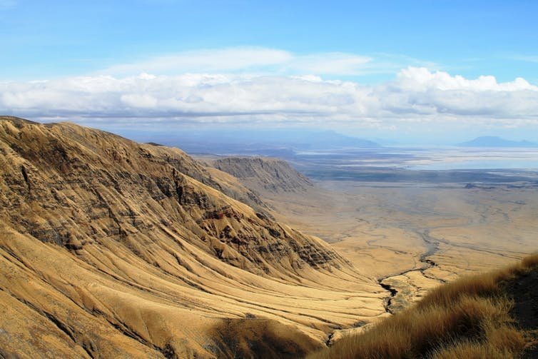
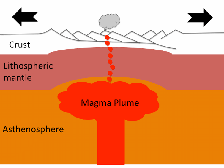
The East African Fracture is defined as an active fracture and the source of these stress lies in the circulation of the underlying mantle. Under this crack, a large mantle rise causes the lithosphere to rise upwards, eventually weakening the temperature increase and breaking due to faulting. Findings of mantle elevation which were warmer than normal were found in geophysical data and were named "African Superswell". This superplume is not only an accepted source of tensile separation forces resulting in the formation of slit valleys, but is also used to explain abnormally high topography of the South and East Africa Plates. Separation is not easy cracks show a very different topography characterized by a series of fault-bounded depressions surrounded by high land. In the East African system, a series of aligned cracked valleys separated by large delimiting faults can be clearly seen from the distance. Not all of these fractions were formed at the same time, but they followed a series of years ago in Northern Ethiopia, which started at about 30m in the Afar region and spread to Zimbabwe in the south averaging 2.5-5cm per year.

Although we have not noticed cracking many times, the formation of new faults and the formation of cracks or new movements along old faults can result in earthquakes as Nubia and Somalia plates continue to disperse. Somehow, in East Africa, most of the earthquake fields are spread over a wide area along the crack valley and are relatively small in size. The side-by-side volcanism is a more advanced surface appearance of the continuing continental fracture process and the proximity of the hot molten asthenosphere to the surface. A moving timeline, the East African Crack, is something unique that allows me to observe the different phases of the crack throughout its length. Since the crack is still small, in the south, the expansion rate is low, and so the faulting is a wide field.
However, the slit valley base towards the Afar region is covered with volcanic rocks. This field shows that the lithosphere is almost completely hugged to the point of separation. When this happens, a new ocean will begin to emerge with the solidification of the alanda magman created by the broken plates. Eventually, over a period of tens of millions of years, the spread of the seabed will proceed through the entire crack. It will fill the ocean and as a result the African continent will shrink and become a large island in the Indian Ocean, including some of Etiopian and somalia and the African Horn.

Source
Plagiarism is the copying & pasting of others work without giving credit to the original author or artist. Plagiarized posts are considered spam.
Spam is discouraged by the community, and may result in action from the cheetah bot.
More information and tips on sharing content.
If you believe this comment is in error, please contact us in #disputes on Discord
Hi! I am a robot. I just upvoted you! I found similar content that readers might be interested in:
https://www.youtube.com/watch?v=hQD7X76C0MIPlz help me , upvote my post
I am following you