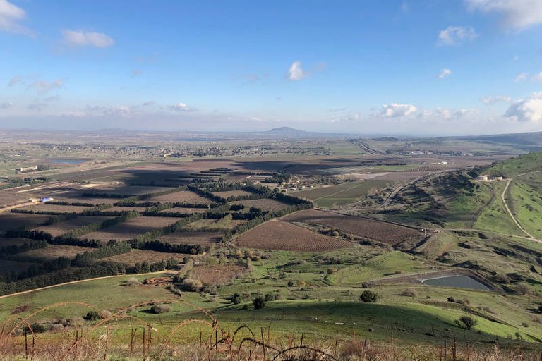
The Golan height are an elevated area in northeastern Israel along its border with Syria. It is one of the most rural and beautiful regions of the country and a hiker's paradise.
The Golan trail is a Hiking route about 120 Km long that runs from Mount Hermon at the North of the Golan at an elevation of about 1500 m ASL all the way to the south at about 200 m ASL near the sea of Galilee. It can be tackled from North to South or opposite. The full trail takes between 5 and 10 days depending of the traveler's ability and character. You can backpack and sleep rural, sleep at organized campsites, or in hostels and B&B in villages along the way.
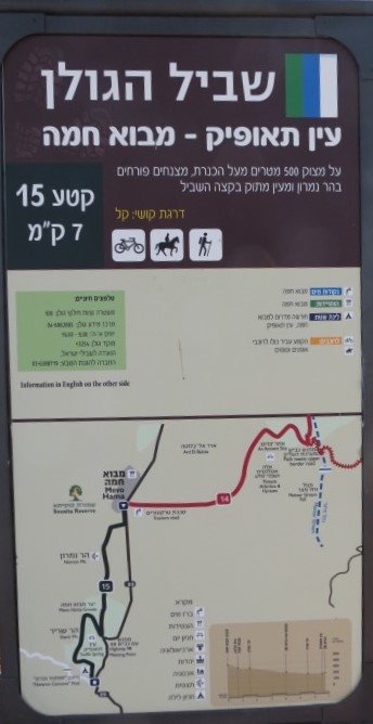
The trail is divided into 15 segments. At the beginning of each segment there is an information board with a map and elevation chart. The whole trail is very well waymarked with a "White/Green/White" 3 stripes marking. (More information of the 15 segment of the Golan Trail).
Some of the main attraction you will pass along the way:
- Mount Bental: Amazing views of Mount Hermon, The Golan and Syria. Ram Pool: A small lake in an extinct volcano crater.
- Rugum El Hiri: An ancient circular ritual site nicknamed sometimes as Israel's Stonehenge.
- Ein Keshatot: An ancient synagogue from the Talmudic period.
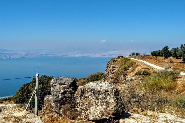
- Mevo Hama Cliffs: Cliffs overlooking the Sea of Galilee.
The Trail can be walked all year.
- Best period is March-May: Chances for rain are smaller and the land is Green, Fresh and full of wildflowers. (May could be already too hot)
- December-February: Temperatures are very good for hiking, but you should be ready also for some rain.
- October-November: Pleasant to a bit hot temperature and almost no rain. But the land is dry and dusty from the long summer.
- June-September: Very hot and dry. Not recommended. But can be done if it's your only option.