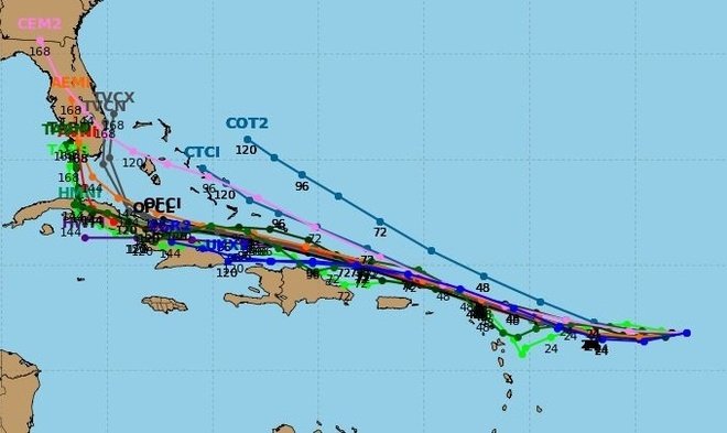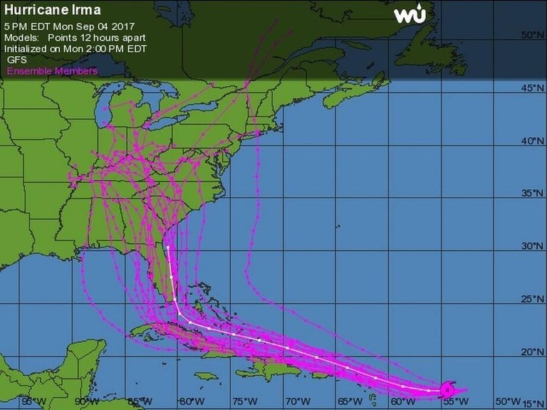
Now bearing down on the Caribbean, the latest GEFS model shows Hurricane Irma could be heading right towards Florida.
Most of the models still showing a sharp turn about 5 days out... but the path remains uncertain and things could still change. Predictions will improve over the coming days.
#HurricaneIrma is expected to be near the Cuba coast by Saturday. Right now Irma is moving toward the west-southwest near 13 mph.
NOAA’s Climate Prediction Center forecasts that the 2017 Atlantic hurricane season, which runs from June 1 through November 30, could be the busiest in seven years.
“We’re now entering the peak of the season when the bulk of the storms usually form,” said Gerry Bell, Ph.D., the lead seasonal hurricane forecaster at NOAA’s Climate Prediction Center.
The NOAA's National Hurricane Center (NHC) said Irma could have "some impacts" on Florida after passing the Caribbean.
Rick Scott, Gov of FL, declared the State of Emergency as Hurricane Irma makes her approach with a possibility of impacting millions of Floridians.
At this point, trying to predict the exact location of Irma’s landfall is no better than a guessing game.

