The Dickson Fjord Landslide and Tsunami
I have been reading about this particular event for the last few days, and it is so amazing and remote that I think this is ready for general consumption. It is like our planet was humming. Let me summarize the interesting geologic and climate change phenomenon I am talking about.
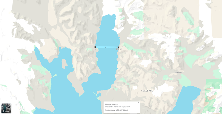
Dickson Fjord, the site of the 2023 landslide and tsunami, is a secluded and dramatic landscape located in the far northeastern corner of Greenland. The fjord is a narrow, deep waterway that stretches approximately 100 kilometers inland from the coast. Its steep, glaciated walls rise thousands of meters above the water, creating a breathtaking but inhospitable environment.
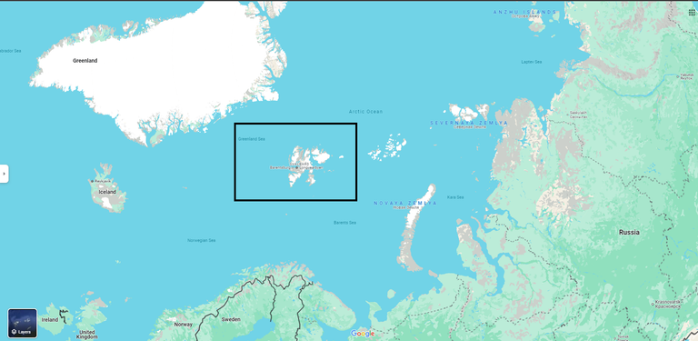
The topography of Dickson Fjord is characterized by a stark contrast between the rugged mountains and the pristine waters. The fjord is fed by several glaciers, including the massive Store Koldewey Glacier, which contributes to its impressive depth and cold temperatures. The surrounding landscape is dominated by barren rock formations and vast ice fields, making it one of the most remote and inhospitable regions on Earth.
Due to its remote location and harsh climate, Dickson Fjord is rarely visited by humans. There are no permanent settlements in the area, and only a handful of research stations and scientific expeditions have ventured into the region. The closest inhabited areas are located hundreds of kilometers away, making Dickson Fjord a truly isolated and unspoiled wilderness.
The remoteness of Dickson Fjord has contributed to its pristine condition. The lack of human activity has allowed the region's ecosystems to develop undisturbed, resulting in a unique and diverse range of flora and fauna. Despite the harsh climate, the fjord is home to a variety of marine life, including seals, whales, and polar bears. The surrounding mountains and glaciers also provide habitat for a number of Arctic bird species.
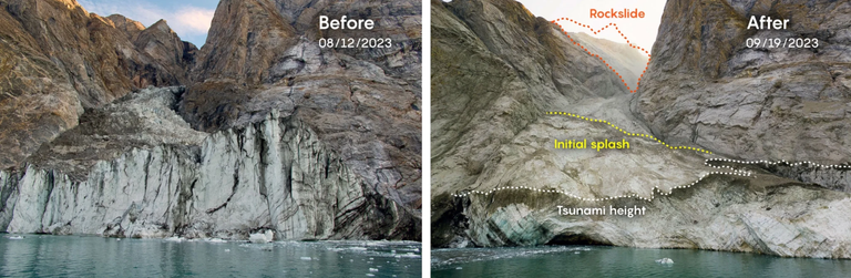
In September 2023, a massive landslide occurred in Dickson Fjord, a remote region of East Greenland. This catastrophic event triggered a tsunami that reverberated through the fjord for nine days, causing seismic vibrations that were detected around the world. The landslide, which involved the collapse of a 1.2-kilometer-high mountain peak into the fjord, unleashed a 200-meter-tall wave that traveled through the narrow waterway.
Causes of the Tsunami
The primary cause of the Dickson Fjord tsunami was a large-scale landslide that occurred in the remote region. This landslide was likely influenced by several factors, including:
- Glacier retreat: Climate change has led to the accelerated retreat of glaciers in Greenland. This process can destabilize surrounding slopes, making them more susceptible to landslides.
- Permafrost thawing: Rising temperatures have caused permafrost to thaw, which can reduce the stability of slopes and increase the risk of landslides.
- Geological factors: The specific geological conditions in the Dickson Fjord region, such as the presence of weak rock formations or fault lines, may have contributed to the landslide.
The tsunami's impact was significant, with waves over a dozen feet high damaging a research base on the nearby island of Ella. However, the most surprising aspect of the event was the prolonged seismic activity that followed. The tsunami's energy was trapped within the fjord, causing it to oscillate back and forth for an extended period. This unusual behavior generated a continuous seismic signal that puzzled scientists worldwide.
Researchers from the University of Copenhagen and other institutions conducted a thorough investigation into the event, analyzing satellite imagery, seismic data, and eyewitness accounts. Their findings revealed the intricate dynamics of the landslide and tsunami. The collapse of the mountain peak created a massive debris flow that plunged into the fjord, displacing a significant volume of water. This displacement led to the formation of the tsunami wave, which was amplified by the fjord's unique topography.
The prolonged seismic activity was a result of the tsunami's interaction with the fjord's walls and the surrounding terrain. As the wave oscillated back and forth, it generated vibrations that were transmitted through the Earth's crust. These vibrations were detected by seismometers around the globe, providing valuable insights into the event's magnitude and duration.
Implications for Future Research and Disaster Preparedness
The Dickson Fjord tsunami highlights the need for further research into the potential impacts of climate change on geological hazards. Key areas of research include:
- Hazard assessment: Developing more accurate methods for assessing the risk of landslides and tsunamis in vulnerable regions.
- Early warning systems: Improving early warning systems to provide timely alerts of potential hazards.
- Disaster preparedness: Enhancing disaster preparedness plans and response capabilities to minimize the impacts of future events.
- Climate change adaptation: Implementing strategies to adapt to the changing climate and reduce the vulnerability of coastal communities to natural hazards.
The Dickson Fjord tsunami serves as a stark reminder of the potential consequences of climate change-induced geological hazards. By understanding the causes, impacts, and implications of this event, scientists and policymakers can work together to develop effective strategies for mitigating risks and protecting vulnerable communities.
Now imagine that that this event happened somewhere rather near to a population center. Say somewhere around a fjord in Norway. It doesn't have to snow/ice covered, a simple landslide and rock debris associated with it will do it. Imagine the people and property loss!
Do we have any protection for this? I think not.


The truth is that as much as we'd like to think we can predict and mitigate natural disasters, in the end they are unstoppable forces. Take the recent hurricane we had in Houston as an example. Don't get me wrong, it's always good to prepare and do what you can but nature is always going to have it's way.
Yes, not just Hurricane, now we are having strong winds like Jericho, and the downtown is shot for a month! Heights and Rice area trees are still being cleared, and we didn't even have a proper Hurricane went over us! If you factor that in, you would be building a bunker!
To think that Beryl was only a Category 1 is kind of scary. Imagine if it had been a higher level, the damage would have knocked out the city for weeks!
Yes, it was no Harvey or Ike. I am especially worries about our Power Grid and Internet. We didn't lose power, but didn't have internet (comcast) for 2 weeks.
I am happy that I live in Lithuania. From what I know here natural disasters don't really happen here. The worst I remember was wind breaking some trees. Nothing really bad. So if the war will not reach us life here will remain good.
Yeah. Other than the war nearby I say you are probably "middle of nowhere" :) which in this context is a good thing.
It would be terrifying, but seeing in first person - from a safe spot - something like this happening must be a surreal experience: waves taller than skyscrapers, earth trembling for days due to the sheer force of water, a mountain vanishing in minutes... the power of nature is truly majestic.
Yes, this type of events are better observed on TV.
Yikes, your never think of a tsunami being contained within a fjord. The funneled wave would be horrifying if as you say it was near a population centre!
Only an unique geography like that place can have situations and events this singular. Mechanism is quite common though. Do you know where it can happen that is close to population? West coast. California, essentially LA to San Francisco!
It's a frightening thought, I mean that area is not known for it's stability!
All the expensive houses on Malibu cliffs! Remember Tony Stark’s home in Ironman! Yeah that’s history
I'm dealing with Tsunami wreckage at one of my manufacturing locations. It's wild to see how destructive nature can be.
This is Tsunami near North Pole, that's the difference :)
I find it really interesting that the waves oscillated back and forth across the fjord. The impact of climate change. I believe, are just beginning to be felt. I wonder what people are going to do when their beach front property becomes a sunken mess.
Yes, there will be massive impact on everyone's bottom line just on the financial loss alone. Human capital is whole another ball game.
Amazing the waves went on for so long, I agree we can't protect us against the full force of human nature. It's a very interesting area, the frozen part of the world.
Yes, I had to look it up in map.
!!!
This reads like one of those disaster movies that were popular in the 90s. Except that it's real. And the virtual collapse of a mountain. Hard to imagine. You're right--anywhere near a population center would be catastrophic.
Yes this does reads like a disaster movie indeed!
Oscillating tsunami waves sounds both terrifying and breathtaking 🔥😍😂😂
I didn't even know such a place existed...
Dickson fjord....
Unique name
I had to look up the place too on the map.
Thank God that we don't experience much of damning natural disasters in Nigeria, though flood torment some parts of our nation
Thanks for your contribution to the STEMsocial community. Feel free to join us on discord to get to know the rest of us!
Please consider delegating to the @stemsocial account (85% of the curation rewards are returned).
You may also include @stemsocial as a beneficiary of the rewards of this post to get a stronger support.