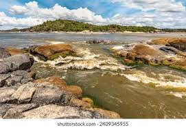
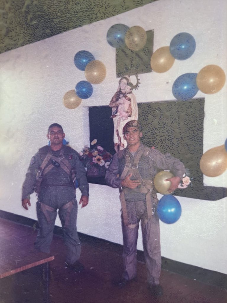
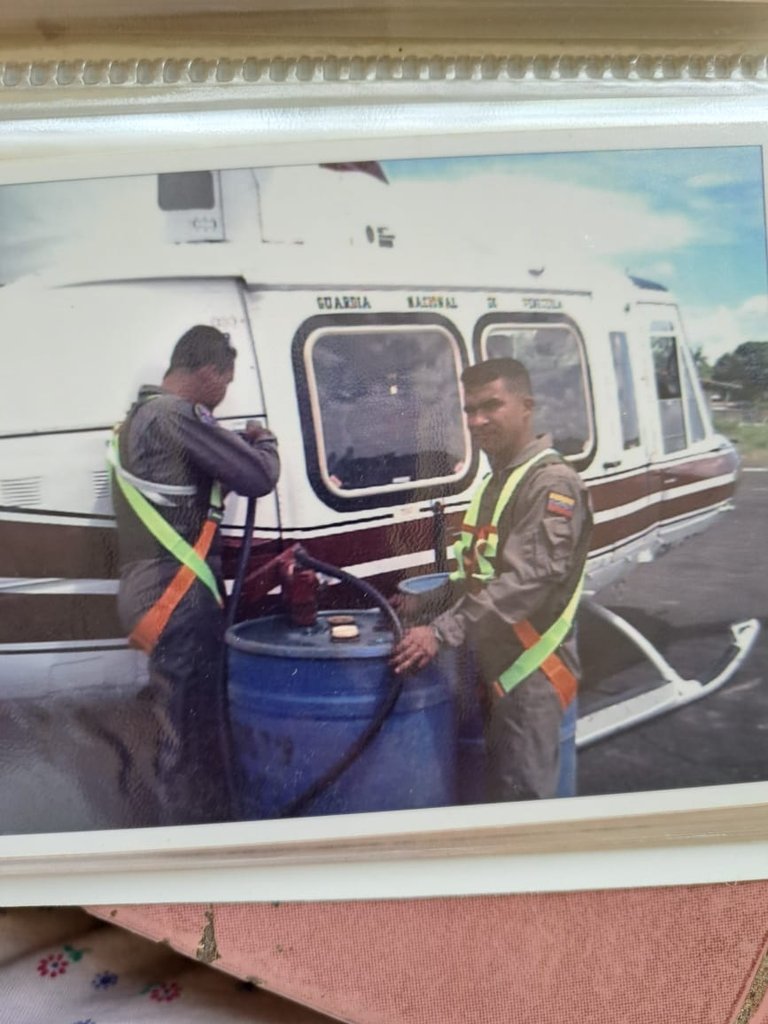
Muy buenas tardes compañeros de las comunidades de Hive Blog, quien les escribe su anfitrión Francisco Yáñez Rojas, quien hoy les va a deleitar con un paisaje natural en una zona inhospita de mi Venezuela amada, la cual he tenido la oportunidad de volar y conocer a mis inicio en la vida aeronáutica.
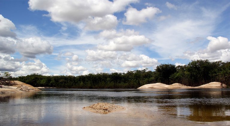
Hoy haré referencia del río Orinoco desde su nacimiento con un pequeño caudal, sus ramificaciones conocido por su impresionante esplendor y belleza natural, así como sus puentes colgantes elaborados para facil acceso a otras regiones de la nación.
Good afternoon fellow members of the Hive Blog communities, who writes your host Francisco Yáñez Rojas, who today will delight you with a natural landscape in an inhospitable area of my beloved Venezuela, which I have had the opportunity to fly and know at the beginning of my aeronautical life.
Today I will make reference to the Orinoco River from its source with a small flow, its ramifications known for its impressive splendor and natural beauty, as well as its hanging bridges made to facilitate access to other regions of the nation.
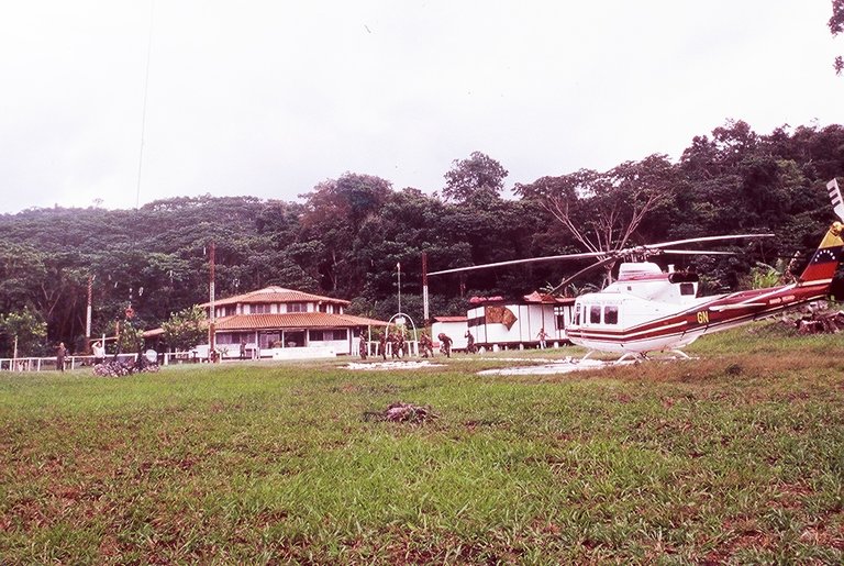
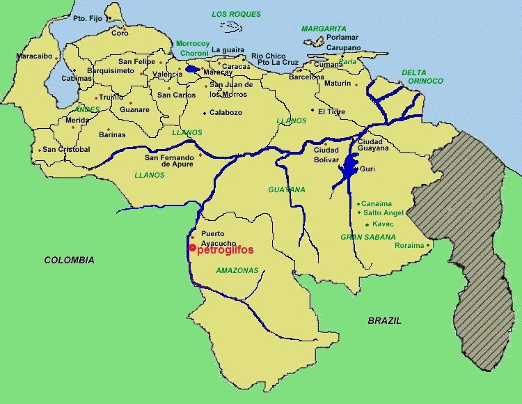
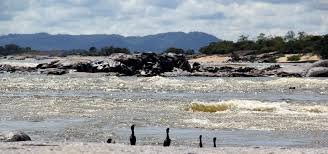
Rio Orinoco a 5 km de su nacimiento en el cerro Carlos Delgado Chalbaud (Sierra Parima). Imagenes del año 2001. Puede observarse el "1er puente" justo al pasar al lado del Comando de la Guardia Nacional Bolivariana en esa zona.
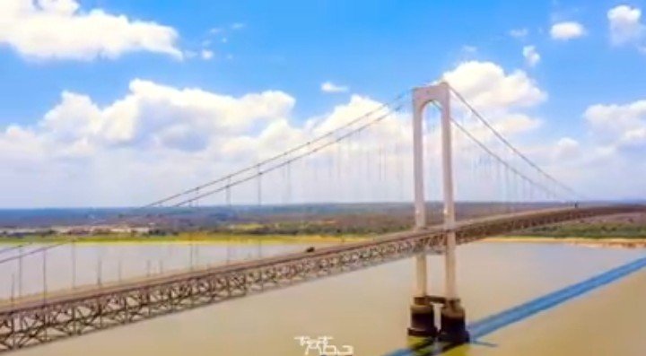
Entonces el Puente de Angostura sería el segundo puente sobre el Orinoco.
Orinoco river 5 km from its source in Carlos Delgado Chalbaud hill (Sierra Parima). Images from 2001. You can see the "1st bridge" just passing by the Command of the Bolivarian National Guard in that area.
Then the Angostura Bridge would be the second bridge over the Orinoco.

PUENTE ANGOSTURA
conecta el Estado Bolívar con el Estado Anzoateguí, es un puente colgante que fue inaugurado el 6 de enero de 1967.
Ciudad Bolívar, Estado Bolívar - Soledad, Estado Anzoátegui.
ANGOSTURA BRIDGE
connects the State of Bolivar with the State of Anzoategui. It is a suspension bridge that was inaugurated on January 6, 1967.
Ciudad Bolivar, Bolivar State - Soledad, Anzoategui State.
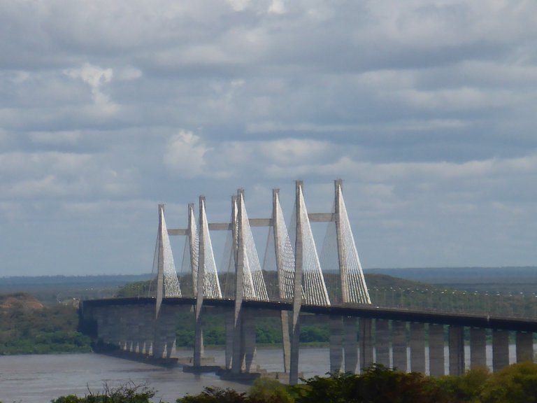
El puente sobre el río Orinoco o Puente Orinoquia como fue bautizado el día de su inauguración, es un puente atirantado de hormigón y acero que une a las riberas norte (Estado Bolívar) y sur (Estado Anzoátegui) del río Orinoco a la altura de Ciudad Guayana, convirtiéndose en la segunda estructura en ser levantada sobre dicho río después del puente de Angostura. Es una de las obras de infraestructura más importantes de la zona sur de Venezuela; inaugurado el 13 de noviembre de 2006.
The bridge over the Orinoco River or Orinoquia Bridge, as it was baptized on the day of its inauguration, is a concrete and steel cable-stayed bridge that joins the north (Bolivar State) and south (Anzoátegui State) banks of the Orinoco River at the height of Ciudad Guayana, becoming the second structure to be erected over said river after the Angostura Bridge. It is one of the most important infrastructure works in southern Venezuela; inaugurated on November 13, 2006.
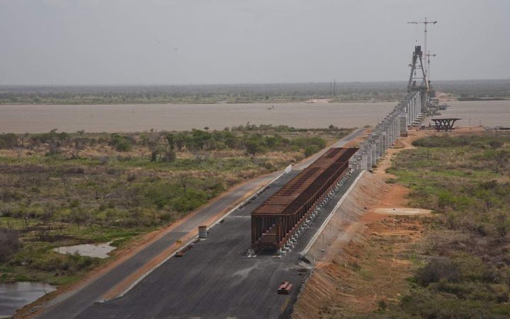
Concluida esta obra, la misma empresa constructora Odebrecht, inició el Tercer puente sobre el río Orinoco, entre las poblaciones de Cabruta (en el Sur de Guárico) y Caicara (parte nororiental del Bolívar).
El Puente Mercosur (Tercer puente sobre el Río Orinoco) es una infraestructura inconclusa de transporte de tipo carretero-ferroviario que se construye desde finales de 2006, en la región de Guayana, al sur de Venezuela y que unirá las poblaciones de Caicara del Orinoco, Municipio Cedeño en el estado Bolívar y Cabruta, Municipio Juan José Rondón en el estado Guárico. Es el segundo puente más grande de América Latina y el número 38 en el mundo (no terminado).
Once this work was completed, the same Odebrecht construction company began the Third Bridge over the Orinoco River, between the towns of Cabruta (in southern Guárico) and Caicara (in the northeastern part of Bolívar).
The Mercosur Bridge (Third Bridge over the Orinoco River) is an unfinished road-rail transport infrastructure that has been under construction since late 2006, in the Guayana region, in southern Venezuela, and will connect the towns of Caicara del Orinoco, Cedeño Municipality in the State of Bolívar, and Cabruta, Juan José Rondón Municipality in the State of Guárico. It is the second largest bridge in Latin America and the 38th largest in the world (not completed).
El río Orinoco, conocido por su esplendor y majestuosidad, es un símbolo de la belleza natural de Venezuela. Sus aguas caudalosas y su biodiversidad única lo convierten en un tesoro nacional.
Qué orgullo tener un río tan maravilloso en nuestra amada Venezuela.
The Orinoco River, known for its splendor and majesty, is a symbol of Venezuela's natural beauty. Its rushing waters and unique biodiversity make it a national treasure.
What a pride to have such a wonderful river in our beloved Venezuela.
El río Orinoco es uno de los ríos más importantes de América del Sur (además del río Amazonas) que nace y discurre mayormente por Venezuela y una parte por Colombia.
The Orinoco River is one of the most important rivers in South America (besides the Amazon River), which originates and flows mostly in Venezuela and partly in Colombia.
Aunque la desembocadura del Orinoco en el océano Atlántico fue documentada por Cristóbal Colón el 1 de agosto de 1498, durante su tercer viaje; su nacimiento en el cerro Delgado Chalbaud, solamente fue explorado por primera vez por los no indígenas en 1951, 453 años más tarde.
Although the mouth of the Orinoco in the Atlantic Ocean was documented by Christopher Columbus on August 1, 1498, during his third voyage; its source at the Delgado Chalbaud hill was only explored for the first time by non-indigenous people in 1951, 453 years later.
El explorador español Diego de Ordás fue el primer europeo en recorrer el Orinoco, entre junio y agosto de 1531, desde su delta hasta su confluencia con el Meta.
The Spanish explorer Diego de Ordás was the first European to travel the Orinoco, between June and August 1531, from its delta to its confluence with the Meta.
Alexander von Humboldt exploró la cuenca en el año 1800, informando sobre los delfines rosados de río, y publicando extensamente sobre su flora y fauna.
Alexander von Humboldt explored the basin in 1800, reporting on pink river dolphins, and publishing extensively on its flora and fauna.
El Orinoco es navegable en prácticamente toda su extensión, permitiendo tráfico de barcos oceánicos hasta Ciudad Orinoco y Ciudad Bolívar, donde se encuentra el puente de Angostura, a 435 km de la desembocadura.
The Orinoco is navigable in practically all its extension, allowing traffic of oceanic boats up to Ciudad Orinoco and Ciudad Bolívar, where the bridge of Angostura is located, 435 km from the mouth.
Imágenes tomadas desde mi teléfono marca Redmi 12, algunas imágenes fueron tomadas desde una cámara marca Samsung st77 y traducción de idiomas desde la aplicación Deepl.
Images taken from my Redmi 12 brand phone, some images were taken from a Samsung st77 brand camera and language translation from the Deepl app.