Los trifinios son lugares geográficos en los que se unen o confluyen tres fronteras de tres Estados o territorios diferentes.
No está del todo claro el número de trifinios existentes en el mundo ya que a menudo determinados países no reconocen a otros como estados legítimos o incluso reclaman dichos territorios como propios. A pesar de eso se estima que en todo el planeta puedan existir en torno a 150 triples fronteras.
Los trifinios pueden estar determinados bien por coordenadas geográficas o bien por un lugar o accidente geográfico.
Un ejemplo de triple frontera por coordenadas geográficas sería un punto concreto en el desierto del Sahara donde confluyen las fronteras de Argelia, Mali y Mauritania.
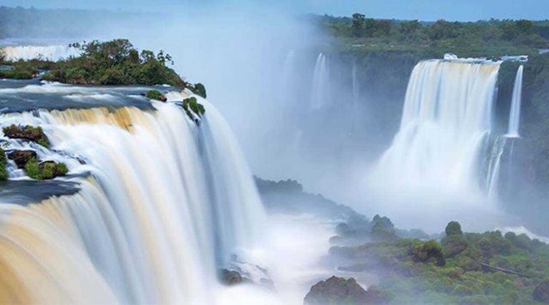
Un ejemplo de trifinio determinado por accidente geográfico y quizás la triple frontera más famosa del mundo es la confluencia de los ríos Iguazú y Paraná que da lugar a las famosas cataratas de Iguazú, que marcan la frontera entre Brasil, Paraguay y Argentina
Otros trifinios famosos son el Monte Roraima en Suramerica que marca la frontera entre Brasil, Venezuela y Guyana. En Asia destaca el Pico Jongsong que determina la frontera entre Nepal, China e India y en Europa el trifinio entre España, Francia y Andorra.
Los trifinios o triples fronteras pueden en algunos casos convertirse en puntos de conflicto entre los países implicados, especialmente si hay disputas territoriales o diferencias culturales o políticas.
En la actualidad lo máximo que existe son trifinios, tres fronteras de tres territorios diferentes pero es imposible encontrar cuatro países o más que tengan coincidencias de fronteras en algún punto.
Trifinios are geographical locations where three borders of three different states or territories meet or converge.
It is not entirely clear how many tri-border areas exist around the world, as some countries often do not recognise others as legitimate states or even claim such territories as their own. Nevertheless, it is estimated that there may be around 150 tri-border territories around the world.
Tri-border boundaries can be determined either by geographical coordinates or by a geographical location or feature.
An example of a tri-border by geographical coordinates would be a specific point in the Sahara desert where the borders of Algeria, Mali and Mauritania meet.
An example of a tri-border determined by geographical accident and perhaps the most famous tri-border in the world is the confluence of the Iguazú and Paraná rivers, which gives rise to the famous Iguazú Falls, marking the border between Brazil, Paraguay and Argentina.
Other famous trifurcations include Mount Roraima in South America, which marks the border between Brazil, Venezuela and Guyana. In Asia, the Jongsong Peak marks the border between Nepal, China and India and in Europe the trifinio between Spain, France and Andorra.
Tri-frontiers can in some cases become points of conflict between the countries involved, especially if there are territorial disputes or cultural or political differences.
At present the maximum that exists are trifinios, three borders of three different territories but it is impossible to find four countries or more that have border overlaps at any one point.
References:
https://blog.chapkadirect.es/trifinios-del-mundo/
https://geografia.laguia2000.com/general/trifinios-y-cuadrifinios
Image source:
This report was published via Actifit app (Android | iOS). Check out the original version here on actifit.io