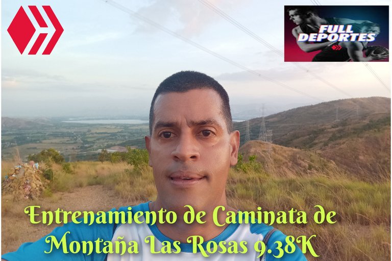
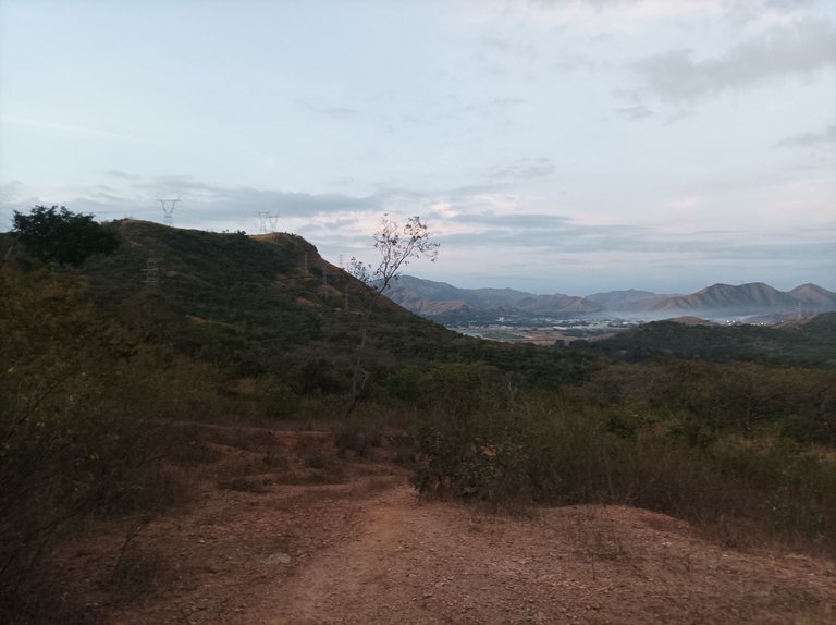
Greetings friends of Hive and @fulldeportes, today I am going to share with you my mountain hiking training on the La Rosas hill route, in the community of Villa de Cura, Aragua state, Venezuela.
Cabe destacar que había planificado con mi amigo el día de ayer jueves para hacer este entrenamiento hoy viernes, pero como a la 5:30 me informo que no iba ya que no pudo dormir, de igual forma hice mi entrenamiento, activando la aplicación Strava y Actifit a la 6:01 am, caminando a un ritmo de un 80%, hoy pude apreciar mucho tráfico en la vía, por eso es que me gusta hacer esta ruta los fines de semana que hay menos vehículos en la carretera, al llegar a la entrada de Villa de Cura, pase con un tiempo de 15 minutos.
It is worth noting that I had planned with my friend yesterday Thursday to do this training today Friday, but at around 5:30 he informed me that he was not going because he could not sleep, in the same way I did my training, activating the Strava and Actifit applications at 6:01 am, walking at a pace of 80%, today I could see a lot of traffic on the road, that is why I like to do this route on weekends when there are fewer vehicles on the road, when I arrived at the entrance of Villa de Cura, I passed with a time of 15 minutes.
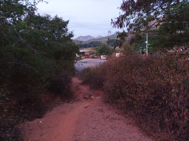
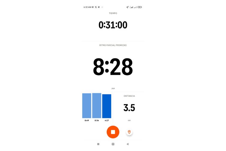
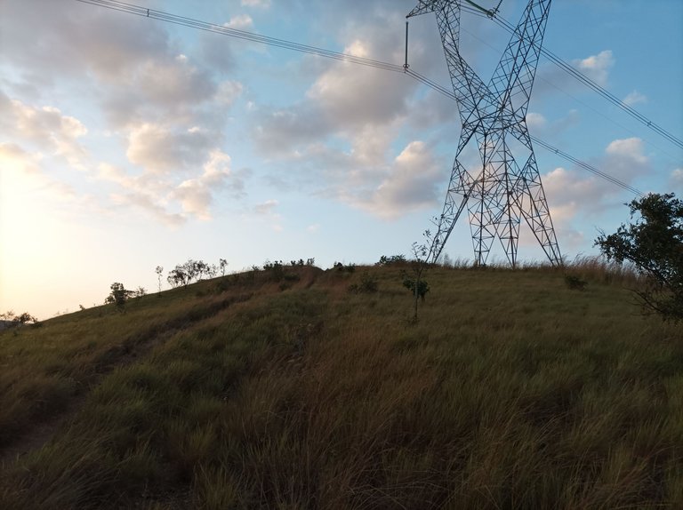
Después continúe avanzando hacia la dirección hacia Cagua, municipio Sucre, el tiempo estaba un poco oscuro y con algo de frío, una vez que llegue a la entrada a Las Rosas mi reloj registro un tiempo de 31 minutos, mi mejor marca es de 29 minutos con 46 segundos, con una distancia de 3.5 K, a un ritmo promedio de 8 minutos con 28 segundos, aquí me detuve unos segundos para mover la cerca y comenzar a subir la montaña, manteniendo el mismo ritmo en esta primera subida.
Then I continued moving towards Cagua, Sucre municipality, the weather was a little dark and a bit cold, once I reached the entrance to Las Rosas my watch recorded a time of 31 minutes, my best time is 29 minutes and 46 seconds, with a distance of 3.5 K, at an average pace of 8 minutes and 28 seconds, here I stopped for a few seconds to move the fence and start climbing the mountain, maintaining the same pace on this first climb.
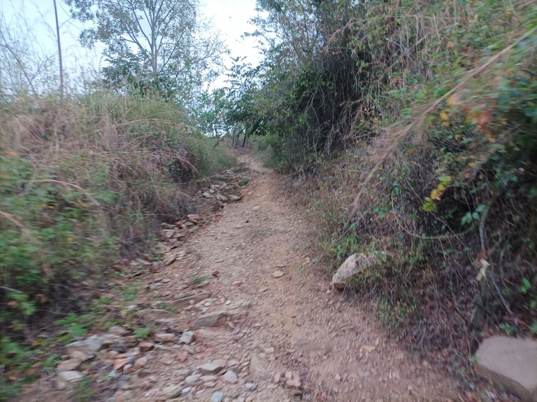
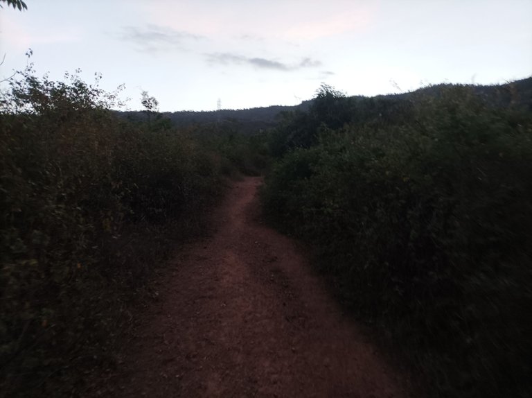
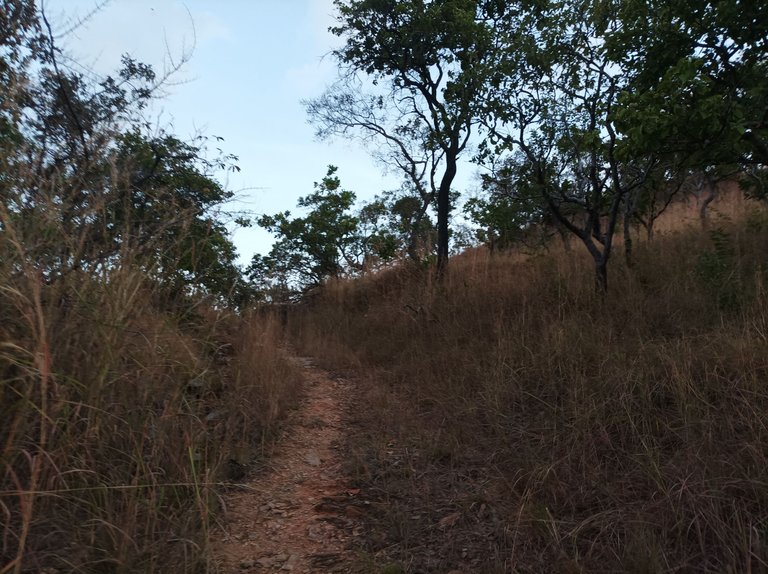
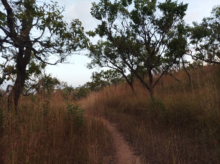
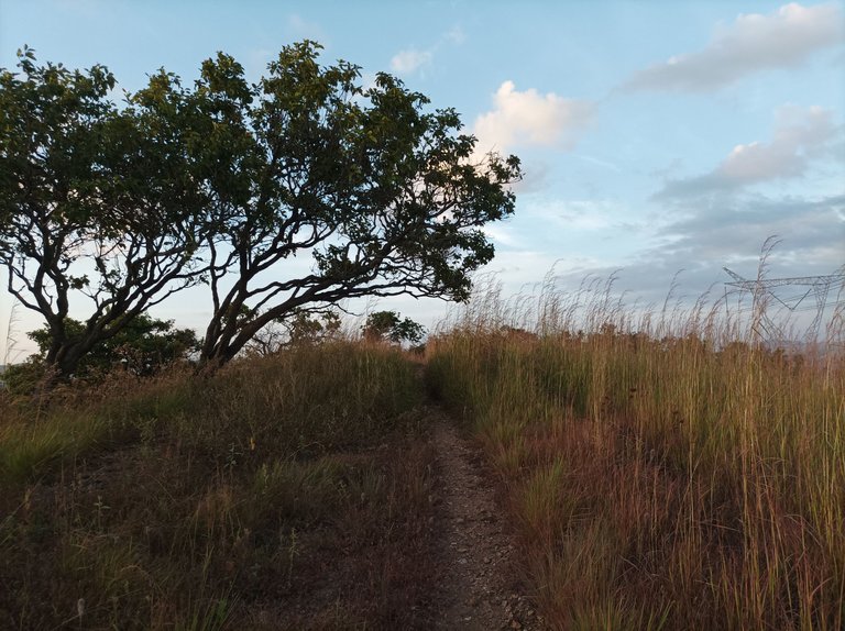
En este trayecto se acaba la parte plana y nos encontramos con varias pendientes que son exigente con terreno de tierra y en algunas partes con piedras, pasando por donde está una doble via con 4.81K y luego complete los 5K con un tiempo de 48 minutos, para pasar por la parte donde se encuentra una pequeña capilla del anima sola, a medida que avanzaba la subida estaban seguidas, llegando hasta la parte en la que podemos ver la laguna de Taguaguay, con 5.78K en un marca de 56 minutos con 49 segundos.
On this route the flat part ends and we find several slopes that are demanding with dirt terrain and in some parts with stones, passing through where there is a double track with 4.81K and then completing the 5K with a time of 48 minutes, to pass through the part where there is a small chapel of the Anima Sola, as the climb progressed they were followed, reaching the part where we can see the Taguaguay lagoon, with 5.78K in a time of 56 minutes and 49 seconds.
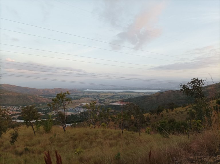
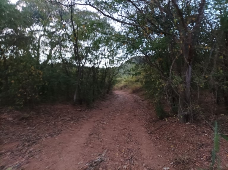
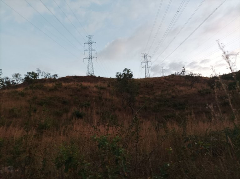
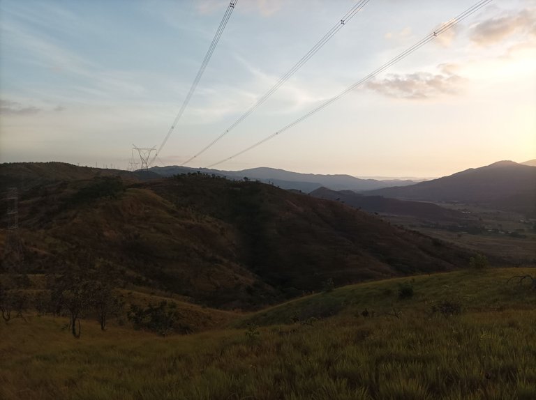
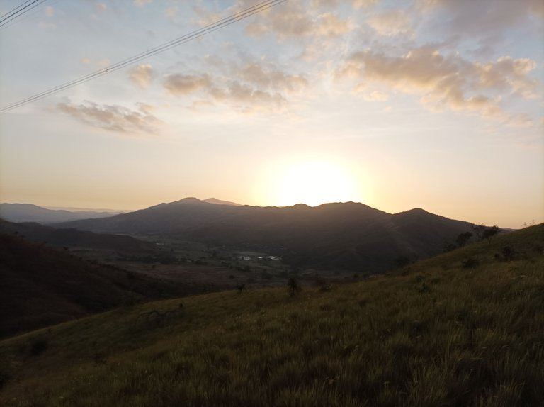
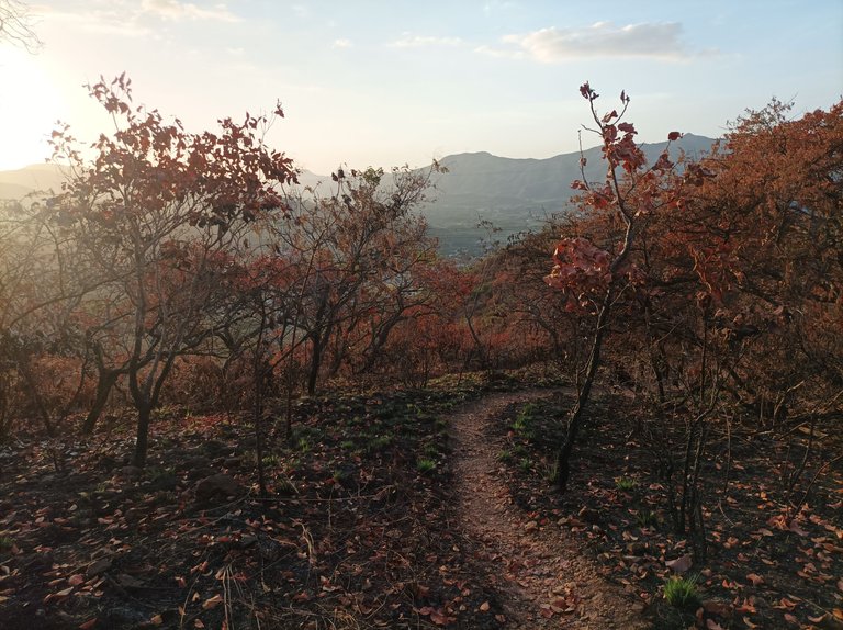
Una de las cosas que me gustan en este tipo de entrenamiento es ver el amanecer en la montaña y sentir la brisa en mi rostro, es muy gratificante poder disfrutar del contacto con la naturaleza y capturar con mi teléfono móvil este bello paisaje. Me detuve unos segundos para hidratarme, pude observar algunas partes de la montaña que se ve han sufrido un poco por los incendios, debido a la sequía, continúe caminando para pasar por La Piedra, después Las Torres y llegué al sector de Las Mercedes.
One of the things I like about this type of training is watching the sunrise on the mountain and feeling the breeze on my face. It is very gratifying to be able to enjoy contact with nature and capture this beautiful landscape with my mobile phone. I stopped for a few seconds to hydrate myself. I could see some parts of the mountain that have suffered a bit from the fires due to the drought. I continued walking to pass through La Piedra, then Las Torres and I arrived at the Las Mercedes sector.
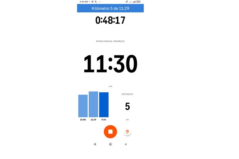
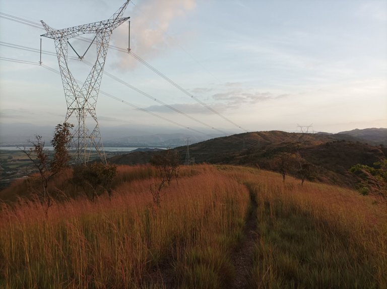
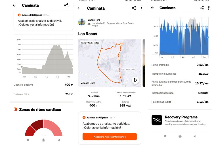
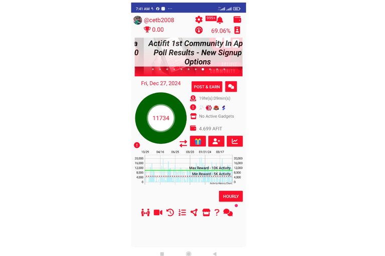
Asimismo, comencé nuevamente a subir como 200 metros, y llegar a donde están las máquinas de ejercicios, ya en esta parte lo que falta es pura bajadas, no ví personas haciendo ejercicios, luego de terminar de descender de la montaña, llegué a la avenida Lisandro Hernández con una distancia de 9.38 K, en un tiempo de 1 hora 38 minutos, con un desnivel positivo de 400 m y desnivel máximo de 750 o m, registrado en la aplicación Strava y 11734 pasos en Actifit.
Likewise, I began to climb again about 200 meters, and get to where the exercise machines are, now in this part what is missing is pure descents, I did not see people doing exercises, after finishing descending the mountain, I arrived at Lisandro Hernández Avenue with a distance of 9.38 K, in a time of 1 hour 38 minutes, with a positive slope of 400 m and a maximum slope of 750 m, recorded in the Strava application and 11,734 steps in Actifit.
Echa un vistazo a mi actividad en Strava: https://strava.app.link/Gdv3MAzSFPb
Check out my activity on Strava:
Espero que les haya gustado mi entrenamiento de caminata de montaña, nos vemos en el próximo.
I hope you liked my mountain walking training, see you in the next one.
Fotografías: Teléfono Redmi Note 10
Portada realizada en APP GridArt
Logos utilizados de Hive y de fulldeportes
Traductor utilizado: Traductor de Google
Photos: Redmi Note 10 Phone
Cover made in The APP GridArte
Used logos of Hive and fulldeportes
Translator used: Translator used: Google Translate

Vote la-colmena for witness By @ylich

Posted Using InLeo Alpha
Saludos amigos de Hive y de @fulldeportes, hoy voy a compartir con ustedes mi entrenamiento de caminata de montaña en la ruta del cerro La Rosas, en la comunidad de Villa de Cura, estado Aragua, Venezuela.
¡Genial! La caminata por el cerro La Rosas suena increíble. Disfruta de la naturaleza y de esa hermosa ruta. ¡Éxito en tu entrenamiento! 🥾🌄
Saludos, gracias, feliz día.
Excelente entrenamiento mi estimado amigo @cetb2008 . Como siempre es un gusto leer tus publicaciones
Saludos muchas gracias amigo.
Otro entrenamientos que suma kilómetros de vida, en estos últimos días del 2024, sigamos entrenando amigo, el 2025 viene con todo, saludos ☺️🤗
Hola amiga, gracias por comentar, feliz día.