Kok-Kiya is a small river in the Naryn region of Kyrgyzstan at an altitude of 3100+ meters above sea level. It flows near the border with China, and its source is on the slopes of the Kakshaal-Too ridge in the Central Tien Shan mountain system.
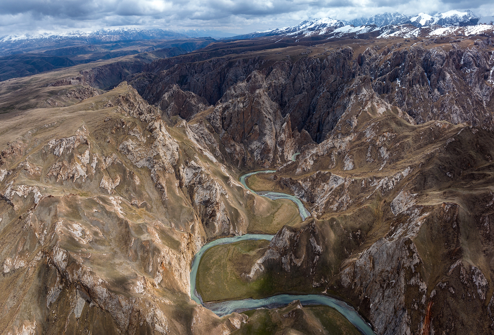
It seems to me that yaks are more common in these places than people — but perhaps this impression is deceptive, since the Kok-Kiya canyon is located not so far from the alpine lake Köl-Suu — one of the hard-to-reach, but really beautiful sights of the country. However, about the lake another time, and for now I invite you to look at several views of the Kok-Kiya River and the canyon of the same name, through which it flows in one of its sections.
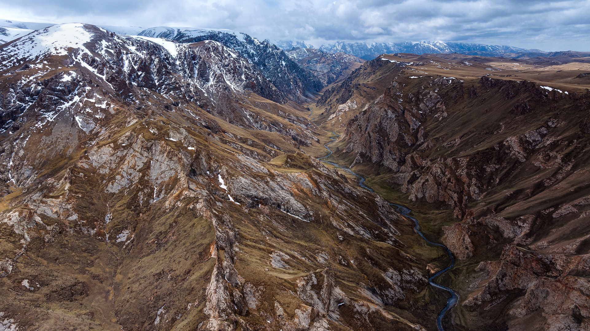
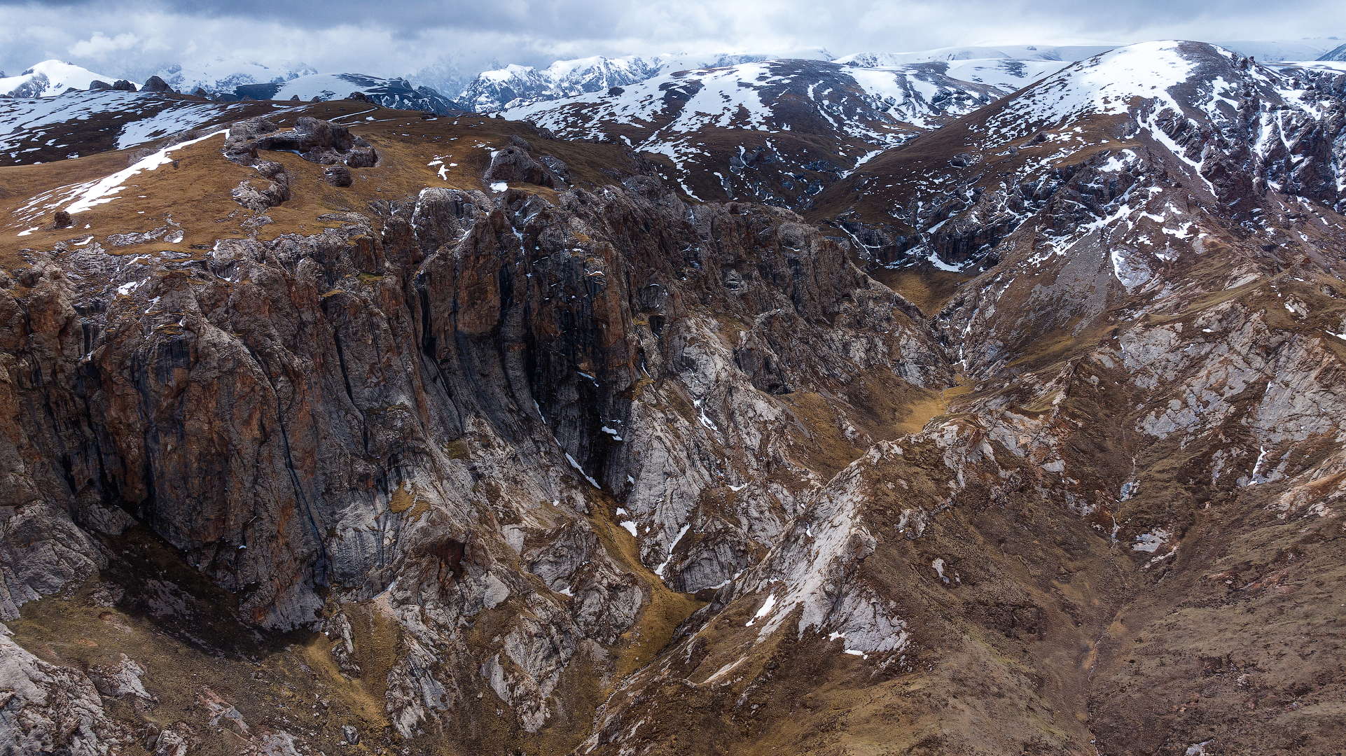
Kok-Kiya is a mountain river, but it is quite small, calm and not very full-flowing, at least after the main mass of snow has melted from the mountains. Somewhere in small valleys it spreads wider, and somewhere — it is squeezed between rocks, cutting its way through the mountains.

And such a place turns out to be the severe but picturesque Kok-Kiya Canyon. Quite narrow and deep, it can easily accommodate the river during any flood.
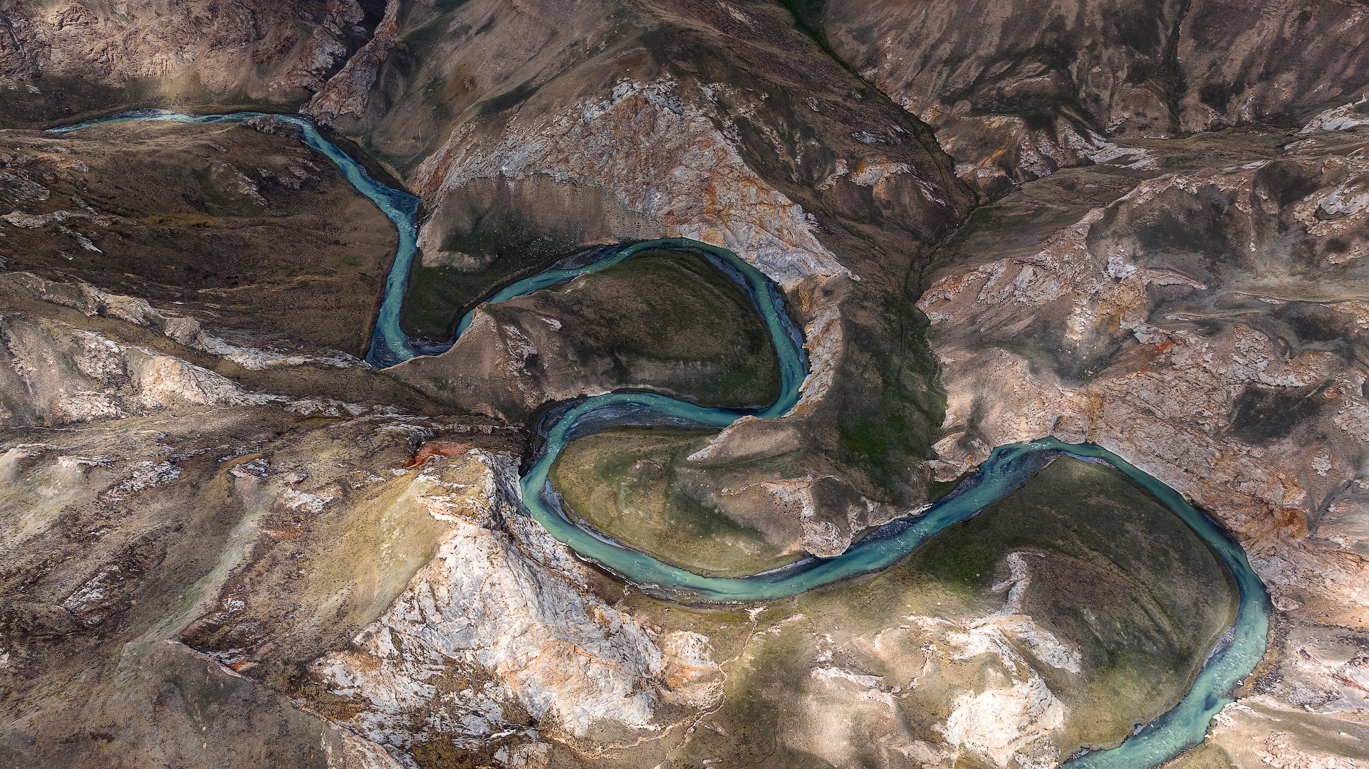
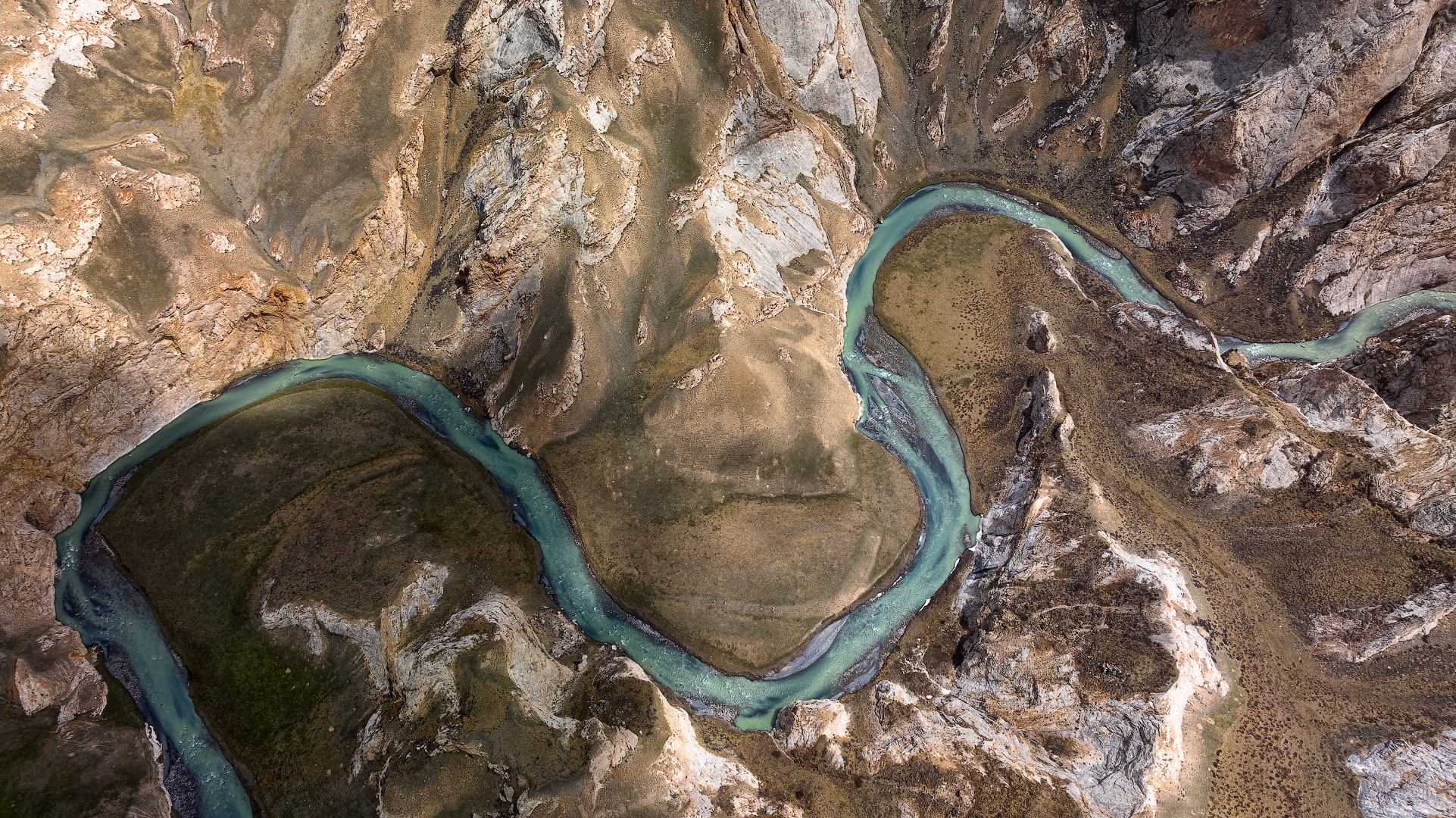
In the mountains, I am always fascinated by the color of lakes and rivers, this rich milky-turquoise shade of water, which is given by a high concentration of various minerals dissolved in the water. And in combination with rocks, this blue ribbon of the river looks especially good.
Along the canyon for 10-12 kilometers there is a dirt road, along which you can drive, stopping in different places, and come closer to the canyon to look at the river. The views are excellent! Although, of course, with a drone the view is wider than if you look from the ground, but with the height of the canyon walls from 20 to 80 meters above its bottom, there are still gorgeous views from anywhere :)

How to get there? In a good 4WD car in dry weather in summer, the main route is quite passable, and small branches of the roads should be checked additionally, depending on the degree of cross-country ability of the car and the driver's skill. It is recommended to go to these places not with one car, but at least with two, so that in case of trouble with one you can get to cell phone service and help in the other car.
In winter, as well as in spring and autumn in a bad damp weather, it is better not to go there at all without specially prepared vehicles, and, of course, not alone. And be sure to obtain permit in advance from Kyrgyzstan to visit the border zone, that's not difficult, but takes some time.
It's better to watch the photo in high resolution.
Camera: DJI Mavic 3 Pro
You can also see my photos in my blog LJ and in my profile on RTraveler. You also can read a short interview with me here.

Восхитительные дикие места, и настолько красивые!
О да, я не мог наглядеться! :)
Congratulations, your post has been added to WorldMapPin! 🎉
Did you know you have your own profile map?
And every post has their own map too!
Want to have your post on the map too?
Hiya, @ybanezkim26 here, just swinging by to let you know that this post made it into our Honorable Mentions in Travel Digest #2338.
Your post has been manually curated by the @worldmappin team. If you like what we're doing, please drop by to check out all the rest of today's great posts and consider supporting other authors like yourself and us so we can keep the project going!
Become part of our travel community:
Thank you! :)
You are very welcome @sharker! As always - it was well deserved. ☀️🍺
wow! love it!
Thank you! Me too :)