Hello everyone, long time no see you all. You must have had a few times of climbing and conquering mountains. Will we ever remember the first time, that you climbed the mountain? I still vividly remember my first climbing trip, it was a climbing trip in a mountain of Quang Nam province. This mountain peak is called Am Thong peak, this is a mountain peak with a poetic and mysterious beauty. Am Thong Peak is located in the territory of Quang Nam province, Dai Hong commune, Dai Loc district.
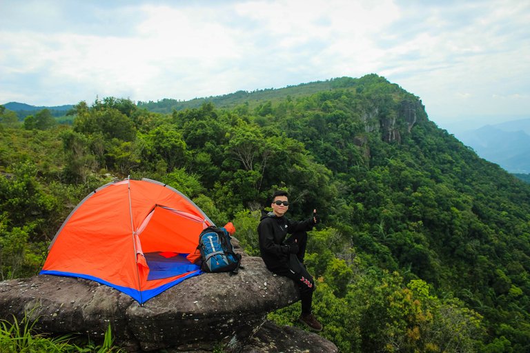
This is my first hike. the feeling of conquering a mountain for the first time is a very exciting feeling, on this trip I had short breaths in the middle of the hill, many times confused as to why I was here, and ended with explosive excitement, the satisfaction of climbing to the top. Standing from the top of Am Thong mountain, my eyes looked far away. Climbing promotes physical and mental health. Climbing gives me a will to never give up.1 The only goal is to conquer, even in difficult times. Climbing trips help me have close friends, people who transmit positivity to each other, the passions of youth and those are the passions that never go out. You will sit with your friends in the campfire, listening to stories that each person has experienced. The friend on the trip that day was named Minh, This friend is a friend, whom I met during a camping trip at Hai Van mountain. It was the field trips that helped us get to know each other and make friends.
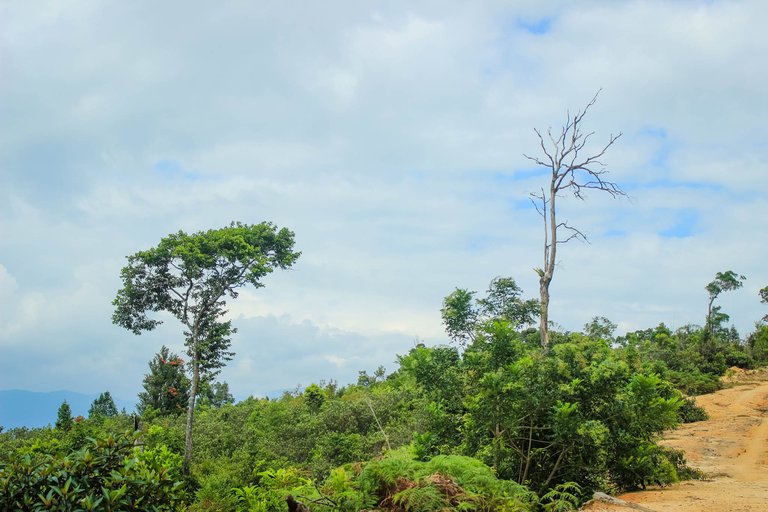

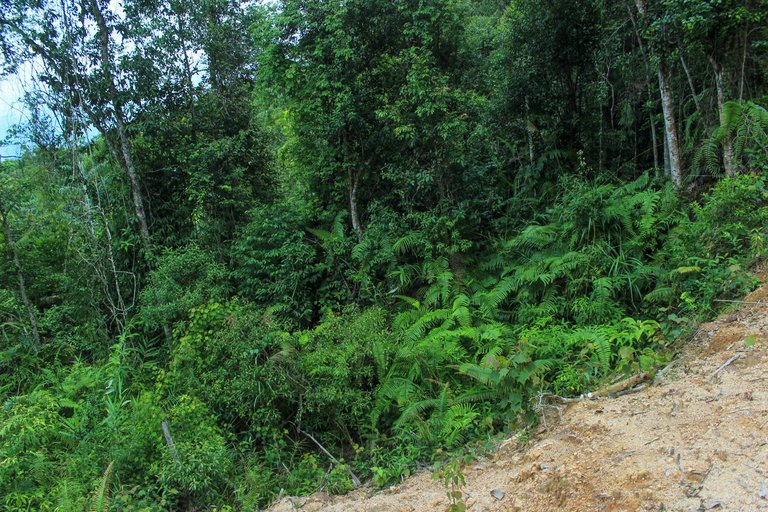
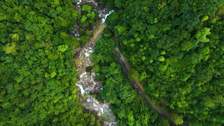
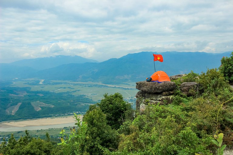
Am Thong Peak possesses amazing natural beauty among majestic mountains, waterfalls, rocky mountains, pine forests and many birdsong. This place is an ideal destination for those who love to explore. Hoi An tourism is famous for its ancient and nostalgic scenery, but Am Thong Peak brings a very different feeling. This place is nestled in the middle of thousands with wild and interesting beauty and is a place that backpackers always want to conquer. Am Thong Peak, also known as Tung Son Peak, Am Thong Peak, is a famous tourist destination in Quang Nam. Am Thong is a limestone mountain range about 830 m above sea level, 46 km from Da Nang city center and 54 km from Hoi An.
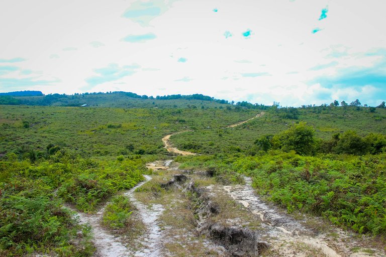
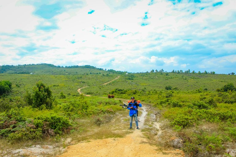
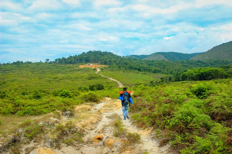
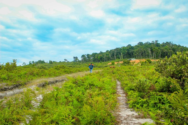
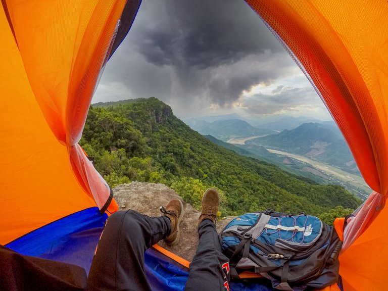
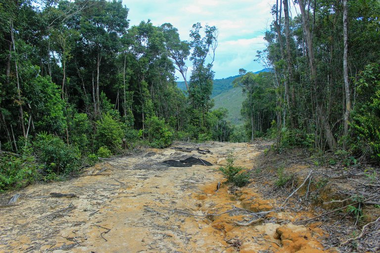
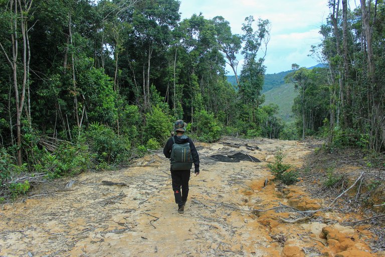
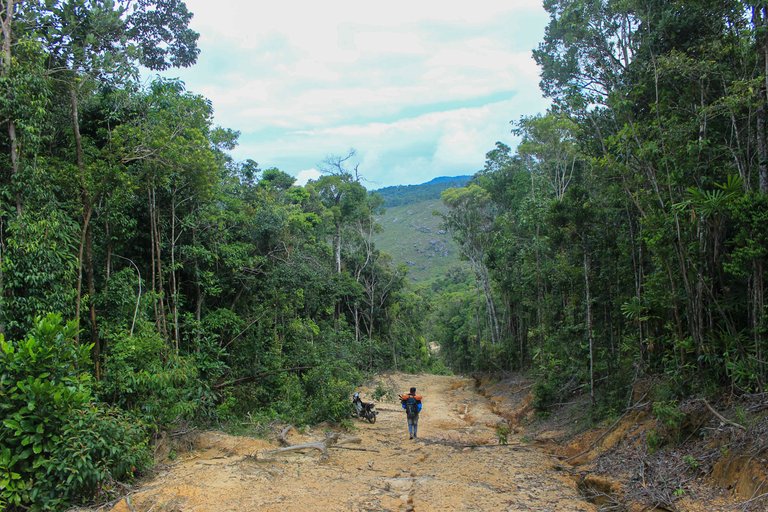
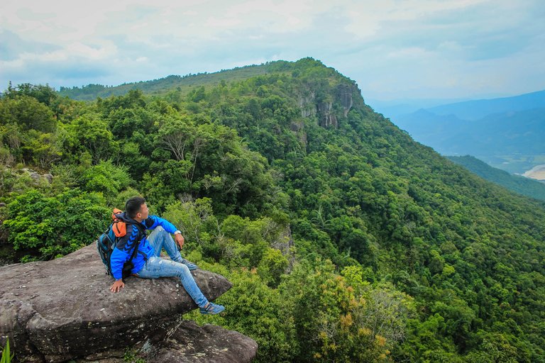
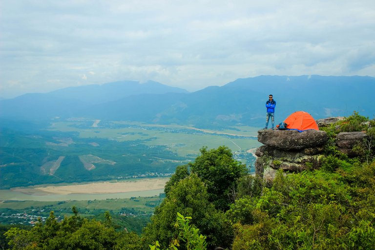
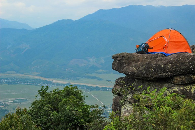
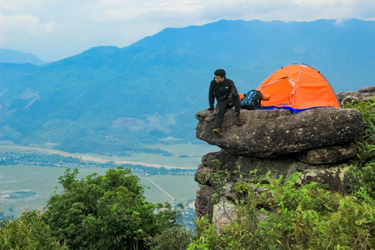
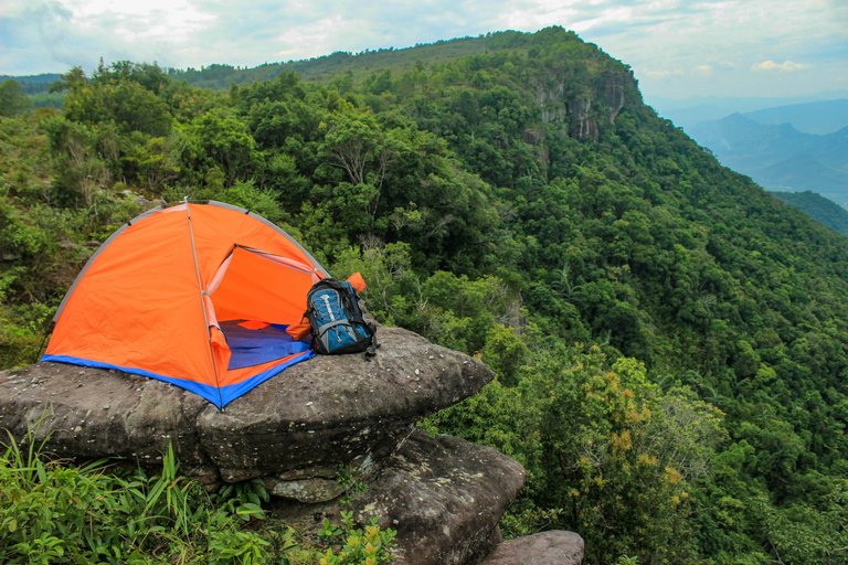
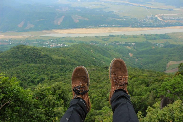
The road to the top of Am Thong is quite dangerous with steep, zigzag cliffs. To reach the top of the mountain you need about 3 hours by motorbike, we chose to walk to be able to explore the beauty of this forest. After 5 hours of climbing, we reached the top of Am Thong. At the top of Am Thong is a flat land with lush trees. , ravishing scenery, bringing many interesting experiences not to be missed. Am Thong Peak is covered with lush vegetation, including ancient conifers and several species of ferns. This mountain top valley setting also has ravishing scenery with the sound of wind, the sound of streams and songs of birds and the melodious melodies of Insects. It will give you the feeling of being immersed in a vivid and colorful natural picture. We were camping on a rock, it looked dangerous but we enjoyed the view below.
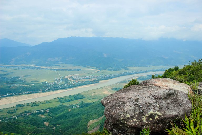
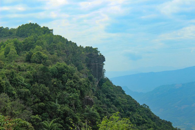
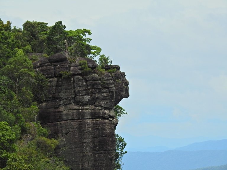
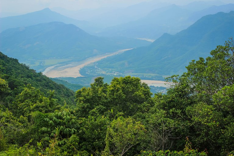
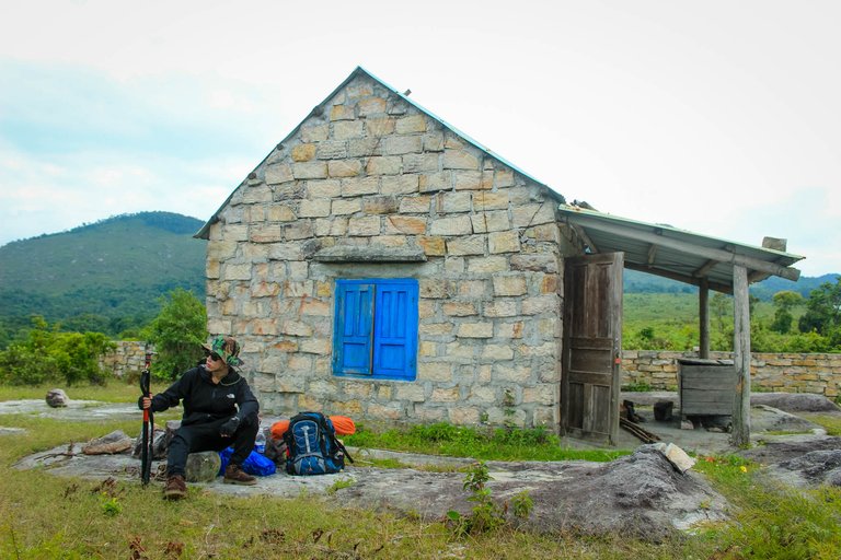
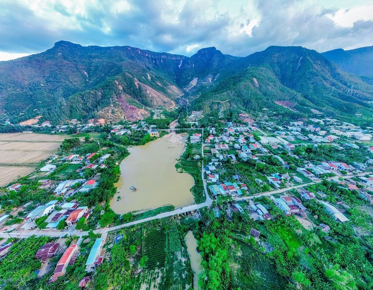
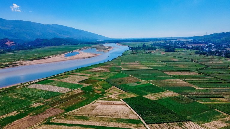
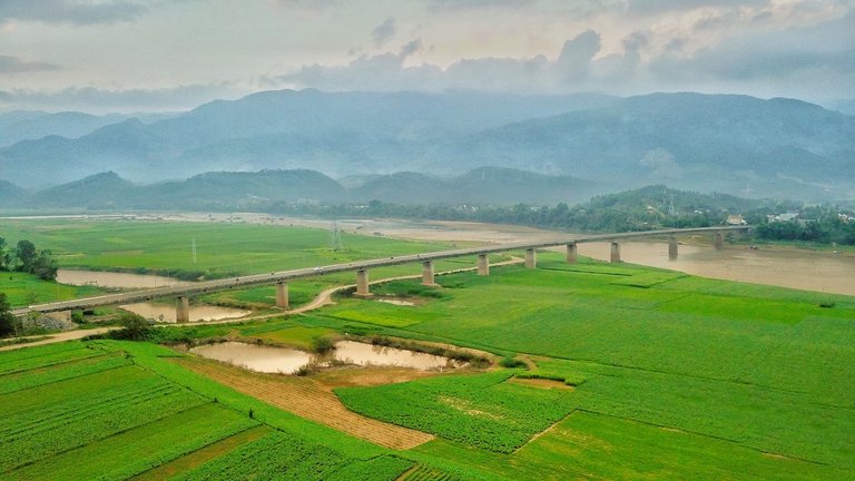
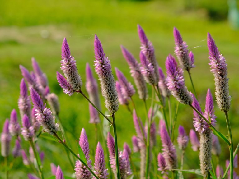
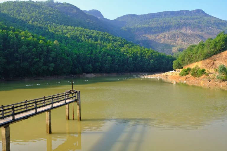
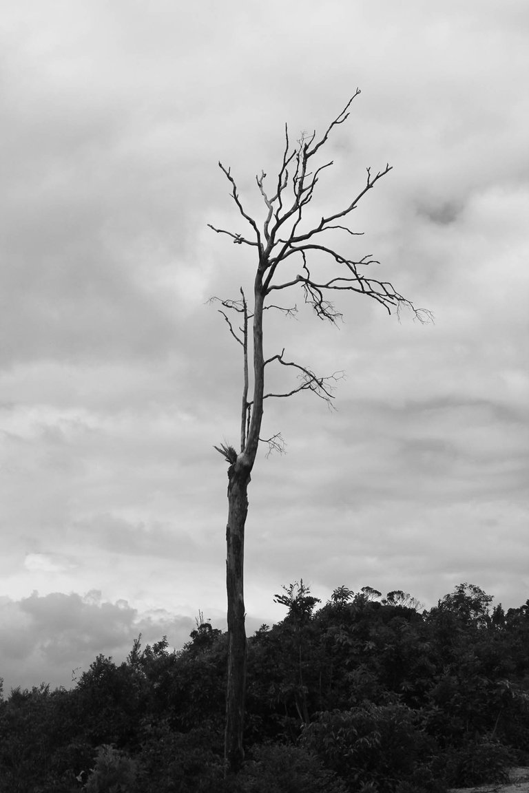
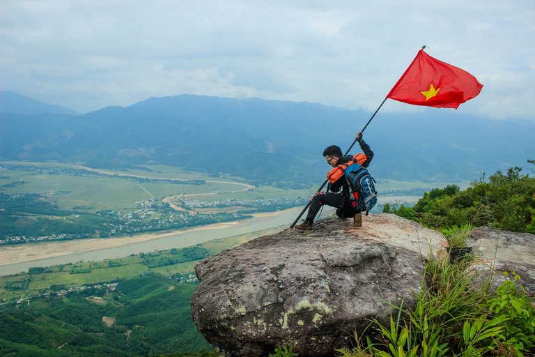
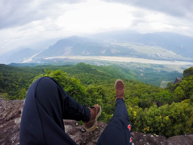
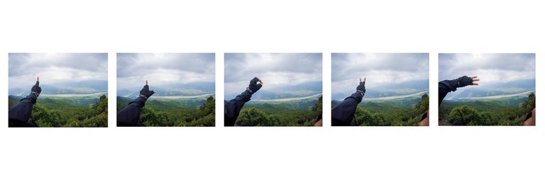
There's a Vietnamese flag here, we've planted it in the ground. This photo is very similar to the American soldiers who planted the American flag at the Battle of Iwo Jima. In the past, there were many pine trees, so it was called the top of Am Thong or Tung Son mountain. Due to the war and exploitation of people, there were only 2 old pine trees left on the cliff. This used to be a place of practice for monks and hermits, now there is also a small temple, worshiping the statue of Bodhisattva Avalokitesvara. Looking out into the distance, people will see a mountain peak, with a face shape facing the river. If you stand from the top of the mountain, you can easily see Dai Hong commune and Vu Gia river at the foot of Am Thong mountain. The temperature here is always 5-7 degrees Celsius lower than at the foot of the mountain, the humidity is high, so there are many species of orchids, cycads, and ferns. Myrtle and Broom are two common types. People still climb the mountain every day to cut brooms and bring them down the mountain to sell. After a night of sleeping on the rock, we welcomed the sunrise at 5am, the morning weather here is quite cold. We had breakfast and started packing up the tents to go back down the mountain. It's been 6 years, I haven't been back here. But every time I think about this trip, I want to once again conquer this mountain.
Like everyone else, I climbed the mountain for the first time. I prepared everything, so much so that my backpack swelled with so many things, flashlights, spare clothes, coats, medicine. After this trip I feel that life is a long journey. After a long time in a place with no life experience. I wish I could go back in time and tell myself life is so beautiful out there, see the world and feel it sooner.
Thank you everyone for reading my post, see you all in my next posts
Trời xanh bát ngát luôn bạn hè :))
Trời âm u xấu mà bạn :))) đến đây lần nào chưa vy
Chưa luôn Khánh ơi, vài bữa đi V sẽ hỏi đường K nha, này chụp bằng máy ảnh hả?
Khánh chụp bằng máy ảnh du lịch hồi trước với go pro4, hồi đó chưa dùng máy ảnh chuyên nghiệp á
mà hình cũng đẹp quá, có duyên với nghề chụp ảnh quá chừng
Chừ vẫn còn giữ chiếc máy ảnh đó, chắc giờ iphone nó chụp đẹp hơn máy ảnh du lịch rồi. Đi chơi về sớm vậy à vy
Congratulations, your post has been added to Pinmapple! 🎉🥳🍍
Did you know you have your own profile map?
And every post has their own map too!
Want to have your post on the map too?
What a camp place. I Love to experience that.
Thank you!At night, this place is full of stars, it will be great to camp with your friends at the top of this mountain.
Ô bữa mình cũng có đi chỗ này nè. Gần Đn mà đã tuyệt luôn
Ni đường đẹp rồi, chắc chạy xe lên tới nơi. Đường trước kinh quá :)))
Nay làm đường betong hết mớ r á. Đoạn sau đất nhưng cũng dễ đi lắm chứ ko như hồi xưa nữa
Lên tới đỉnh thấy chiếc SH, tưởng tụi nó lấp cánh vào bay lên :3
Hahaa. Đợt trc t đi cũng có 1 con Sh lên đc mà
Kinh đi 6 năm rồi mà vẫn còn lưu ảnh hả :3
Google driver không giới hạn tài trợ chương trình này :))))
6 năm trước mà hình đã chụp đẹp thế này rồi. Xịn sò quá. Đại Lộc có nhiều nơi đẹp ghê mà c chưa đi hic
Ảnh flycam thì em mới chụp năm ngoái chị, còn ảnh camp trên này là 6 năm rồi. Em vẫn muốn lên lại đây, mà nghĩ lại cái cảnh đi cái đường nắng không có một cái cây. Có người đi cung trong rừng thì đỡ chị, em đi bằng đường bê tông. Đi nó say nắng, đầu nhức kinh khủng, phải nằm bệt xuống đường nắng chiếu vào mặt.
MÀ nay xe máy chắc đi lên được một đoạn rồi, hồi em leo bộ cực lắm
Congratulations @whynotcamp! You have completed the following achievement on the Hive blockchain and have been rewarded with new badge(s):
Your next target is to reach 70 posts.
You can view your badges on your board and compare yourself to others in the Ranking
If you no longer want to receive notifications, reply to this comment with the word
STOPTo support your work, I also upvoted your post!
Check out the last post from @hivebuzz:
Support the HiveBuzz project. Vote for our proposal!
Beautiful!
Waw, amazing location for the tent on the rock!