Welcome to another article in the footsteps of Jan Hus from Prague to Constance. The last time we left the town of Rabštejn nad Střelou and spent the night in the forest. In today's episode, we look at the historic town of Manětín. Next, we will visit a castle near Nečtiny and through Bezdružice we will end our journey in Konstantinovy Lázně.
Vítejte u dalšího článku ve stopách Jana Husa z Prahy do Kostnice. Naposledy jsme opustili městečko Rabštejn nad Střelou a přenocovali v lese. V dnešním díle se podíváme do historického města Manětín. Dále navštívíme hrad nedaleko Nečtin a přes Bezdružice naše putování zakončíme v Konstantinových Lázních.
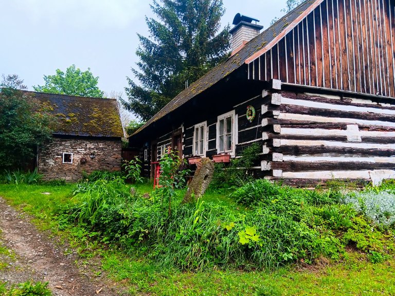
Basically, it rained all night and that's why I got up only when the rain calmed down a bit. But according to the forecast, it looked like it would rain lightly all day. And so I set out on my journey. On the way, I passed through the village of Brdo, where there were several historical buildings, and headed for the town of Manětín.
V podstatě celou noc pršelo a proto jsem se vstal až ve chvíli, kdy se déšť trochu uklidnil. Ale podle předpovědi to vypadalo, že bude mírně pršet celý den. A tak jsem se vydal na cestu. Cestou jsem prošel vesnicí Brdo, kde bylo několik historických stavení a zamířil k městu Manětín.
I always wanted to see Manětín, because I passed by it several times on my way to the town of Úterý. By the way, Uterý is the 11th smallest town in the Czech Republic with only 447 inhabitants. Manětín caught my attention, mainly because there are many baroque statues around the road throughout the city.
Do Manětína jsem se chtěl vždy podívat, protože jsem tudy několikrát projížděl na cestě do města Úterý. Úterý je mimochodem jedenácté nejmenší město v ČR ve kterém žije 447 obyvatel. Manětín mě zaujal především tím, že kolem silnice skrze celé město je spousta barokních soch.
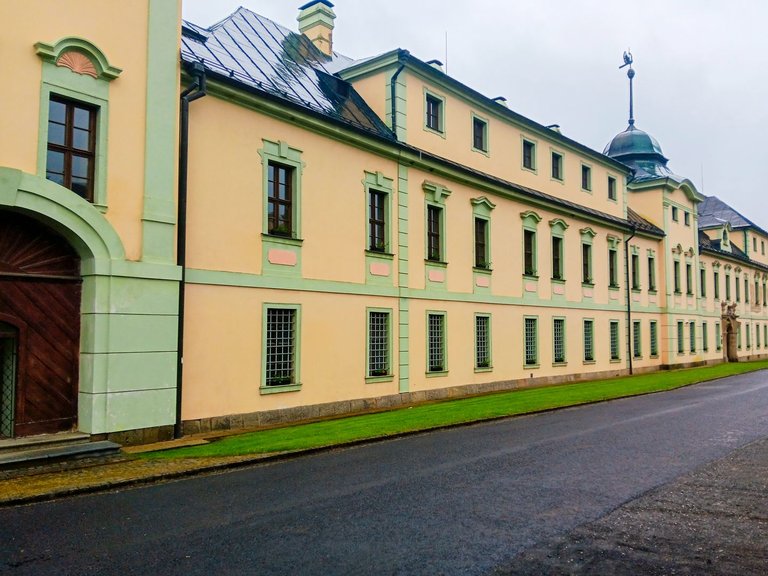
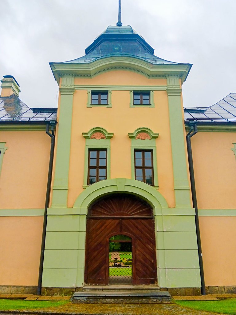
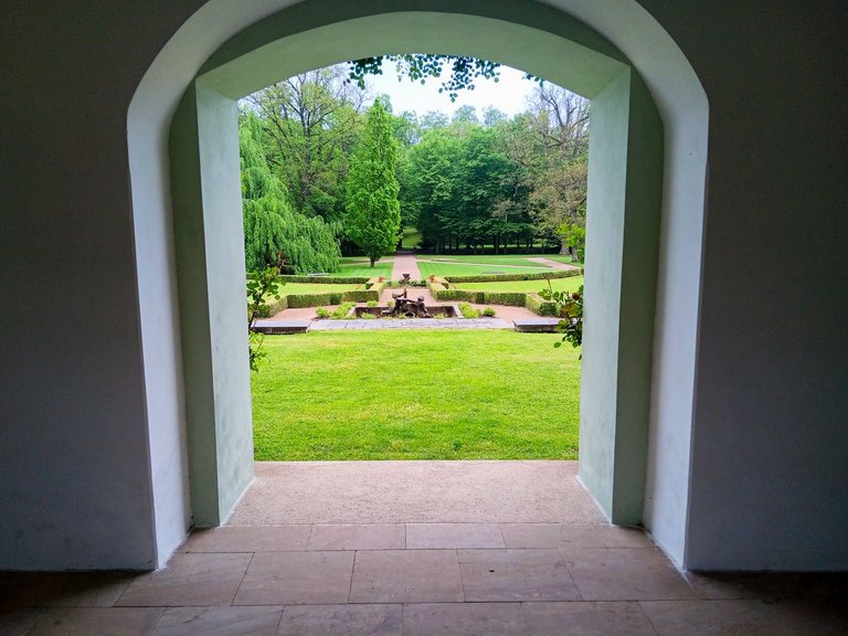
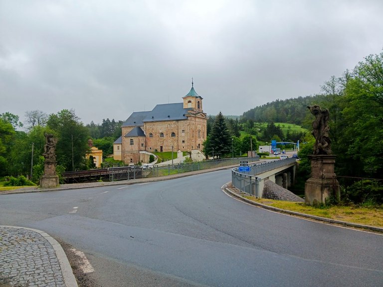
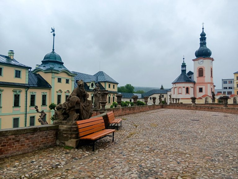
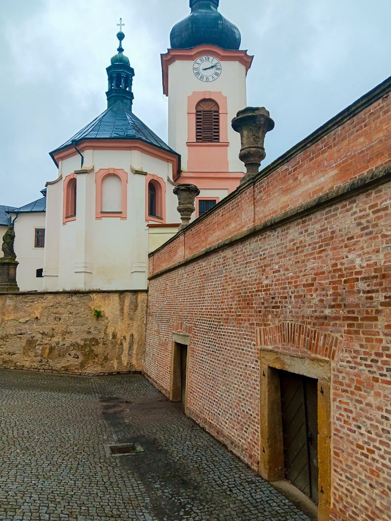
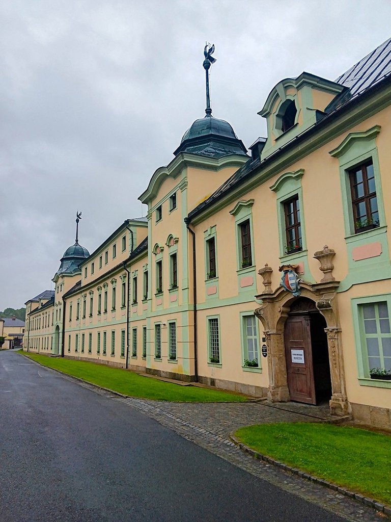
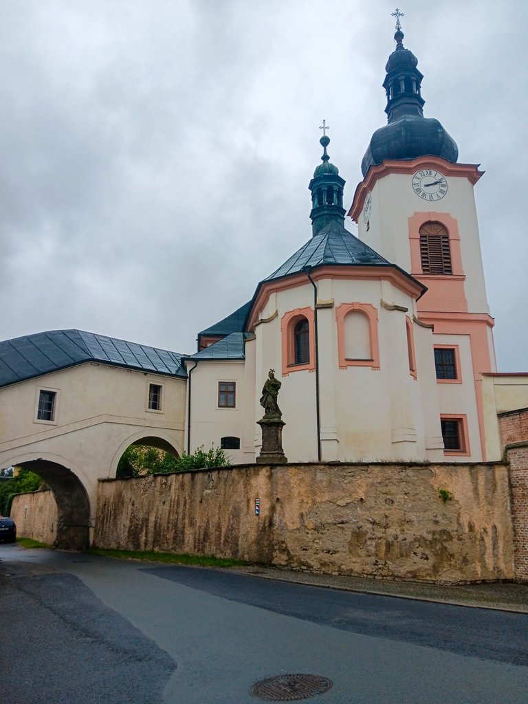
Of course, I was not only impressed by the statues around the road, but also by the castle on the main square.
Samozřejmě mě nezaujali jen sochy kolem silnice, ale i zámek na hlavním náměstí.
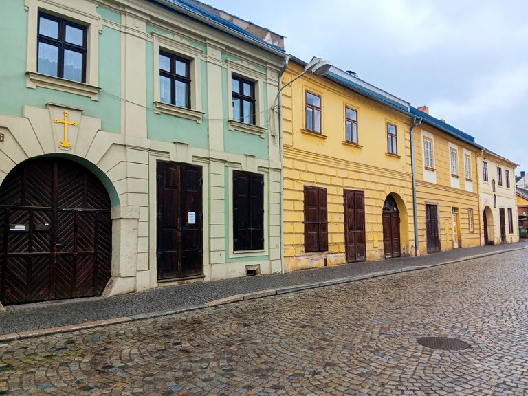
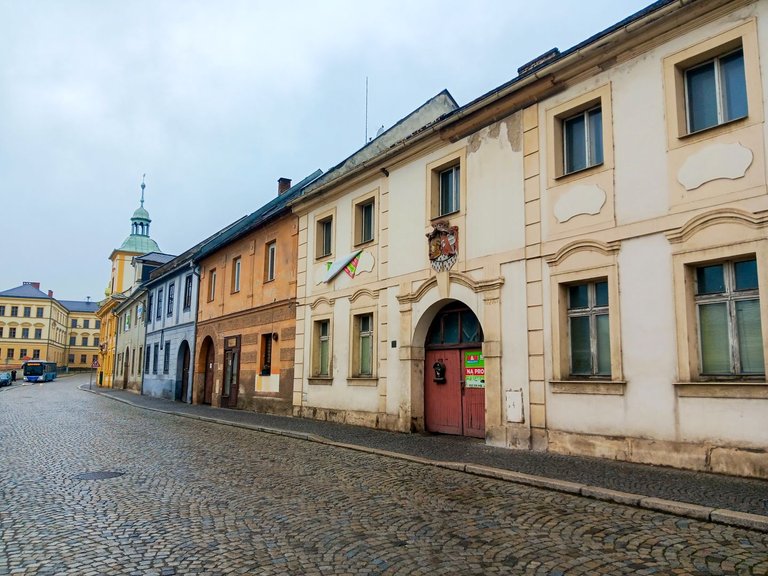
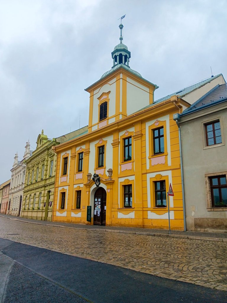
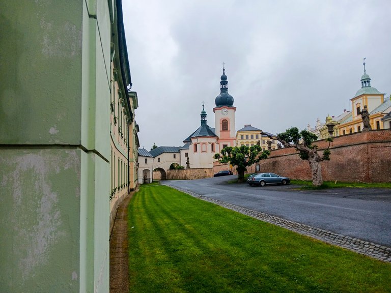
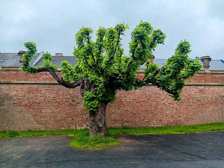
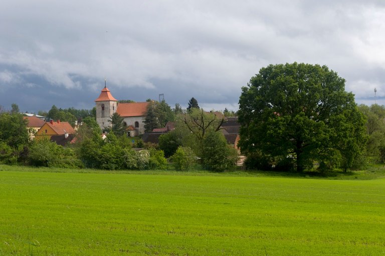
The main road is lined with historic houses, which is why the entire town is a declared Municipal Heritage Zone.
Hlavní silnice je lemována historickými domy a proto je celé město vyhlášenou Městskou památkovou zónou.
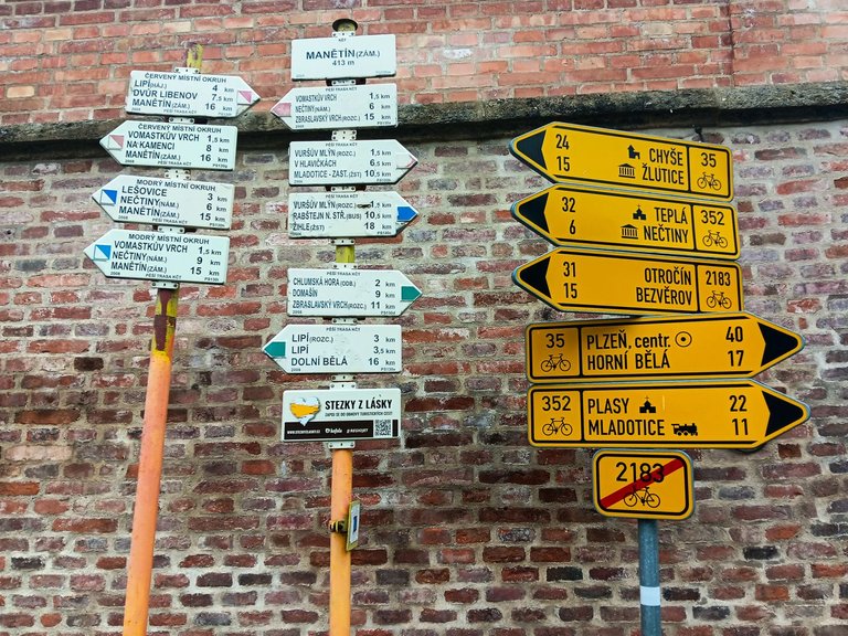
According to the tourist signpost, it is possible to go in all directions and everywhere you will find something interesting from history or beautiful nature.
Podle turistickém rozcestníku je možné se vydat všemi směry a všude najdete něco zajímavého z historie, nebo krásnou přírodu.
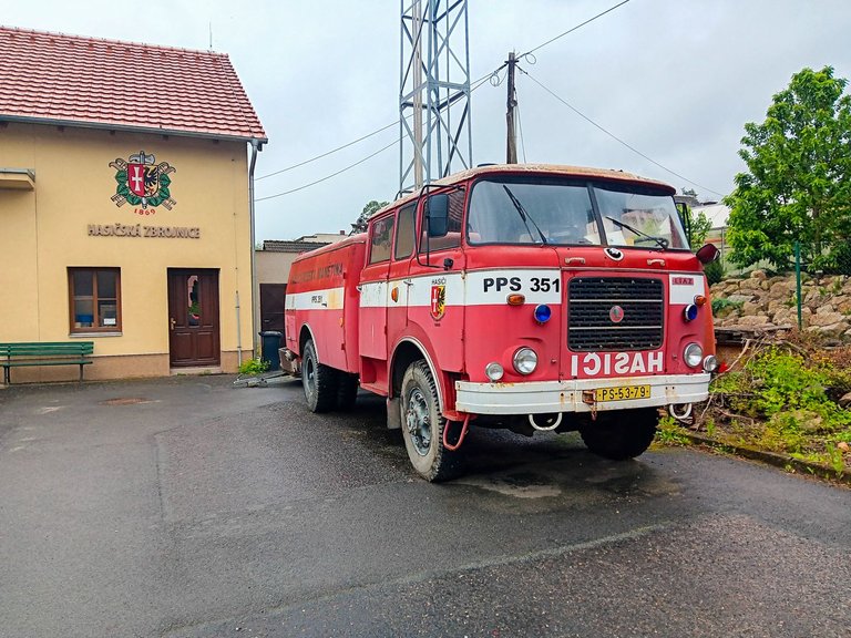
I continued along the educational trail, which is called Mlýnská stezka (the Mill Trail) and maps the history of local milling. I passed the fire station on the outskirts of town. And I thought "the old town needs an old fire truck".
Já jsem pokračoval po naučné stezce, která se jmenuje Mlýnská stezka a mapuje historii místního mlynářství. Na okraji města jsem minul hasičskou stanici. A říkal jsem si "staré město potřebuje staré hasičské auto".
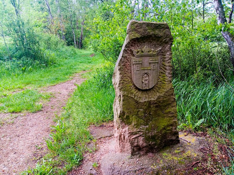
Soon after I left the town, I arrived at the region border between Manětín and Nečtiny, where they have this border stone.
Za nedlouho jsem dorazil na hranici mezi Manětínem a Nečtinami, kde mají tento hraniční kámen.
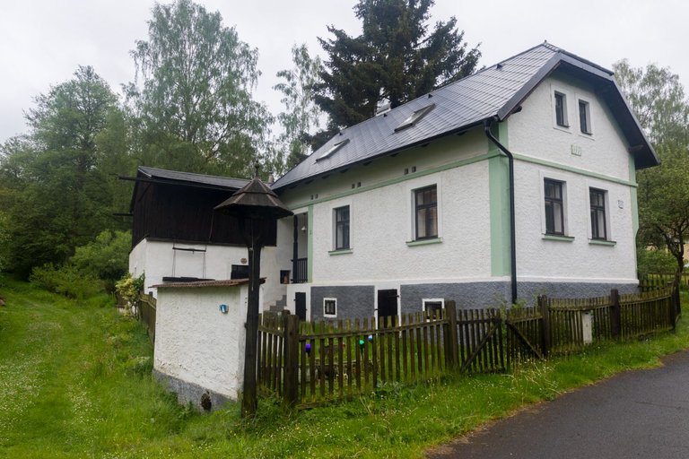
The journey was very pleasant because it followed the Manětínský potok (Manětín stream). I learned the history of milling on this creek from the many signs. There were 6 mills and one hammer in less than 6 kilometers.
Cesta byla velmi příjemná, protože sledovala Manětínský potok. Na mnoha cedulích jsem se dozvěděl historii mlynářství na tomto potoce. Na necelých 6 kilometrech bylo 6 mlýnů a jeden hamr.
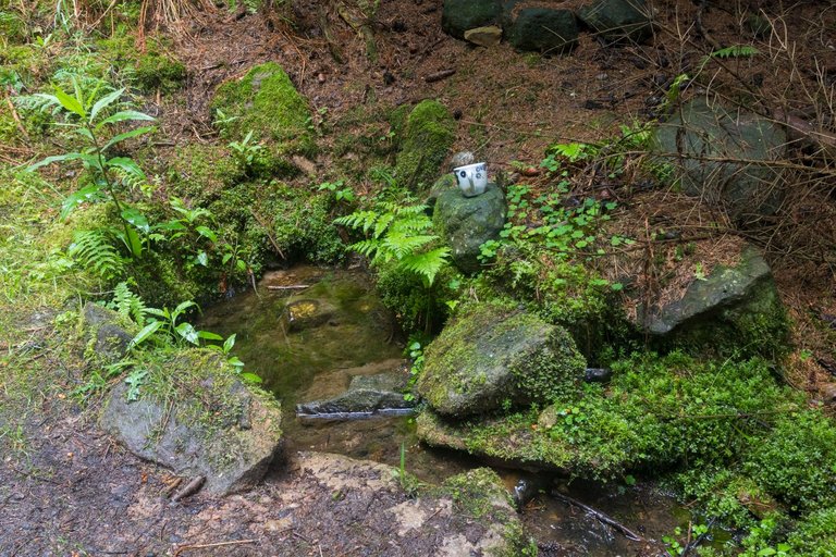
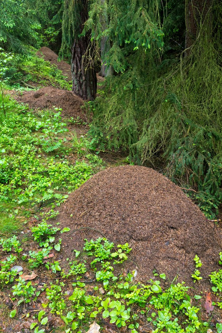
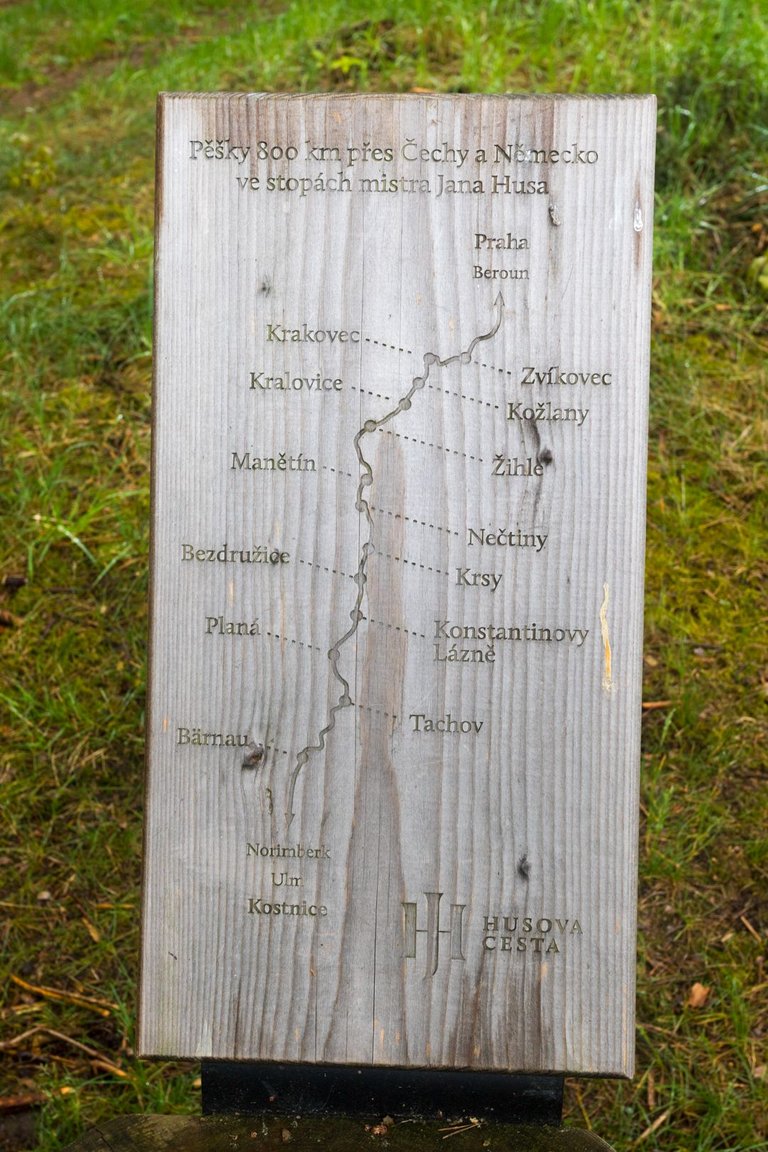
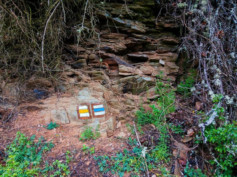
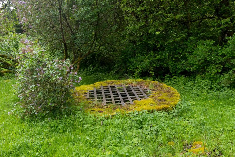
I filled up the water in one of the springs, looked at the anthills and continued to Nečtiny. Where I did not linger and continued on. At one of the rest stops that the Hus route offers, I found out that I am about halfway through my journey in the Czech Republic, or so I will be after completing this stage.
Doplnil jsem vodu v jedné ze studánek, prohlédl si mraveniště a pokračoval do Nečtin. Kde jsem se nezdržel a pokračoval dále. Na jednom z odpočívadel, která Husova cesta nabízí jsem zjistil, že jsem asi za polovinou svojí cesty na území ČR, nebo tedy po dokončení této etapy budu.
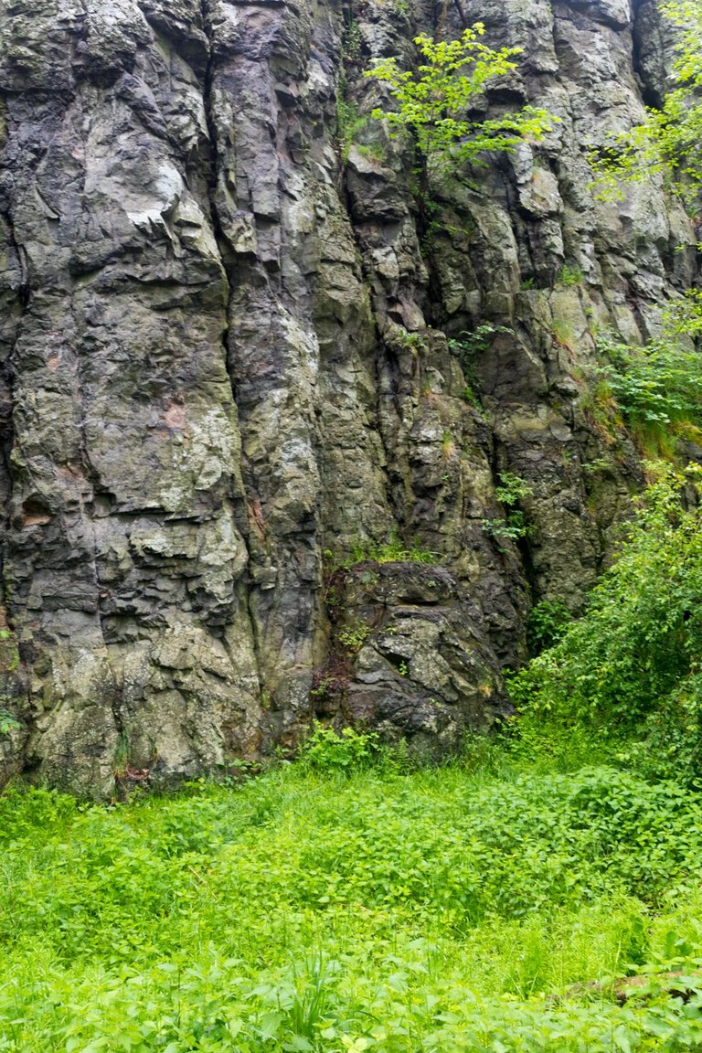
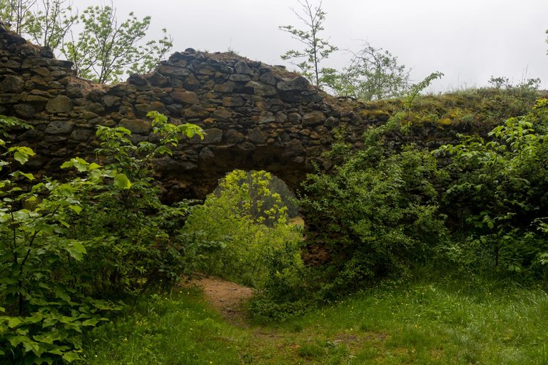
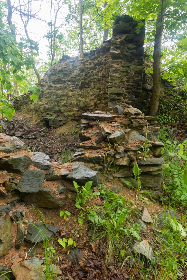
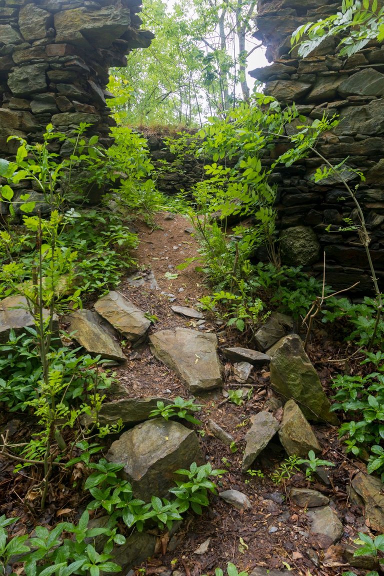
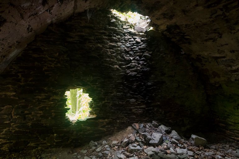
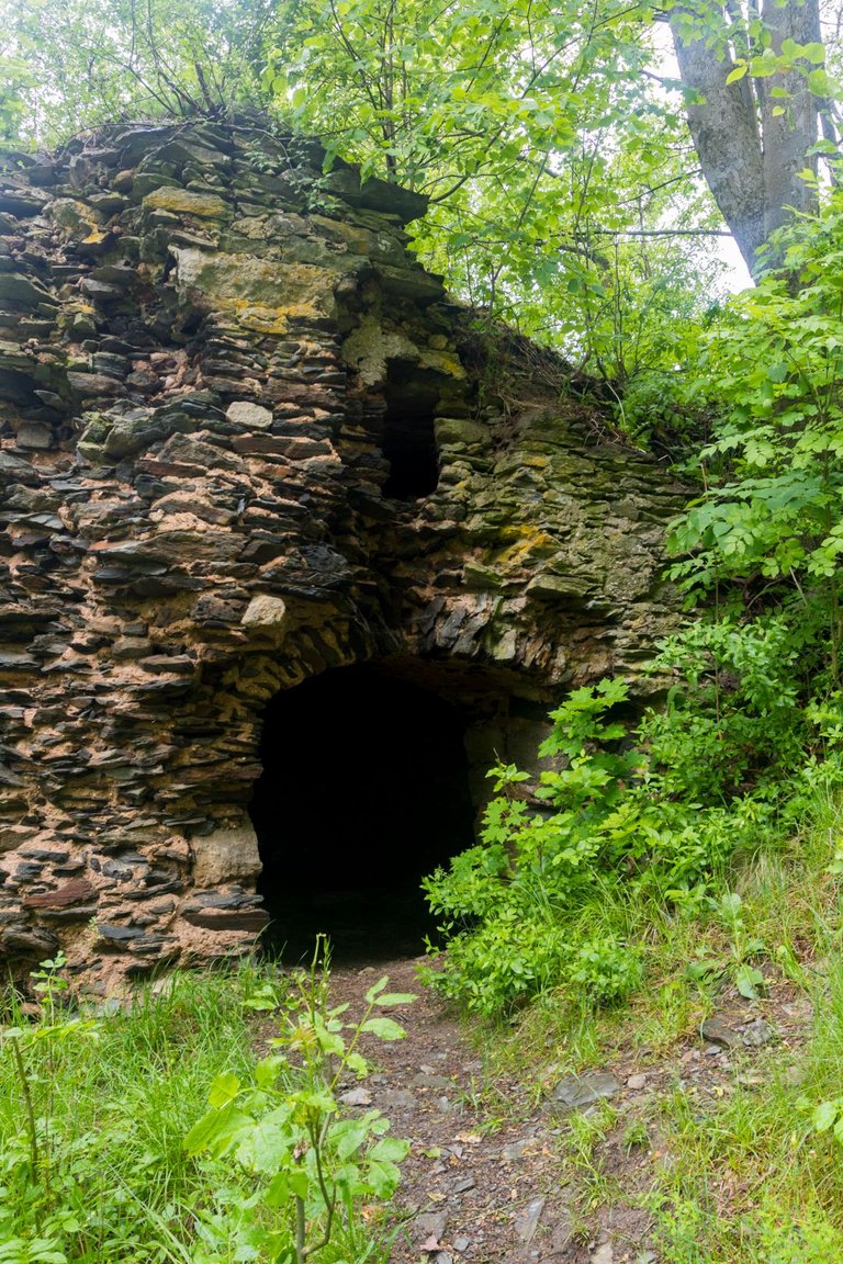
After less than 3 kilometers after I left Nečtiny, I reached the black basalt rock on which the ruins of Preitenstein Castle were supposed to be. So I decided take a little detour and climbed the basalt rock. Where I discovered the remains of a huge castle that occupied the entire top of the rock.
Po necelých 3 kilometrech co jsem opustil Nečtiny. Jsem došel pod černou bazaltovou skálu na které měla být zřícenina hradu Preitenstein. Tak jsem se rozhodl pro malou zacházku a vystoupal na bazaltovou skálu. Kde jsem objevil pozůstatky obrovského hradu, který zabíral celé návrší skály.
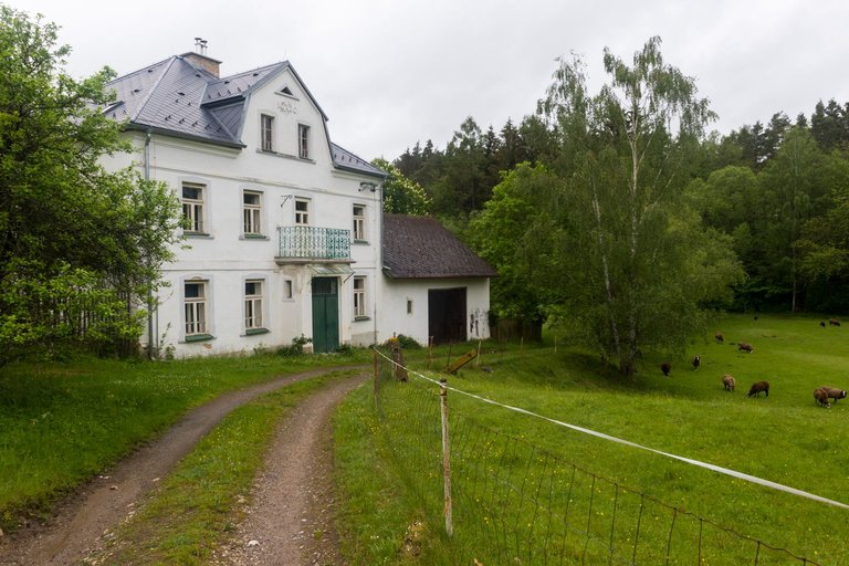
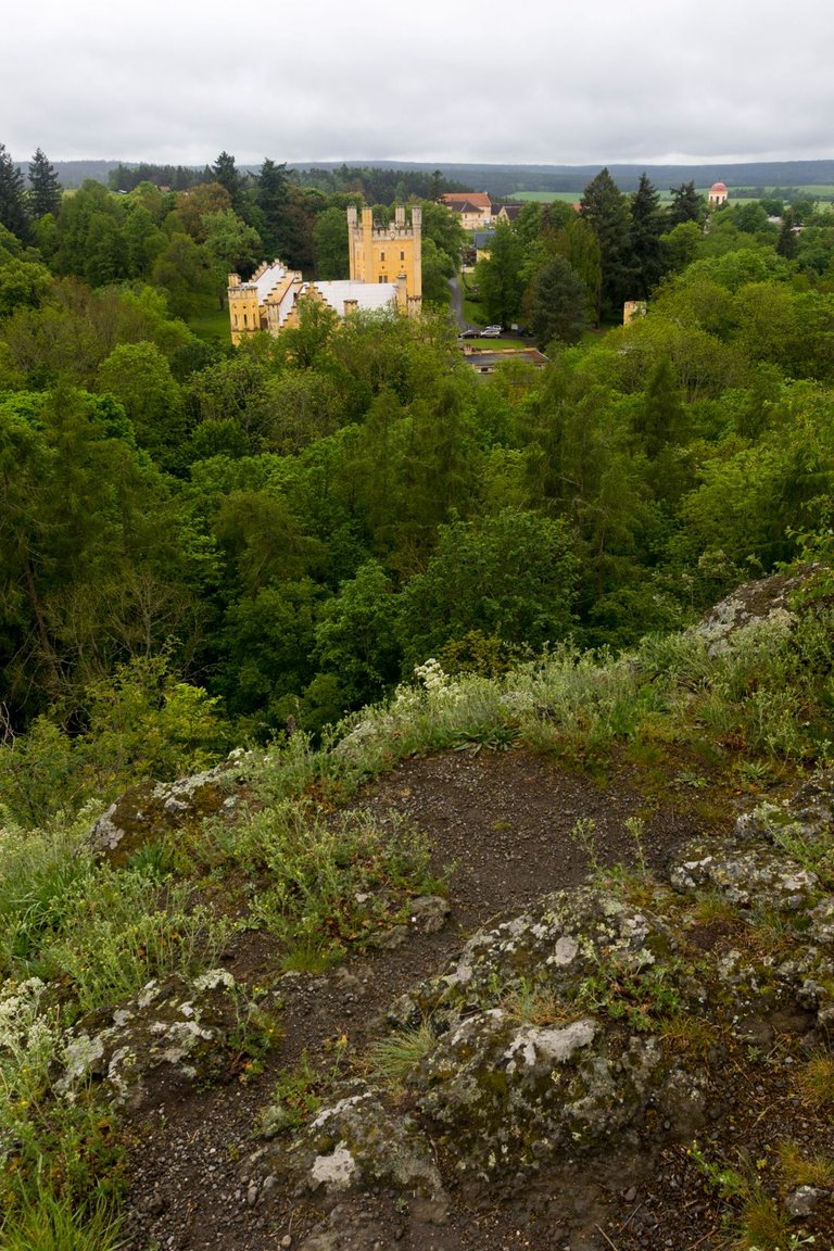
Near the rock stands a Neo-Gothic castle, which during the socialist era served as an accommodation facility for children. That's why it's in the state it is. Today, the castle is a hotel and restaurant. That's why I only refreshed myself with an apple in the castle park and continued on.
Hned po skálou stojí novogotický zámek, který v době socialismu sloužil jako ubytovací zařízení pro děti. Proto je ve stavu jakém je. Dnes je ze zámku hotel a restaurace. Proto jsem se pouze občerstvil v zámeckém parku jablkem a pokračoval dále.
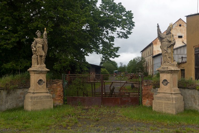
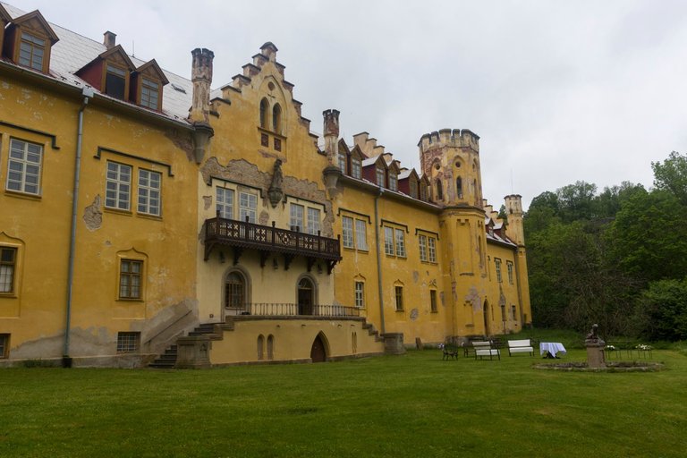
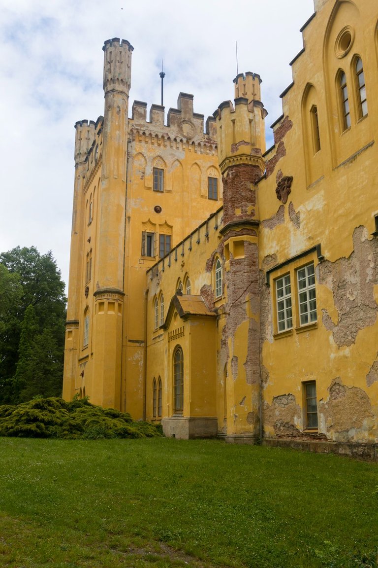
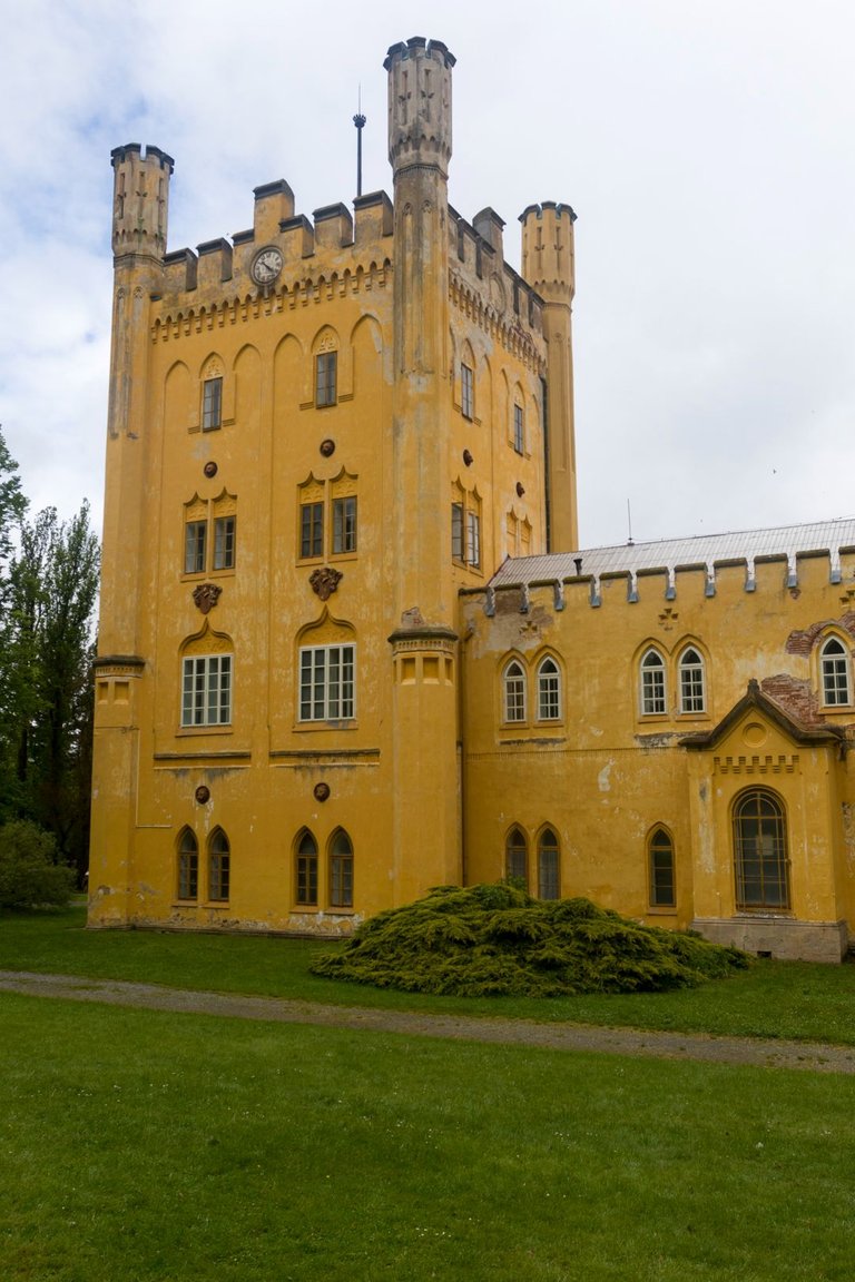
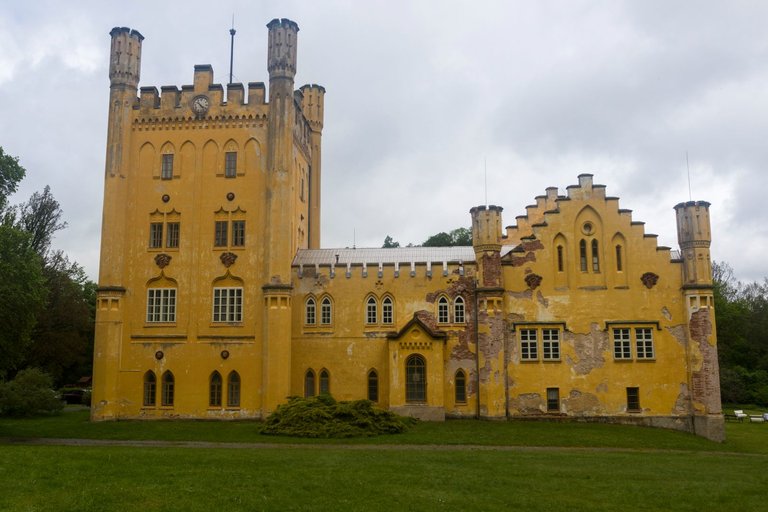
There is another castle in the nearby village of Hrad Nečtiny, but it is in an even worse condition than the previous one. Because there was an agricultural cooperative here. And it is still here, this time in private hands. One of the entrances is guarded by baroque statues of Saint Florian and Saint Adalbert.
V přilehlé obci Hrad Nečtiny je další zámek, ale ten je ještě v horším stavu než ten předchozí. Protože zde bylo zemědělské družstvo. A to je zde doposud, ale v soukromých rukách. Jeden z vjezdů stráží barokní sochy svatého Floriána a svatého Vojtěcha.
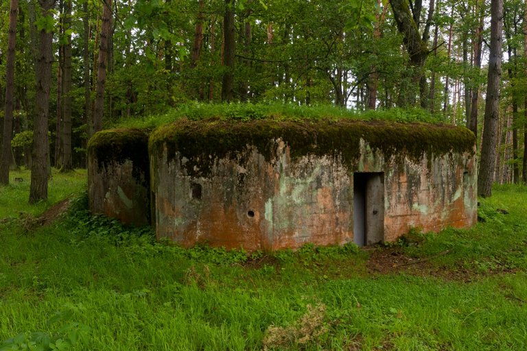
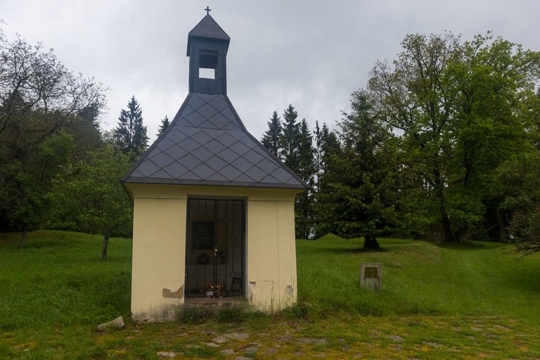
After visiting history, I again headed towards nature. But not for long, because after 3.5 kilometers I reached the top of Umíř hill (616m). Where the village of the same name used to be. There are only a few wells left of the village, a repaired chapel and a bunker that was built before the Second World War. There is also a tourist shelter and a spring. The site is marked in the map as an official bivouac site.
Po návštěvě historie, jsem opět zamířil vstříc příroda. Ale ne na dlouho, protože po 3.5 kilometrech jsem došel na vrchol kopce Umíř (616m). Kde bývala stejnojmenná obec. Po vesnici zde zbylo jen několik studen, opravená kaple a jeden bunkr, který byl postaven před druhou světovou válkou. Je zde i turistický přístřešek a studánka. Toto místo je označeno v mapě jako oficiální bivakovací místo.
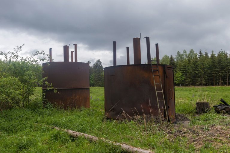
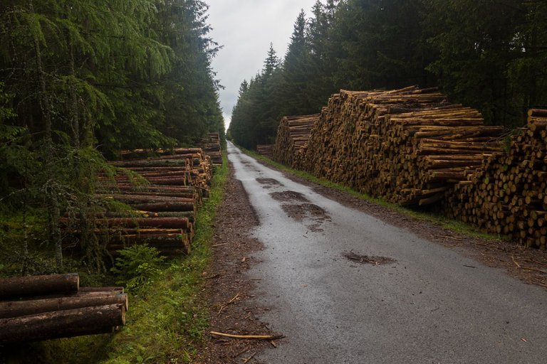
From Umíř, I continued through the forest, where I met containers for the production of charcoal, piles of extracted wood and was caught by a heavy rain from which I had to hide in a young fir grove.
Z Umíře jsem pokračoval dále lesem, kde jsem potkal nádoby na výrobu dřevěného uhlí, hromady vytěženého dřeva a byl zastižen silným deštěm před kterým jsem se musel schovat v mladém jedlovém hájku.
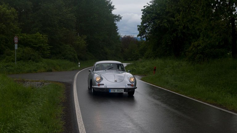
Throughout the day I encountered vintage cars as I moved around the roads. But I only managed to photograph one car. Probably the most interesting and rarest I saw that day. Porsche 356. They probably meet in the already mentioned town of Úterý. Where is the annual meeting of old cars held around this date. There are also hillclimb race, in which I had the opportunity to participate several times as a rider. And this year I plan to go there again, but only as a visitor and photographer.
Po celý den jsem potkával historická auta, když jsem se pohyboval v okolí silnic. Ale podařilo se mi vyfotit pouze jedno auto. Pravděpodobně nejzajímavější a nejraritnější co jsem ten den viděl Porsche 356. Měli pravděpodobně setkání ve městě Úterý. Kde se kolem tohoto data koná každoroční sraz historických vozů. Konají se zde i závody do vrchu, kterých jsem se měl možnost několikrát zúčastnit jako jezdec. A letos tam plánuji jet znovu, ale jen jako návštěvník a fotograf.
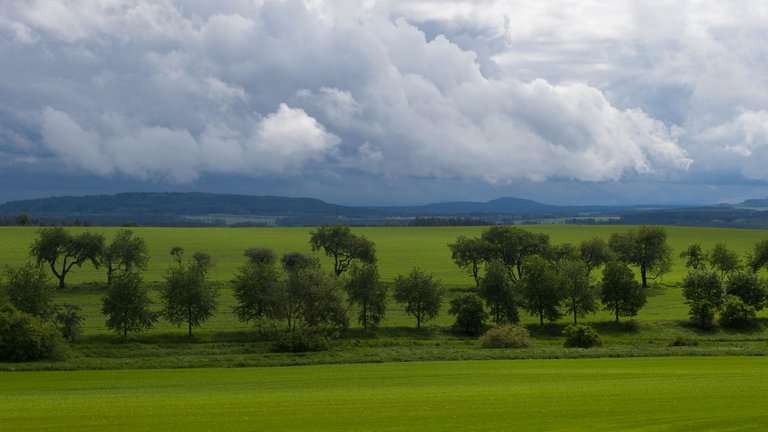
As soon as we left the forest, the sun began to shine through the dark clouds. From which heavy showers of rain fell. But I knew from the forecast that the weather would continue to improve.
Jakmile jsme opustil les, začalo prosvítat slunce skrze temné mraky. Ze kterých padaly silné dešťové přeháňky. Ale podle předpovědi jsem věděl, že se bude počasí nadále zlepšovat.
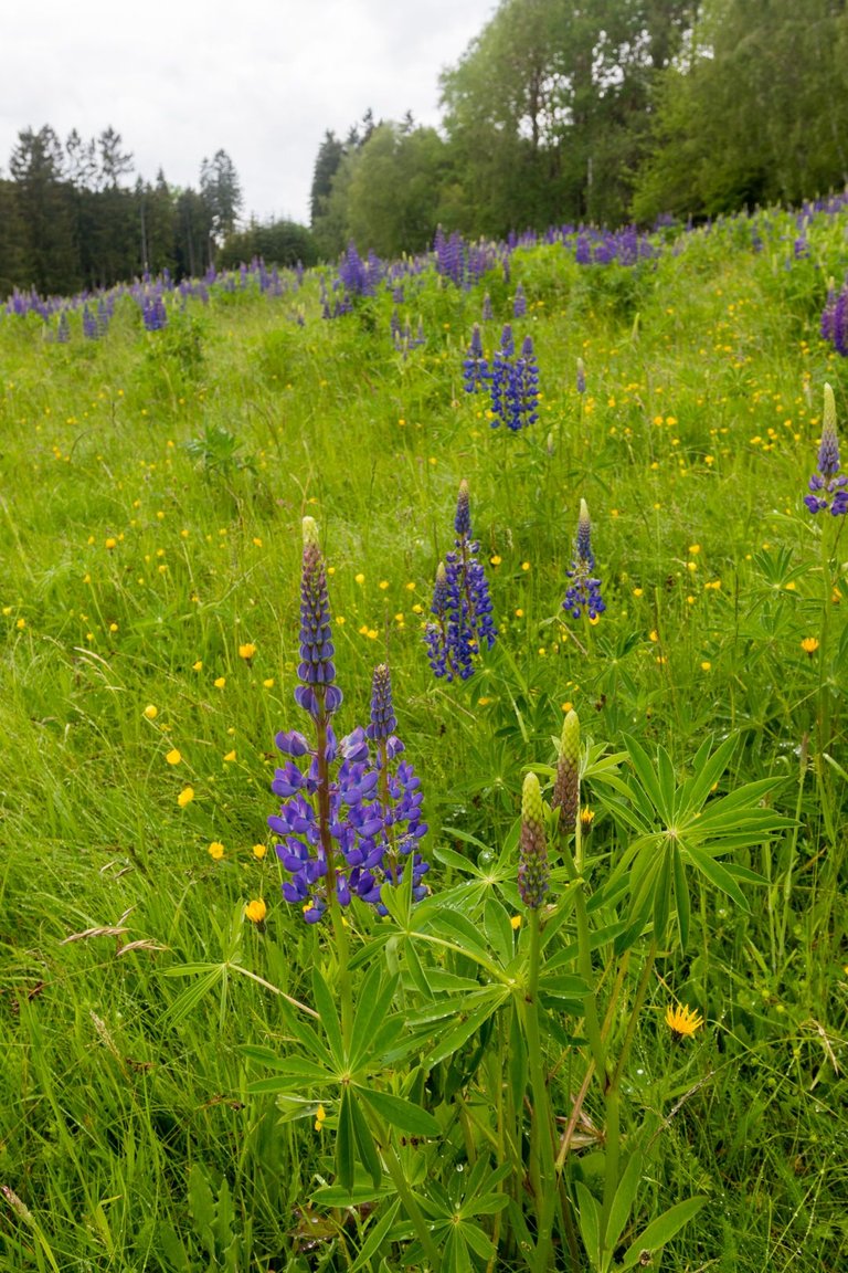
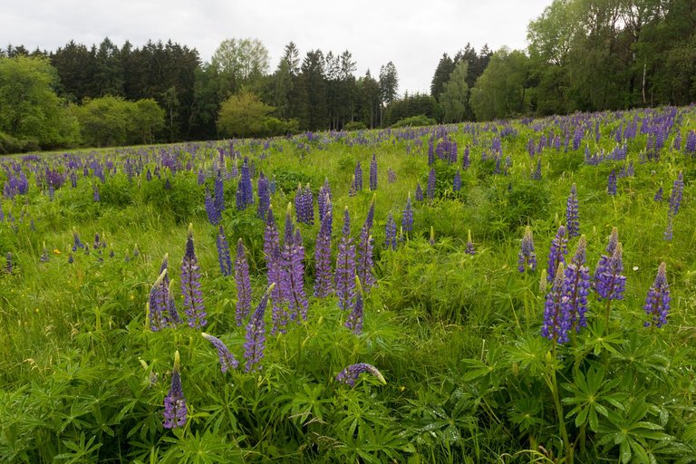
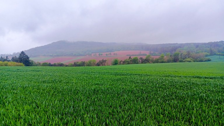
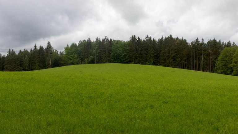
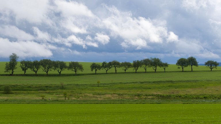
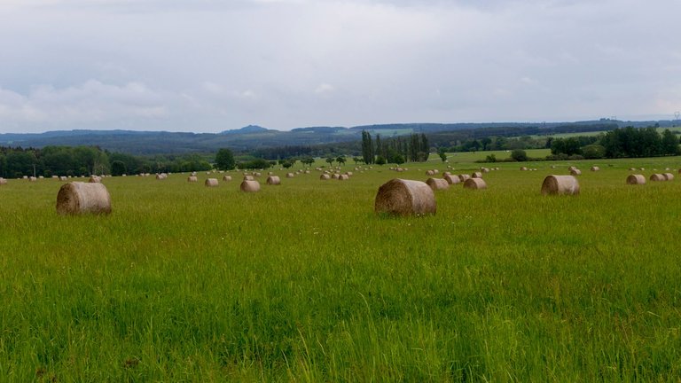
Around the village of Krsy, following the path was somewhat more difficult, as it was necessary to walk along unmarked paths that led me to blooming meadows.
Kolem obce Krsy bylo sledování cesty poněkud složitější, protože bylo třeba projít po neznačených cestách, které mě zavedly na rozkvetlé louky.
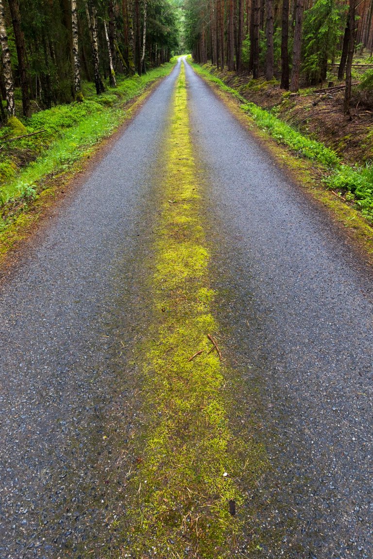
Then it was necessary to go almost 7 kilometers straight. I only had to cross two valleys on the way. Dolský potok (Dolský stream) flowed in one and Úterský potok (Úterský stream) in the other.
Pak bylo třeba jít skoro 7 kilometrů rovně. Cestou jsem musel překonat jen dvě údolí. V jednom tekl Dolský potok a v druhém Úterský.
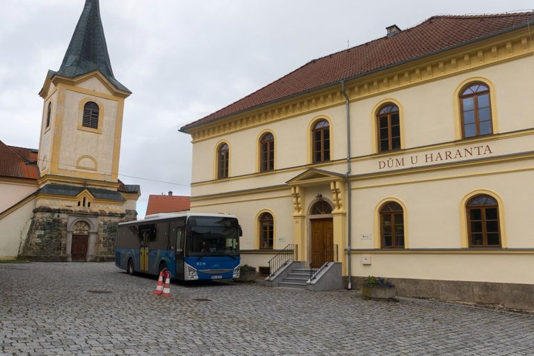
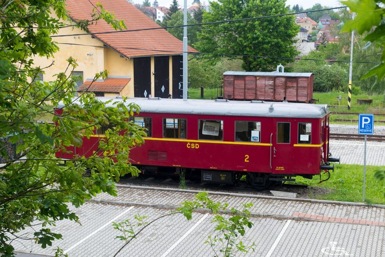
After overcoming these obstacles, I arrived in the town of Bezdružice. I didn't stay here at all, just took a few photos on the square of houses that are being repaired. Otherwise, the city looks quite depressing at first glance. I then headed past the station to the next town of Konstantinovy Lázně.
Po překonání těchto překážek jsem dorazil do města Bezdružice. Zde jsem se vůbec nezdržel, jen udělal pár fotografií na náměstí domů, které jsou opraveny. Jinak město působí na první pohled dosti depresivně. Následně jsem zamířil kolem nádraží k dalšímu městu Konstantinovy Lázně.
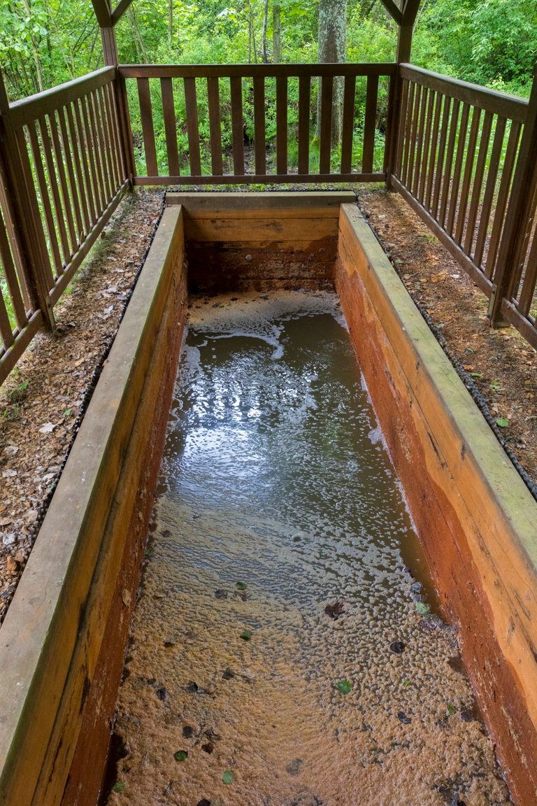
Where I reached after less than two kilometers along the asphalt cycle path. The plan was to top up the water in one of the local mineral springs. The first was Rudolfův pramen (Rudolph's Spring), which was more of a pool with bubbling sulfur water.
Kam jsem došel po necelých dvou kilometrech po asfaltové cyklostezce. Plán byl doplnit vodu v některém ze zdejších minerálních pramenů. První byl Rudolfův pramen, což byl spíše bazének s bublající sirnou vodou.
So I headed to the other spring through the city park. The spring is called Čeliv and is relatively difficult to access. A narrow path leads to it through the meadow, which at that time was soaked from the rains. And besides, the spring is just an unmaintained hole in the ground full of mud. So I was without water and with wet feet. Fortunately, the sun started to peek through the clouds, so I scrambled up the hill and used the local clearings to dry my feet. And while I was here, I decided to spend the night here.
A tak jsem zamířil k druhému prameni přes městský park. Pramen se jmenuje Čeliv a je poměrně špatně přístupný. Vede k němu úzká cestička přes louku, která byla tou dobou promáčená po deštích. A navíc pramen je pouze neudržovaná díra v zemi plná bahna. Takže jsem byl bez vody a s mokrými nohami. Naštěstí začalo prosvítat slunce skrze mraky a tak jsem se vydrápal na kopec a využil místní paseky pro usušení nohou. A když jsem zde byl, rozhodl jsem se zde i přenocovat.

Route from Rabštejn nad Střelou to Konstantinovy Lázně
| Kilometers walked | Meters Up | Meters Down |
|---|---|---|
| 204.4 Km | 4103 meters | 3791 meters |
Jan Hus Trail - Prague (CZ) / Day 1 - part 1
Jan Hus Trail - Prague (CZ) / Day 1 - part 2
Jan Hus Trail - Prague to Beroun (CZ) / Day 2
Jan Hus Trail - Beroun to Skryjská jezírka (CZ) / Day 3
Jan Hus Trail - Skryjská jezírka to Kralovice (CZ) / Day 4
Jan Hus Trail - Kralovice to Rabštejn nad Střelou (CZ) / Day 5
Přijde mi, že snad všechny ty fotky mají nějaké divné barvy. To jsi to nějak editoval, nebo ti to takhle samo vyšlo? Nebo je to monitorem?
Ty s divnýma barvama jsou z telefonu. Vetšina telefonů je nastavených na slunečný počasí a pokud je hnusně s temnýma mrakama tak si s tím neumí poradit a produkujou divný barvy. Měl jsem stejej problém u Huawei i Samsungu takže to má co dělat s velikostí čipu, který si s tím neumí poradit a v postprocesu s tím skoro nic nejde udělat.
Přímo v centru Konst. Lázní je pramen, který se dá načepovat. Ale pít ho místo běžné vody bych ho asi nedoporučoval :-)
Hodně sirnatý a železitý.
Prusíkův pramen
Konstantinovy Lázně, Česko
https://mapy.cz/s/hujojodoru
Mě se právě do centra vůbec nechtělo, tak jsem to nechal na druhý den a zašel k prameni lásky, který není tak sirnatý. Při cestách už jsem pil ledacos a po tom co jsem zkoušel Rádiovku ve Slavkovském lese. Tak snad už nic horšího být nemůže, ta mě opravdu složila asi na 4 hodiny, že jsem si musel jít lehnout uprostřed dne.
No, centrum... Je to hodně maličký :-) Radiovku jsem nezkusil.
Ale věřím, některé prameny mají silné účinky, třeba ty u Frant. Lázní s obsahem projímavé Glauberovy soli :-)
Mě nejvíc chutnala Farská kyselka u Mariánských Lázní. Po sto kilometrech na kole byla vynikající.
Congratulations, your post has been added to Pinmapple! 🎉🥳🍍
Did you know you have your own profile map?
And every post has their own map too!
Want to have your post on the map too?
Congratulations, your post has been added to the TravelFeed Map! 🎉🥳🌴
Did you know you have your own profile map?
And every post has their own map too!
Want to have your post on the map too?
- Go to TravelFeed Map
- Click the create pin button
- Drag the marker to where your post should be. Zoom in if needed or use the search bar (top right).
- Copy and paste the generated code in your post (any Hive frontend)
- Or login with Hive Keychain or Hivesigner and click "create post" to post to Hive directly from TravelFeed
- Congrats, your post is now on the map!
PS: You received this comment because you used the Pinmapple code snippet. Pinmapple is closing down and we are continuing Pinmapple's legacy. You can also import your previous Pinmapple posts to the TravelFeed map.Opt Out
Wow dear friend , what an adventure. Exploring historical towns, encountering vintage cars, and embracing nature's beauty, all captured vividly. Now that's a cool.life right there. Can't wait to read more about your journey and discoveries dear
Congratulations @softa! You have completed the following achievement on the Hive blockchain And have been rewarded with New badge(s)
Your next target is to reach 29000 upvotes.
You can view your badges on your board and compare yourself to others in the Ranking
If you no longer want to receive notifications, reply to this comment with the word
STOPCheck out our last posts:
Congratulations @softa! You received the biggest smile and some love from TravelFeed! Keep up the amazing blog. 😍 Your post was also chosen as top pick of the day and is now featured on the TravelFeed front page.
Thanks for using TravelFeed!
@for91days (TravelFeed team)
PS: You can now read your favourite travel blogs on your phone. Plus, blogging on-the-go just got easier! Download our app on the Apple App Store or get it on Google Play.