Greetings All!
I hope you all are doing well.
Chanderkhani Pass connects Kullu Valley with Parvati Valley of Himachal Pradesh and is considered one of the most scenic trek of Himachal Pradesh. With maximum elevation of about 3700m, it’s about 12-14 km long trek with elevation gain of about 1500m from the starting point (Rumsu Village).
Chanderkhani pass is of great significance to the local people. Dev culture is followed in the Kullu and Parvati valleys that originated from here as the engrams of all eighteen deities were spread across to different villages of Kullu and Parvati valleys from here.
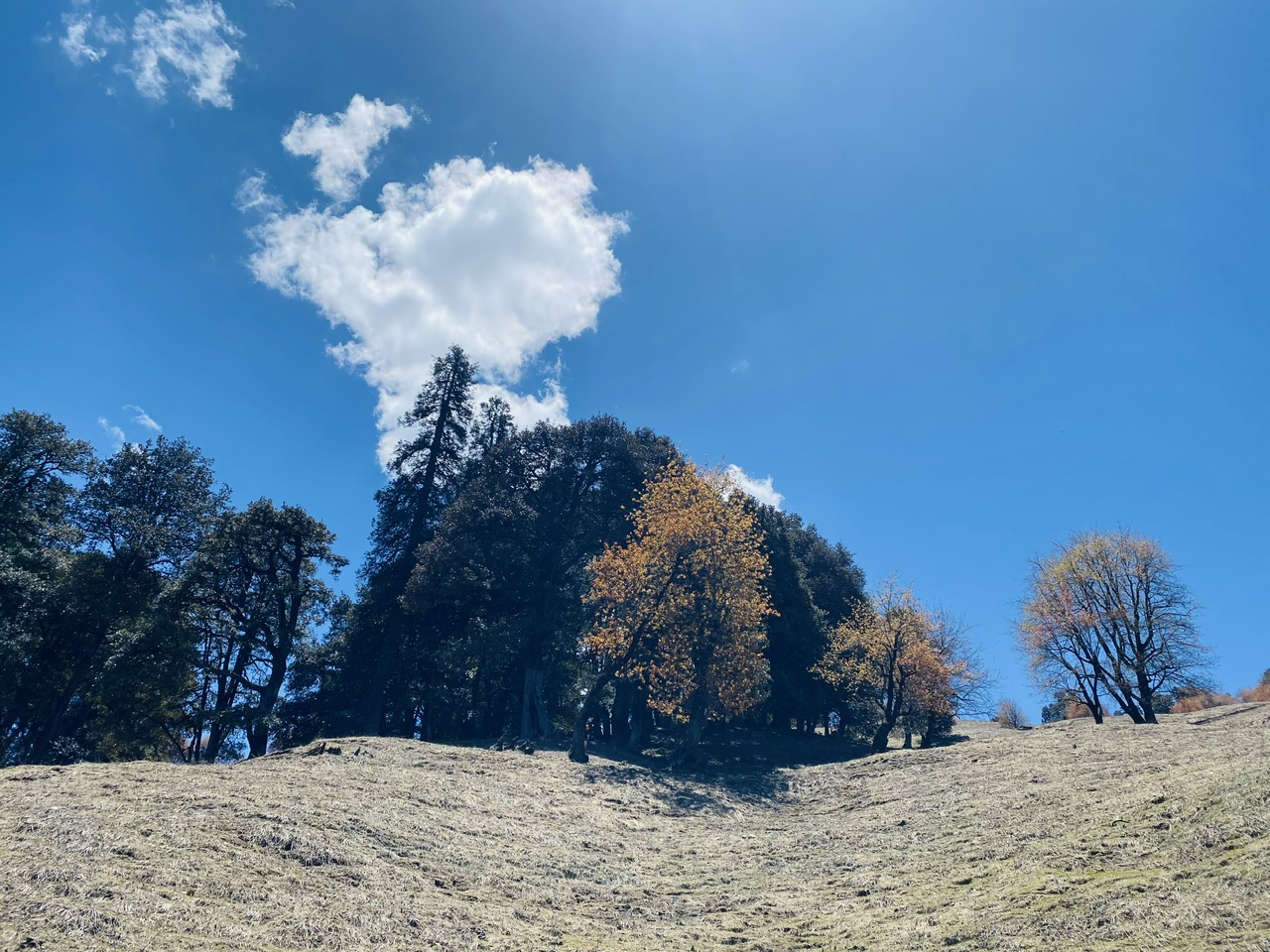
Rumsu to Ghon Karadi-
Ghon Karadi is the first campsite of this trek and to reach there, one has to hike for about 3-4 hours from Rumsu village. This phase of the hike goes through a dense forest.
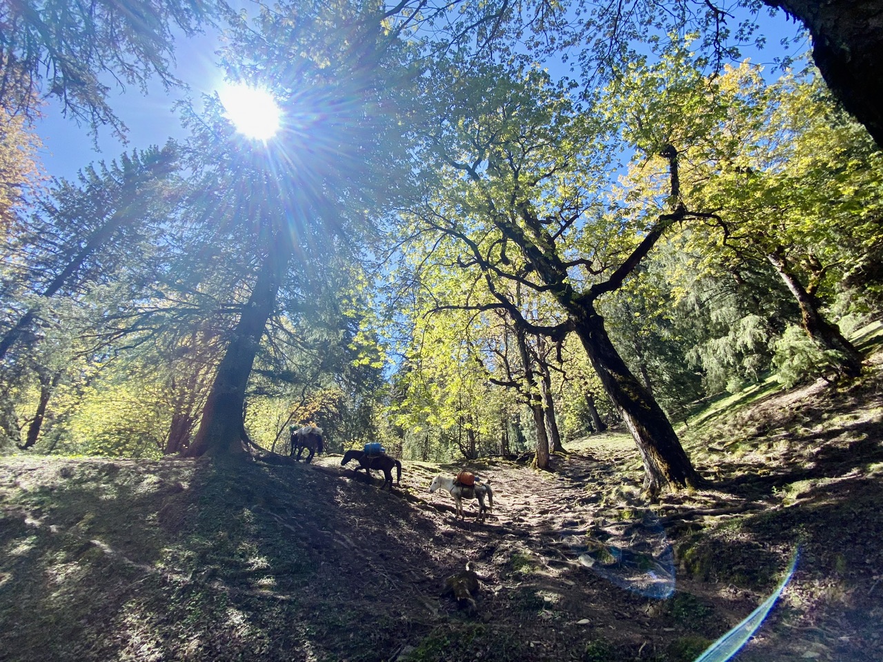
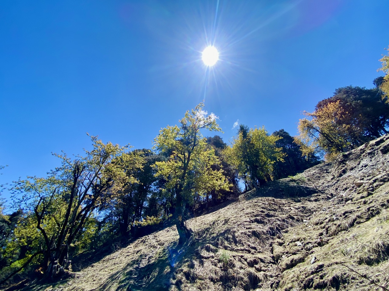
The sky was super clear that day and the little patches of sunshine were penetrating through the trees that felt amazing!
There were many varieties of flora and fauna in that forest. I was told that many of the plants that grew wild here had many medicinal benefits. Many locals hunt for those plants to make money from them as some of those plants have a lot of monetary value.
The trail was getting steeper and we were getting tired! It was still an hour of hike left to reach to the first campsite and we were getting desperate to see the lush green meadows.
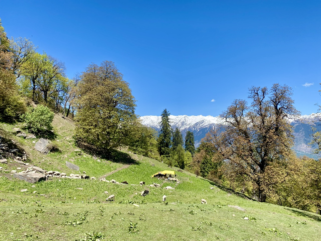
Just before Ghon Karadi, we saw a Shepherd’s tent with his sheep around it. The lush green meadows of this mountain made it an adequate choice for shepherds to live here for several months in a year.
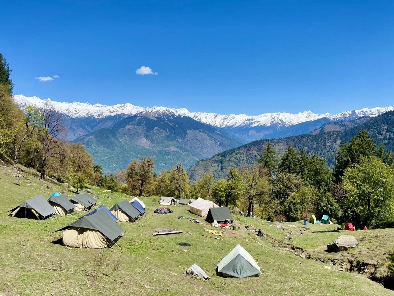
Ghon Karadi campsite
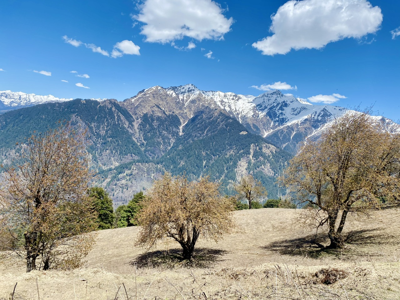
Finally we were here! A lot of tents were pitched here and it looked amazing. The dhaula dhar range of Himalayas was right in front of us all the time.
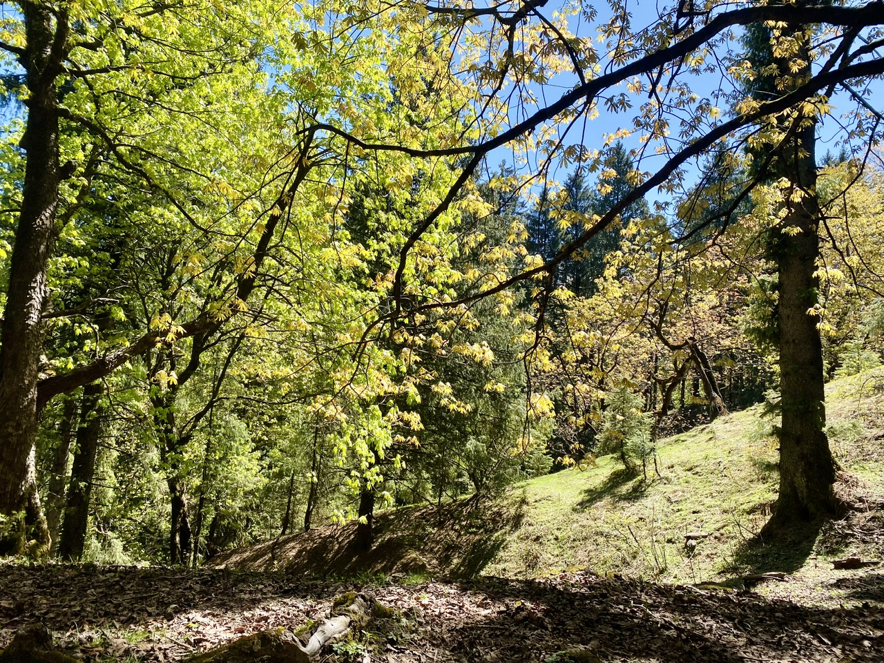
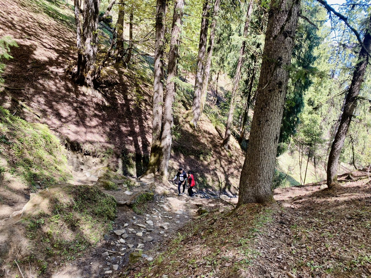
Ghon Karadi to Shedu Pather-
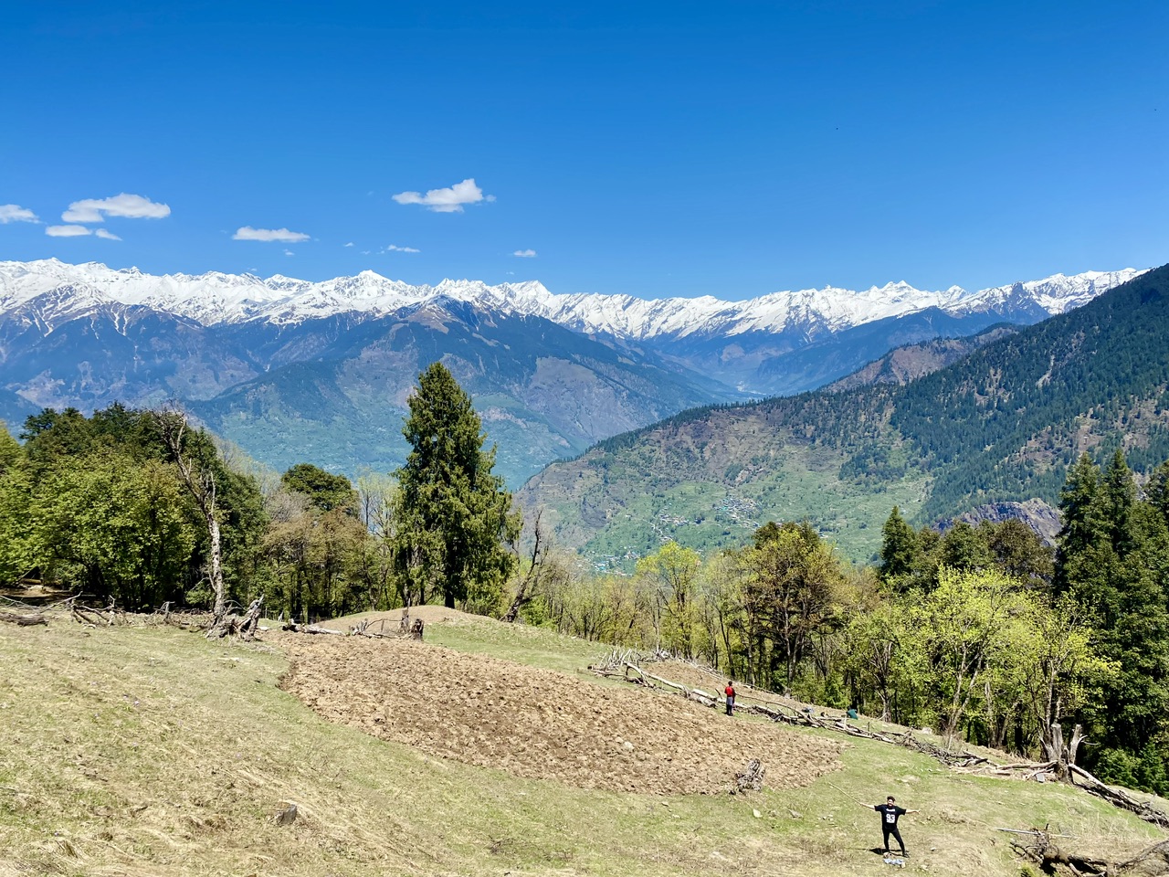
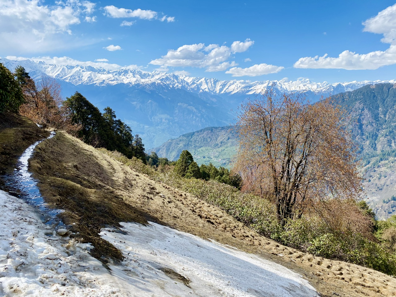
This part of the trek mostly had meadows with some trees in between. The views were getting better as we were gaining elevation.
One thing that I noticed while hiking was there were patches of ploughed land in such a remote parts where it takes around 4-5 hours to reach. I was confused that who cultivates those fields and what grows there?!?
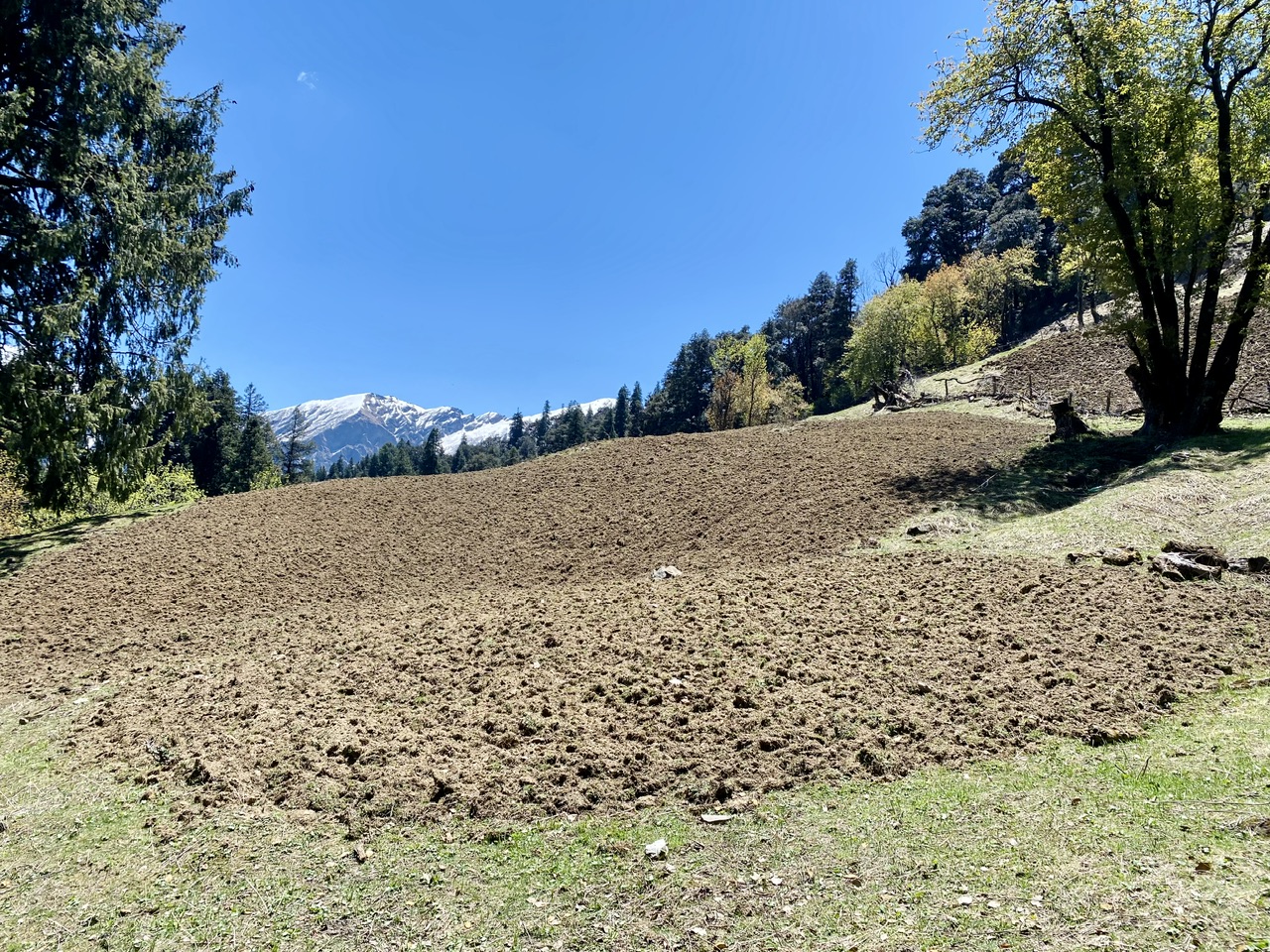
I got to know that locals grow illegal plantations of hash here!!!
This place produces one of the finest hash in the world “Malana Cream” and people were preparing their illegal fields for the cannabis plants.
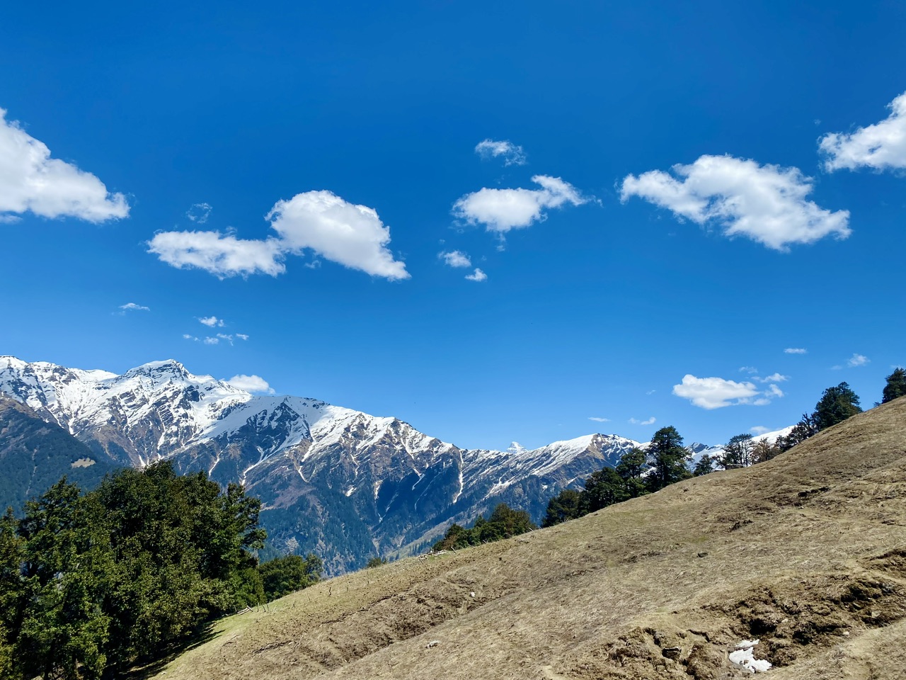
It takes around another 2-3 hours to reach Shedu Pather. This is the second stop of the trek with a few camps pitched there too. The sun was right over our heads and we were getting severely sunburnt because we forgot our sunscreen.
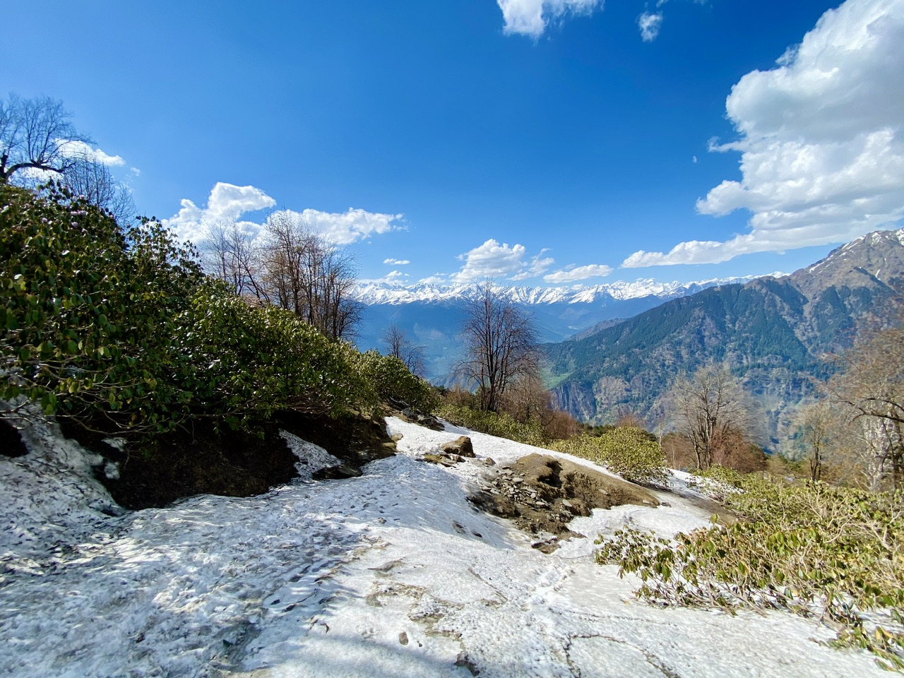
At this point, we had already gained a lot of elevation and the snow capped peaks were right in front of us.
After walking for another 5 mins, we saw the first patch of snow! We were stoked and upon seeing that, every one of us got another rush of energy to reach to our second stop (Shedu Pather).
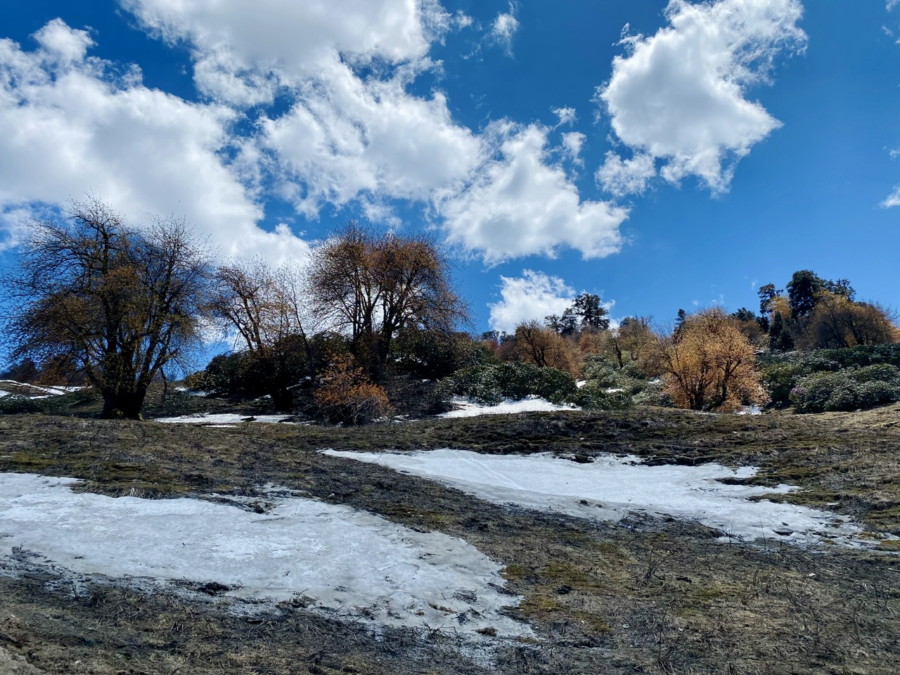
Another fact that I got to know was, this place was called Shedu Pather because of the white coloured stones and rocks that were present here. In local language, Shedu means white and Pather means rock. Below is the photo of Shedu Pather.
Shedu Pather
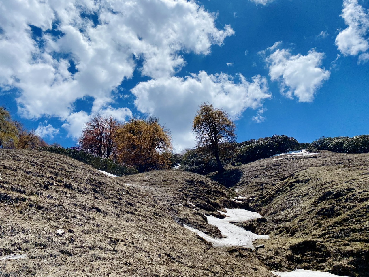
Shedu Pather to Chaklani-
Chaklani is the last campsite of this trek and it takes another hour or two to reach there.
This part of the trek was full of little patches of snow and rusty meadows. Now the vegetation changed dramatically from big beefy trees to small trees, shrubs and bushes.
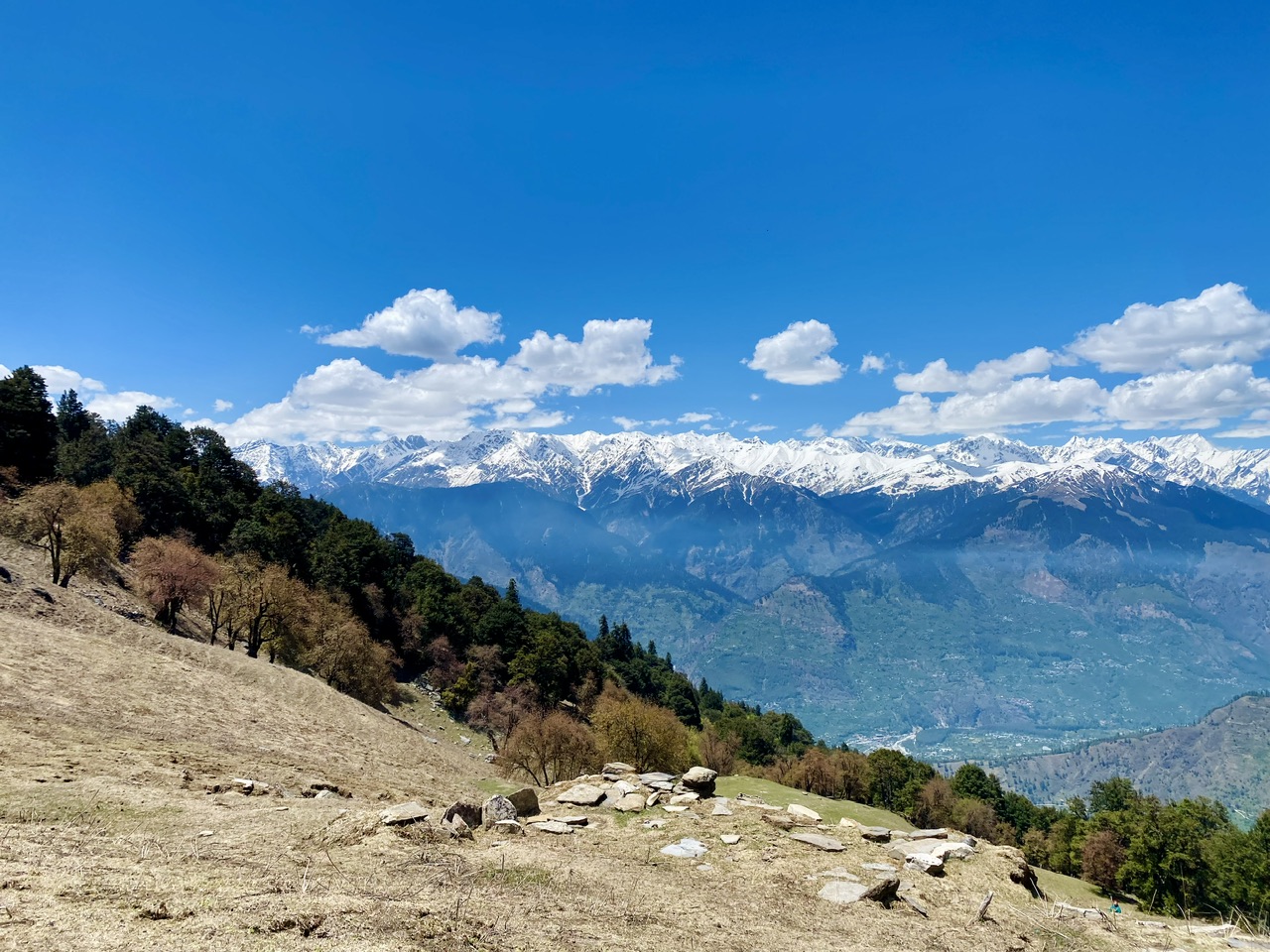
In Chaklani campsite, there were only two tents pitched. It was because of the cold weather and higher altitude. The views from there were magical.
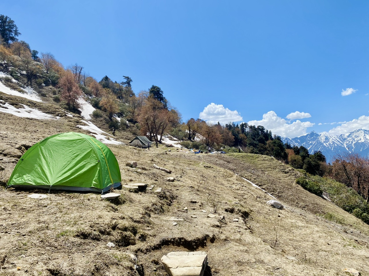
Chaklani Campsite
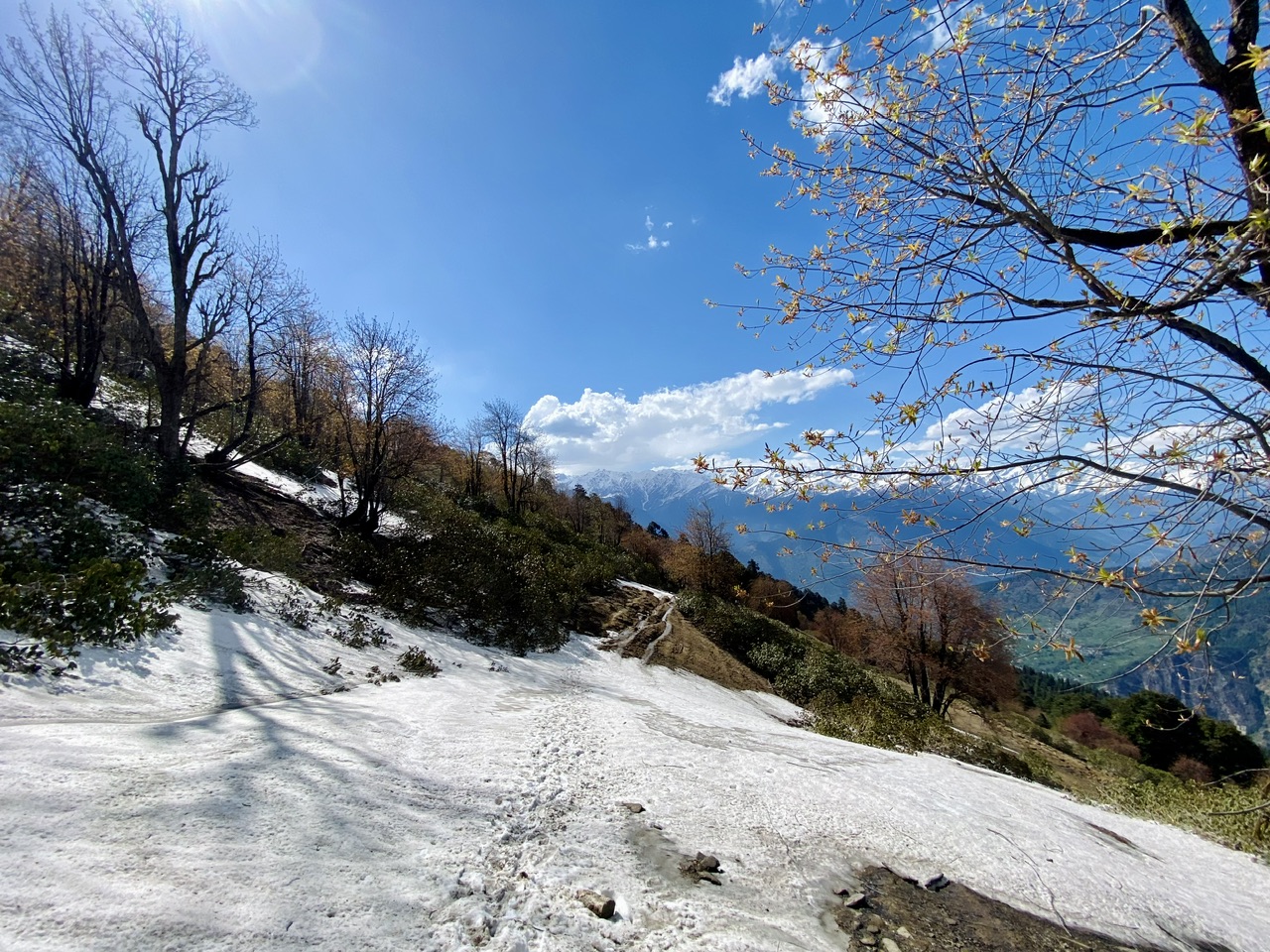
Chaklani to Chanderkhani Pass-
This part of the trek was full of snow!!!
The snow was partially melted because of sun and it was getting very difficult to walk over it.
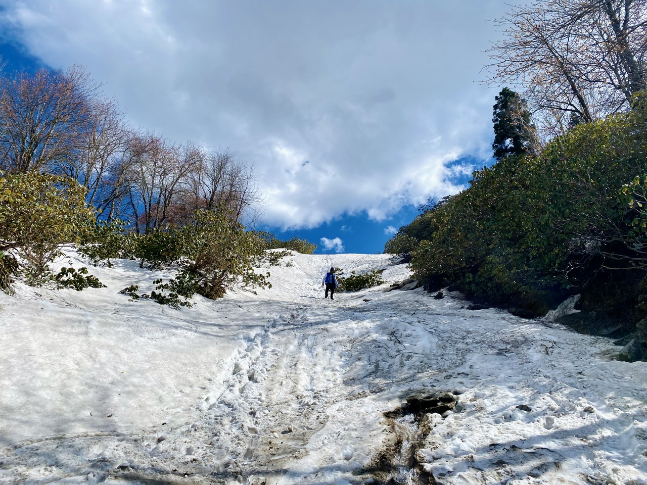
We were slipping often and one of my friend almost hurt his leg once. The vegetation was completely changed now to only bushes. We were soon about to reach the non tropic zone.
The views from here were incomparable. The vibe of this place made me feel like I’m in a dream.
It was around 4 PM and the full day of sun melted a lot of snow. We couldn’t walk on it and our shoes were full of water.
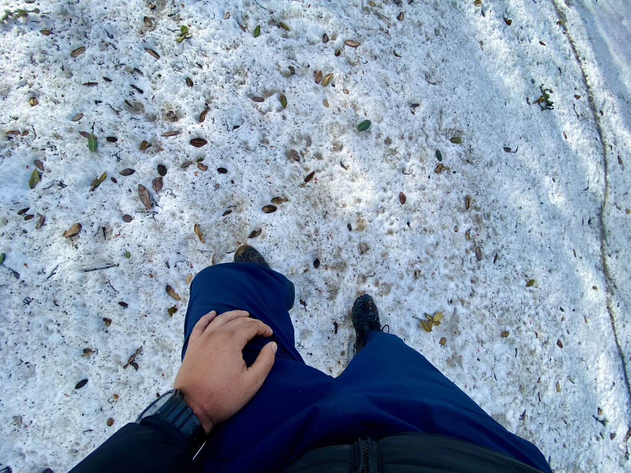
The top of the Chanderkhani pass was only a few minutes away but we couldn’t reach there because of watery snow. My friend’s leg was also hurting a little and so we decided to head back to our camp.
It was a journey that I will remember for my life. Those majestic view will be in my mind forever. I was feeling proud because I walked on the ancient route that connects the two most beautiful valleys on the planet. I was on the same mountain where a lot of historically significant event had occurred that changed the lives of local people forever.
That’s all for today!!!
Thanks for your precious time.
The view is very beautiful
Congratulations @parvkhuller! You received a bright smile from TravelFeed. Our eyes were beaming while reading your post. 😁
Thanks for using TravelFeed!
@for91days (TravelFeed team)
PS: Did you know that we have our own Hive frontend at TravelFeed.com? For your next travel post, log in to TravelFeed with Hive Keychain or Hivesigner and take advantage of our exclusive features for travel bloggers.
Congratulations, your post has been added to the TravelFeed Map! 🎉🥳🌴
Did you know you have your own profile map?
And every post has their own map too!
Want to have your post on the map too?
- Go to TravelFeed Map
- Click the create pin button
- Drag the marker to where your post should be. Zoom in if needed or use the search bar (top right).
- Copy and paste the generated code in your post (any Hive frontend)
- Or login with Hive Keychain or Hivesigner and click "create post" to post to Hive directly from TravelFeed
- Congrats, your post is now on the map!
PS: You can import your previous Pinmapple posts to the TravelFeed map.Opt Out
Congratulations, your post has been added to WorldMapPin! 🎉
Did you know you have your own profile map?
And every post has their own map too!
Want to have your post on the map too?
Hiya, @lauramica here, just swinging by to let you know that this post made it into our Top 3 in Travel Digest #2316.
Your post has been manually curated by the @worldmappin team. If you like what we're doing, please drop by to check out all the rest of today's great posts and consider supporting other authors like yourself and us so we can keep the project going!
Become part of our travel community:
Amazing and beautiful landscapes! How many hours is necessary for get to the top of that mountain?
!PIZZA 🍕
How wonderful. Seeing the green meadows of nature and how little by little the snow takes over. How fantastic.