Hello Hivers!
I hope you all are sensational
Today I will be sharing my experience of a trek I went on recently, in the month of May 2024.
As I hail from Himachal Pradesh, India . It being a mountainous region trekking is something that came naturally to me because everytime I used to visit my maternal grandmother's place I had to hike through the jungles for 2 hours. It was back in 2011 when I went on my first trek ,to Mt. Karol, along with my friends and that's when I realised how amazing trekking is and since then I have done multiple treks.
This time I went on a trek to Beas Kund which is in Manali, Himachal Pradesh.
I went there along with a friend of mine , Rajat Giri, we have been friends since 2016 . He is a year younger than me and always full of gusto. Currently he is managing his resort in Manali called Giri Camps , a perfect place to stay at as it is a little far from the hustle bustle of manali ( about 6 kms away from the main town) + pocket friendly (something very important for most of the travellers) .
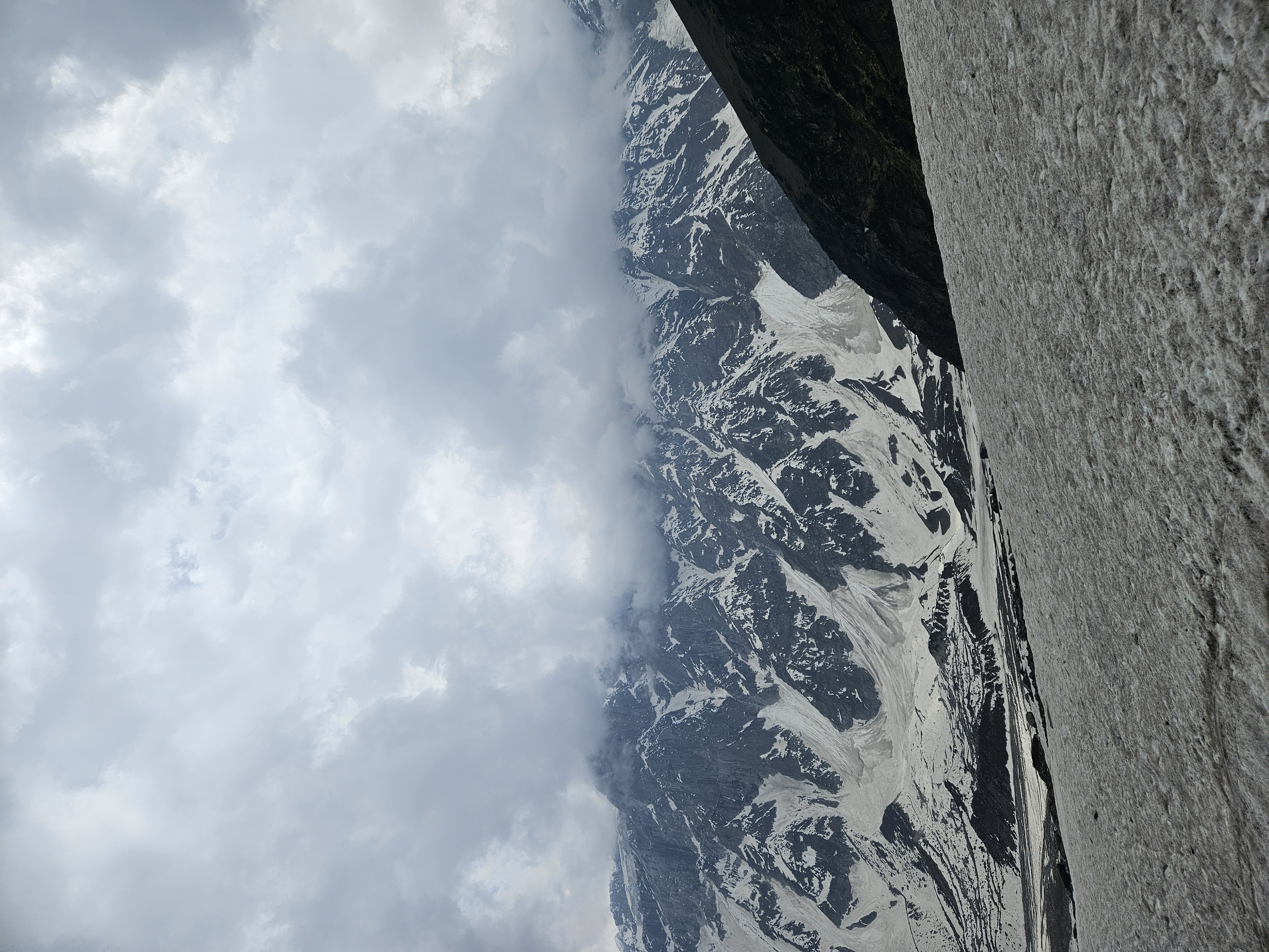
About Beas Kund:
The Beas Kund Trek, situated in Manali, Himachal Pradesh, reaches an elevation of 12,772 feet and spans a total distance of sixteen kilometers. While beginners can embark on this trail, be prepared for covering a considerable distance in a relatively short time.
Starting from Solang Valley, renowned for its adventure sports like paragliding and skiing, the trek offers stunning views of mountain giants such as Shitidhar, Hanuman Tibba, Ladakhi, and Friendship Peaks, with the majestic Pir Panjal Range forming a captivating backdrop.
The Beas Kund trek stands out as a favorite among those seeking a refreshing getaway near Manali, offering a break from the city's commotion. Along the serene banks of the Beas River, trekkers are treated to stunning vistas of the Pir Pinjal ranges. The Dhundi and Bakarthach meadows unfold in breathtaking splendor as you ascend. Eventually, you'll reach the pristine source of the Beas River: a serene glacial lake nourished by melting snow from lofty peaks. This trek welcomes all ages and requires only a moderate level of fitness.
Religious significance:
Legend has it that Sage Vyas frequented Beas Kund for his daily ablutions, imbuing the site with sacred significance for Hindus. Sheltered by a dome-like stone structure, Beas Kund draws thousands of devotees annually. Its name, Beas, is derived from Sage Vyas, the revered author of the Mahabharata. In ancient Indian texts, the river was known as Vipas or Arjiki, while the Greeks referred to it as Hyphasis.
Why did we choose this trek?
As I mentioned at the outset that currently Rajat is managing his resort in Manali on that in the month of May I was visiting my paternal grandmother who lives in Mandi ( which is
3 hours away from Manali) .
So I decided to visit Rajat , we had a great time together. Every evening we used to go the mall road for a stroll and cafe hopping.
On the 3rd day he had some Israelis staying at his property who were leaving for Beas Kund the next day , it being a single day trek even we got intrigued and decided to embark on the trek a day later (not the next day as Rajat had some commitments).

Itinerary:
Mandi - Manali (107kms)
Manali - Giri Camps (6kms)
Giri Camps - Solang Valley (7kms)
Solang Valley - Dhundi {starting point of the trek} (8kms)
Dhundi - Bakar Thach(4kms)
Bakar Thack - Beas kund(4kms)
Trek day:
We started at around 9 am hoping to cross Solang Valley before it got crowded ,as Solang is a tourist place and traffic jams are common there , yet there was traffic due to which we got a bit late and grumpy.
Finally we reached Dhundi after 3 hours and then from there started our trek.
On reaching Dhundi we could see Beas river flowing next to us and our aim was to trek up to the source of the river.
The terrain was not challenging it was a normal hike till Bakar Thach, less efforts and high rewards.
I hail from hilly terrains yet I found the valley absolutely amazing - the deodar forests and the grasslands made everything so much better.
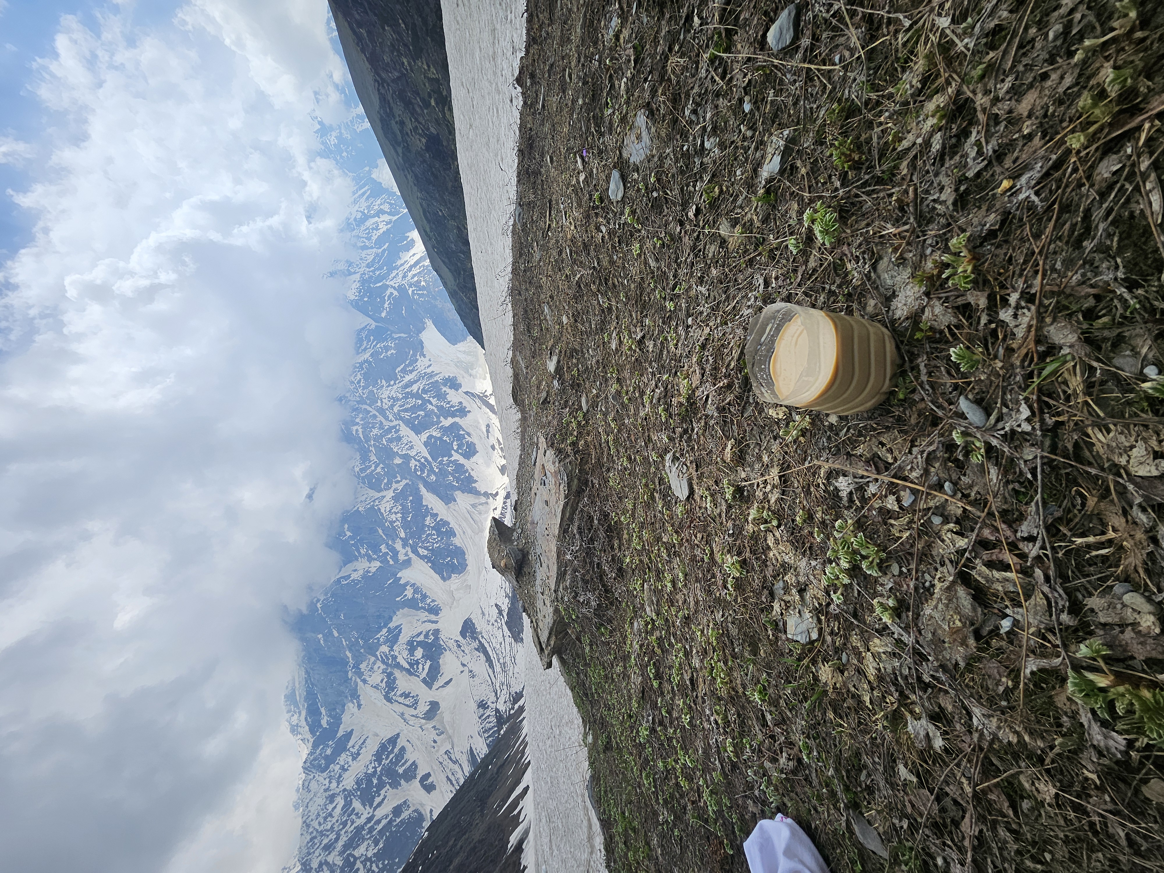
The grasslands enticed the Shepherds as well , on the way we might have come across around 1000-2000 goats and sheep.
As both of us were wearing sports shoes (ignorant us) it was getting a bit hard for us to walk through the snow whereas other tourists were wearing proper trekking shoes but this inferiority complex did come to an end the moment we saw Shepherds, as some of them were wearing slippers!
Yes, you read it right SLIPPERS!
Yet they were traversing the snowy landscape faster than all of us .
On our way we had to cross a few streams as well and navigating the different streams along this trail can be challenging, sometimes necessitating jumping from one slippery rock to another or carefully balancing on narrow wooden planks laid down by the shepherds.
In Bakar Thach( thack means meadows locally) there were a lot of tents pitched and for one moment even we felt like staying there for the night as the view was incredible but it wasn't possible as Rajat had some work in the town the next morning.
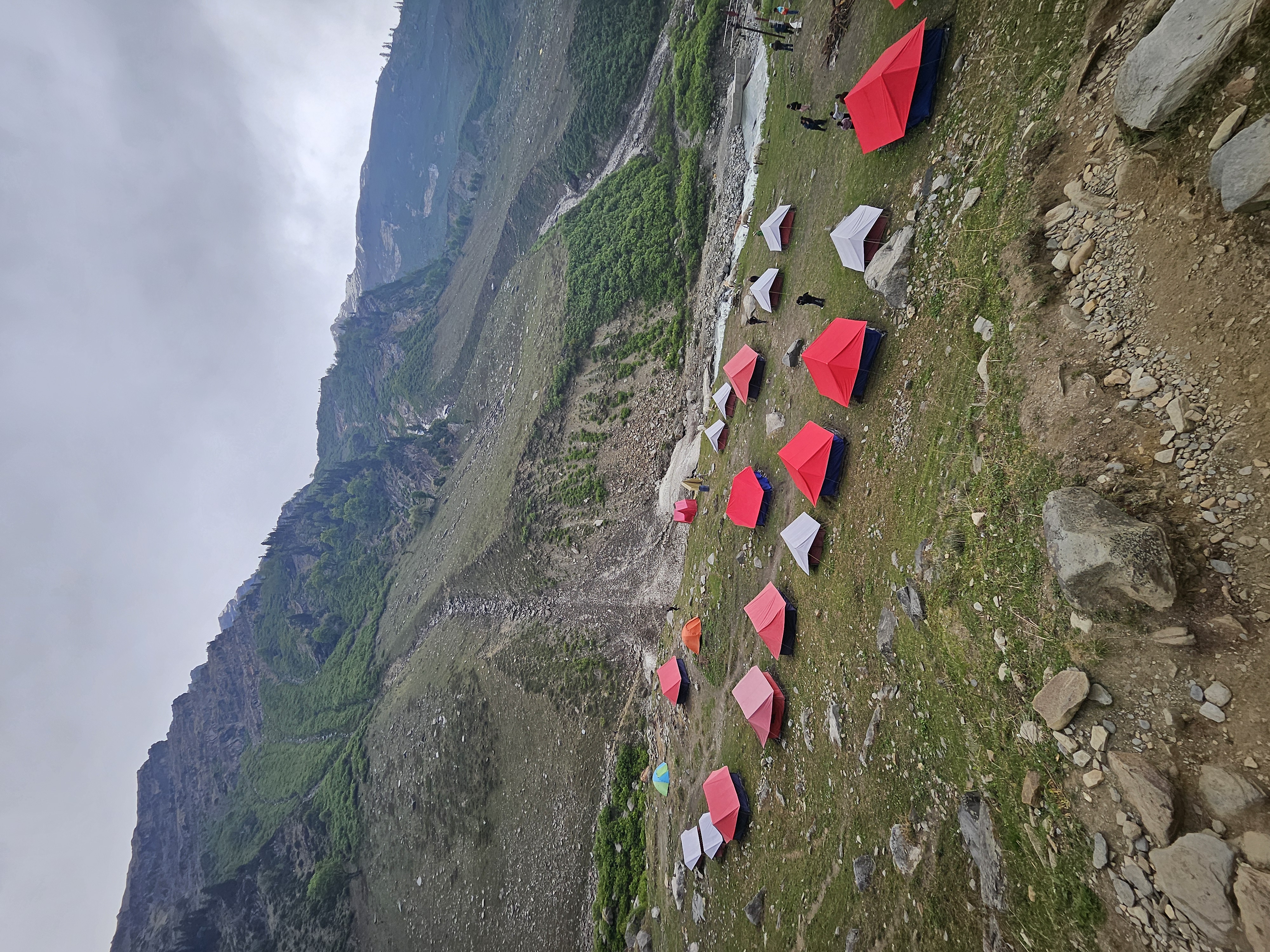
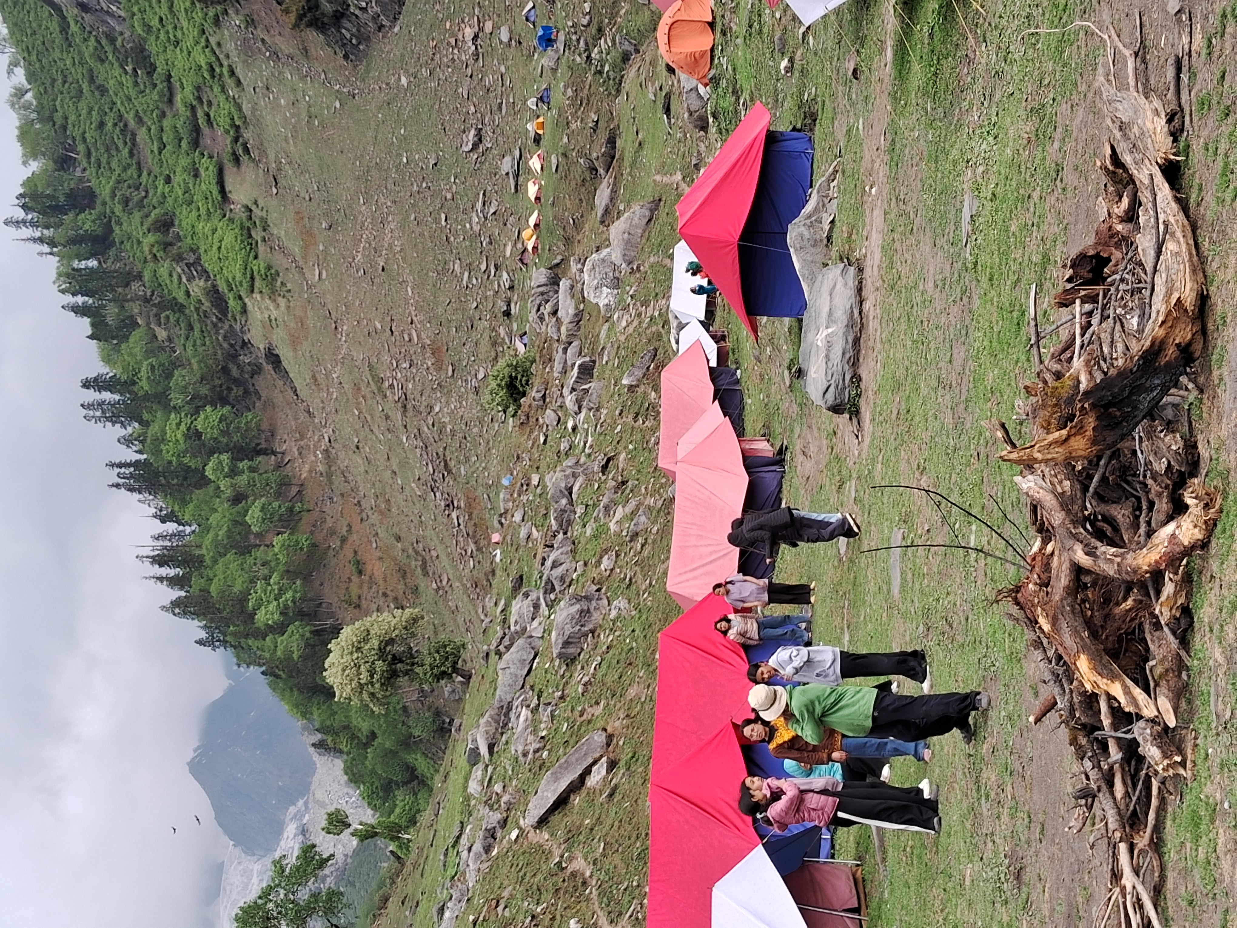
We stopped for a while in Bakar Thach ,not that we were tired , to enjoy the view and the landscape.
After Bakar Thach the terrain did get hard as well as steep .
After walking for a while the terrain completely changed ,there were more boulders than flat land and to our south we could see the majestic Indrasan and Deo Tibba peaks.
We had to cross the boulder fields to reach our destination, while walking through these fields it is very important that you place your feet carefully as a wrong move can actually land you in " 127 hours " type of situation.

The best part of the trek was that there were yellow markings all the way to guide the people so the chances of getting lost were minimal plus the path was indicated by strategically positioned cairns. Cairns are basically stacks of rocks delicately balanced atop boulders they serve as navigational aids in such mazes, particularly when low-hanging clouds reduce visibility to near zero. However considering the views we both actually felt like getting lost up there.
The place was absolutely magical and every corner had picturesque views .
The biggest mistake we made was that we underestimated the trek and decided to get the trek done in our shorts and T-shirts lol.
Because of which once we crossed Bakar Thach we could not even rest properly as the temperature was low and our bodies used to cool down immediately, which was a bit dangerous.
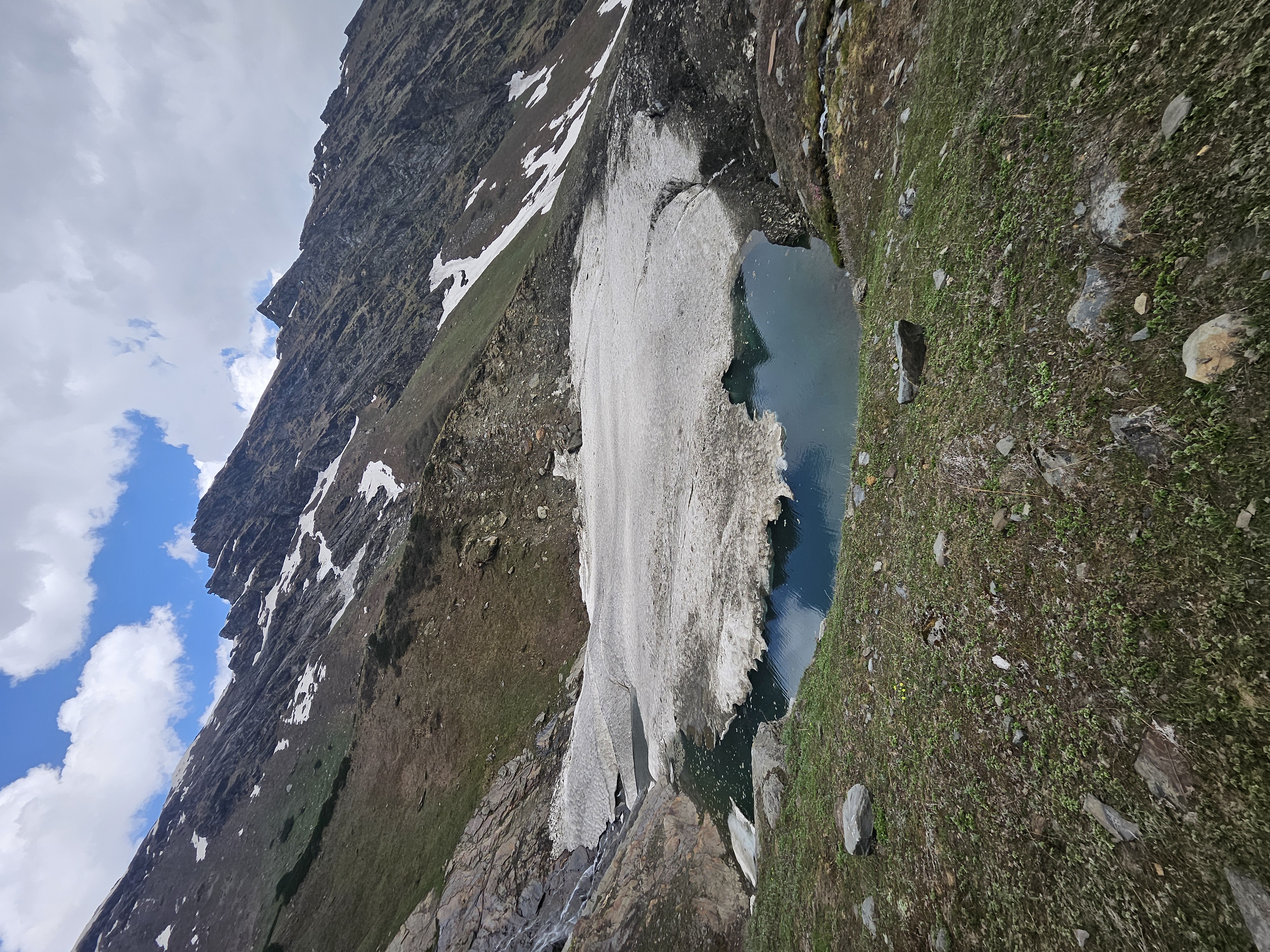
Finally after walking for 4 hours we reached the holy Beas Kund, the pristine blue waters of Beas Kund remain concealed from plain view until they suddenly unveil themselves , everything was serene and tranquil . There was not a single human up there except us , the lake was half frozen . The most thrilling part was that we could see other beautiful summits like Hanuman Tibba, Ladakhi, and Friendship Peaks very clearly.
We relaxed for a while clicked a few pictures ,the idea of spending the night enveloped by tranquil streams and encircled by the breathtaking peaks of the Pir Panjal range from every angle was simply too enchanting to resist yet we had to return to Manali .
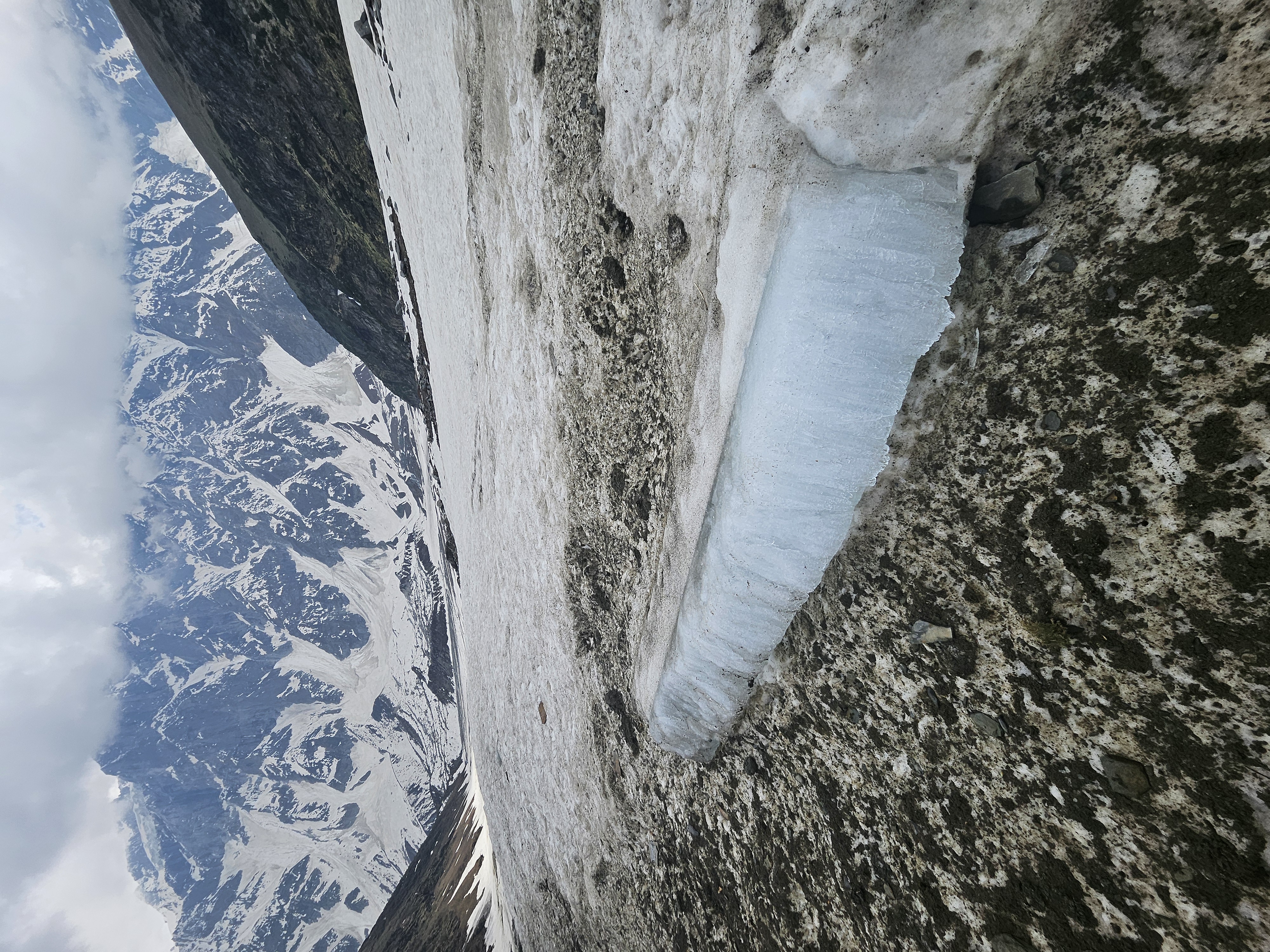
Overall it was an amazing trek just one thing that I didn't like was people polluting the nature. On our way we saw a lot of chocolate wrappers lying around, some of which we ourselves picked up to throw them at a place they belonged , a dustbin.
After 7 hours of trekking we safely reached Giri Camps ,had scrumptious food and called it a day .
That's all from my side this time and thankyou for sticking till the end! 💟
These pictures were clicked by me using Samsung a14
Congratulations, your post has been added to the TravelFeed Map! 🎉🥳🌴
Did you know you have your own profile map?
And every post has their own map too!
Want to have your post on the map too?
- Go to TravelFeed Map
- Click the create pin button
- Drag the marker to where your post should be. Zoom in if needed or use the search bar (top right).
- Copy and paste the generated code in your post (any Hive frontend)
- Or login with Hive Keychain or Hivesigner and click "create post" to post to Hive directly from TravelFeed
- Congrats, your post is now on the map!
PS: You received this comment because you used the Pinmapple code snippet. Pinmapple is closing down and we are continuing Pinmapple's legacy. You can also import your previous Pinmapple posts to the TravelFeed map.Opt Out
Congratulations @lilisis29! You have completed the following achievement on the Hive blockchain And have been rewarded with New badge(s)
Your next target is to reach 1500 upvotes.
Your next target is to reach 100 upvotes.
You can view your badges on your board and compare yourself to others in the Ranking
If you no longer want to receive notifications, reply to this comment with the word
STOPCheck out our last posts:
Congratulations, your post has been added to Pinmapple! 🎉🥳🍍
Did you know you have your own profile map?
And every post has their own map too!
Want to have your post on the map too?
Congratulations @lilisis29! Your post brought a smile to the TravelFeed team so we have sent you a smiley. Keep up the good job. 🙂
Thanks for using TravelFeed!
@invisusmundi (TravelFeed team)
PS: Why not share your blog posts to your family and friends with the convenient sharing buttons on TravelFeed?