Best View in the City of San Fernando!
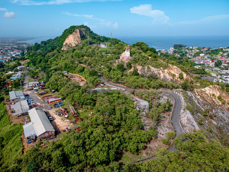
The San Fernando hill is a monolithic mountain or hill that rises from in the midst of an otherwise flat city in the southern planes of Trinidad. The San Fernando hill has a rich history and provides a great view of the Gulf of Paria and the city of San Fernando itself! I decided to fly the drone around the hill to get some shots one evening to document the location by air!
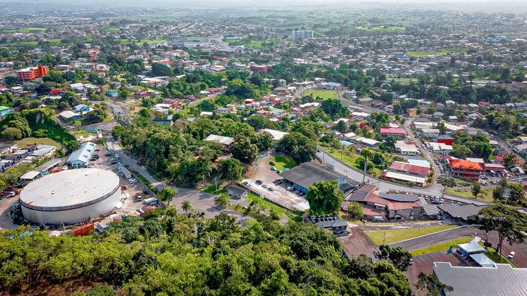
We start off in the city of San Fernando, and by the photos, you can see how relatively flat the location is. You can imagine how the monolithic hill also lovingly called Naparima hill stands out while you are in the streets. You can see it from every angle and every place you might be. It can even be seen from miles away in other counties!
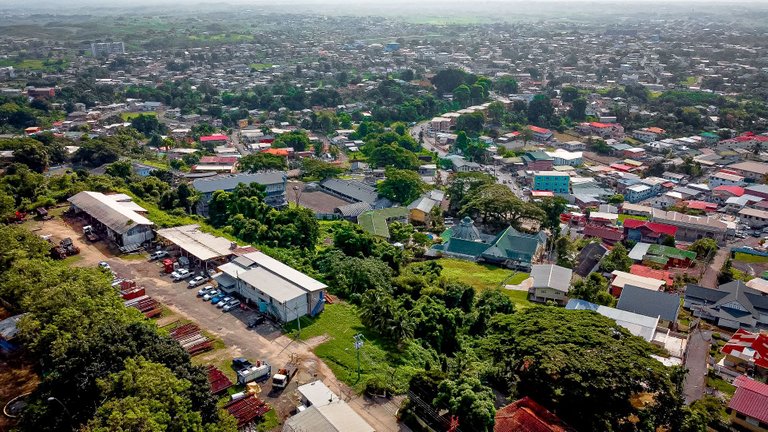
The hill can even be seen from the sea also known as the Gulf of Paria. It is usually used as a landmark by sailors as well as people on land for directions and to determine one's cardinal orientation on the landscape. It is an integral part of the southlands and to think at some point it was going to be leveled by the government way back in the 1980's for quarrying!
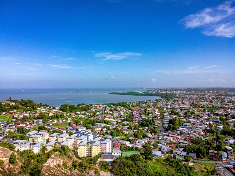
History tells us that the hill was once a mountain and over time it was quarried for use of materials to build most of the roads of the southern areas! At a point, there was a petition to stop the destruction of the hill and maintain the national treasure that it is. There is no way San Fernando would be what it is Today without this hill!
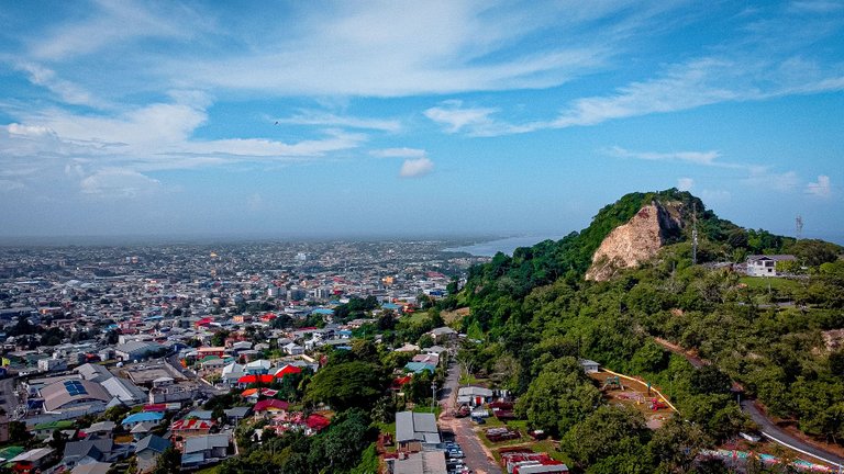
This shot gives you an idea of how it looks towering above the city that stretches for miles! It was a sunny day and great visibility for drone photography. You can imagine that we are in the sky for this shot, how it looks when you are on the ground level!
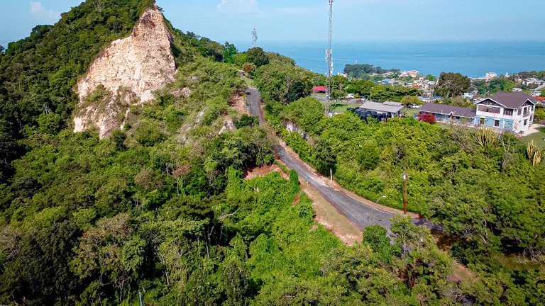
This is the entrance road to the hill that is winding and quite steep as you ascend. The top of the hill has a plateau that was turned into a park and a lookout point for great views of the city. It is especially amazing at night when one can see all the lights in the distance.
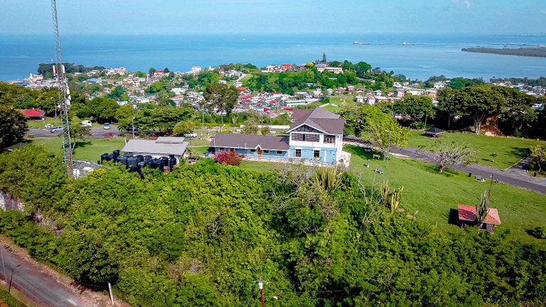
Once you drive up, there is a large building that serves as a museum and lookout gallery that you see there painted in the blue in the photo above. There is ample parking as well as gazebos and sprawling well manicured lawns for picnics and other leisure activities.
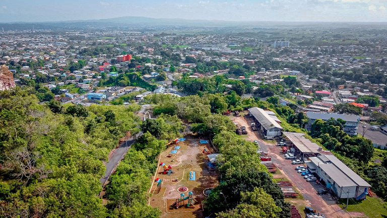
There is even a play park/ jungle gym for the kids in the photo above. Parents usually leave their children well supervised by guards and other support staff there and go walk about the lookout areas and so on. There are usually vendors that sell things to eat and drink on the compound as well.
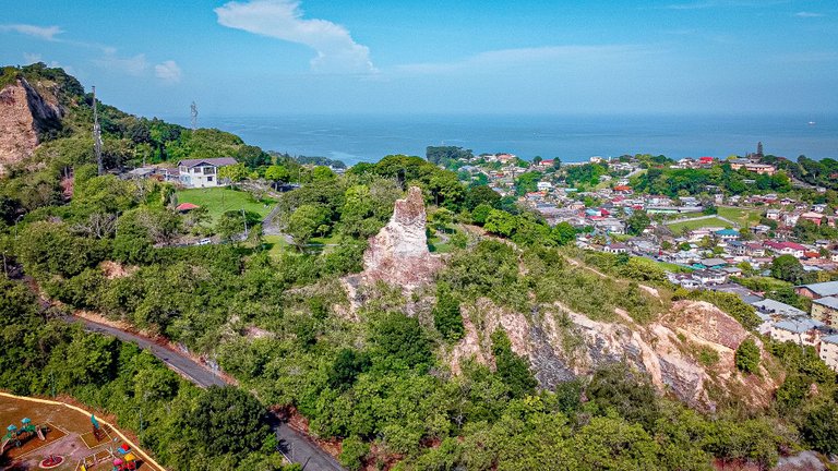
Here is another angle view shot of the hill facing the west. you can see a tall protruding piece of rock in the middle of the photo which was left back from the quarrying days and you can get an idea of how much rock was taken out from this once magnificent natural structure!
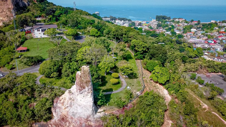
Moving closer to the large remnant rock structure, you can see the paths and walkways amidst trees and well kept lawns that are situated near fences that provide the panoramic views of the ocean and the city below! You can also see the entrance and exit road that cars drive and out with.
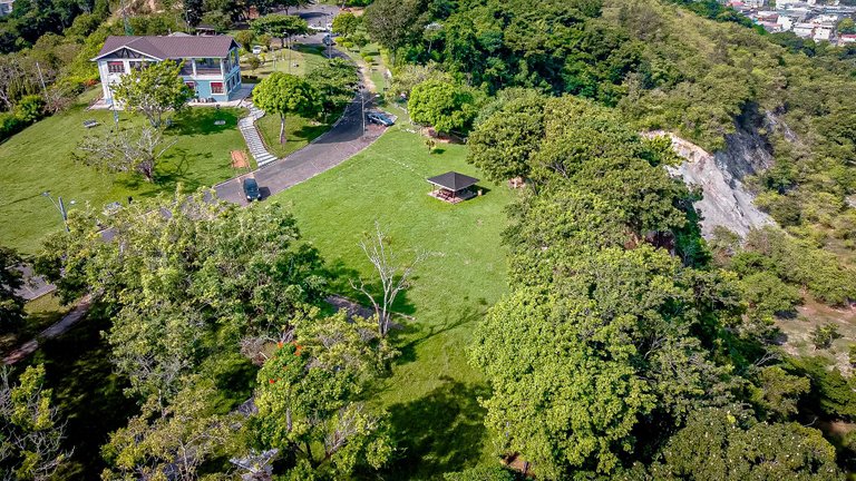
Moving further along and closer to the blue building, you can see one of the gazebos within a large lawn that is used for family events, barbeques and other things such as weddings and proposal shoots. You can also get an idea of how the cards park. along the road as well.
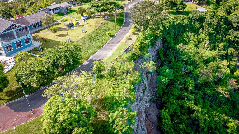
The blue building is a museum and lookout gallery where the top floor had those large lookout binoculars that you can used to look out into the city below and out to the ocean! There are also washroom facilities and a cafeteria that is not always open but indeed present. You can also see the steep drop off cliff right on the edge of the lookout on the right!
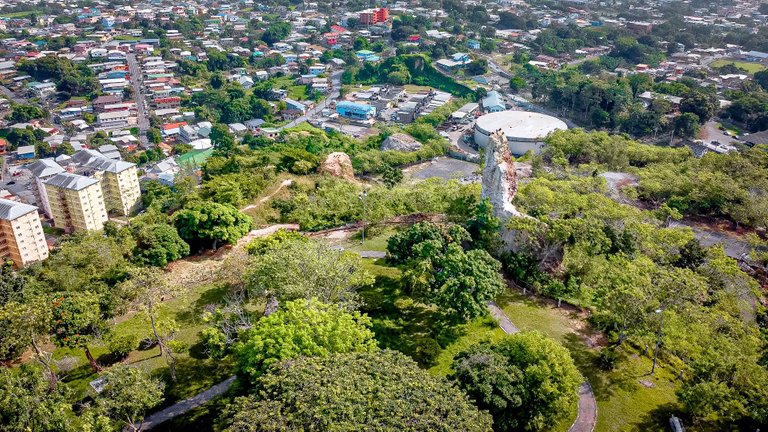
Looking eastwards, this is another angle view of the remnant protruding rock. It looks quite small here but if seen on foot up close and in person, it is quite huge and even make a big man like me feel so small! It is awesome to walk amongst those trees you see there and take in the breeze!
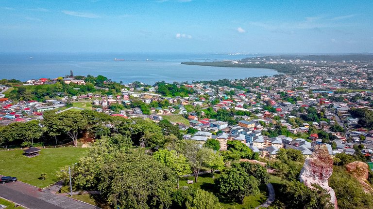
Here is another awesome view of the west cost with the remnant rock on the bottom right side of the shot. You can see all the way down the western coastline to the tip top of the island! It is quite and amazing view on the very clear days much like today! I would have loved to have a telephoto lens on the drone just for this!
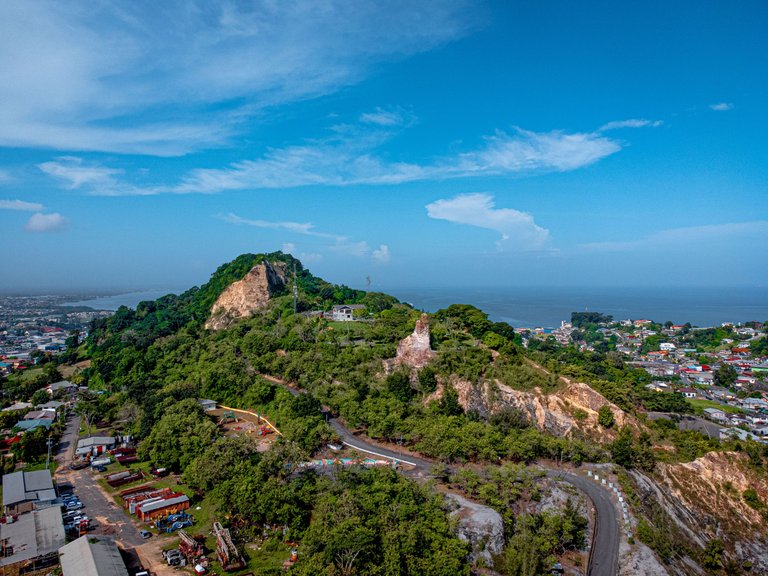
It was so much fun documenting the San Fernando Hill with the drone. I felt much like a bird flying around and capturing photos by air of every aspect of the hill. It really did help to appreciate the location much more by knowing the history of the place and why it was the way it was and how it became what it is known for today! Thanks so much for coming along, Cheers!
those are very beautiful sights captures clearly by your drone 😃 found it interesting how the houses are scattered among the greens and still being able to leave most of the greenery intact, thank you for sharing your wonderful photos of this place! 😄

!ALIVE https://d.buzz
Love it! Thank you! Yeah a lot of Trinidadians love to keep space for their fruit trees!
Did you know you can win 10$ hive by competing in our Monday Challenge? Its Every Monday, just go here.☜(゚ヮ゚☜)
Congratulations, your post has been added to Pinmapple! 🎉🥳🍍
Did you know you have your own profile map?
And every post has their own map too!
Want to have your post on the map too?
Congratulations @lemniscate! You have completed the following achievement on the Hive blockchain And have been rewarded with New badge(s)
Your next target is to reach 300 posts.
You can view your badges on your board and compare yourself to others in the Ranking
If you no longer want to receive notifications, reply to this comment with the word
STOPTo support your work, I also upvoted your post!
Check out our last posts:
Support the HiveBuzz project. Vote for our proposal!