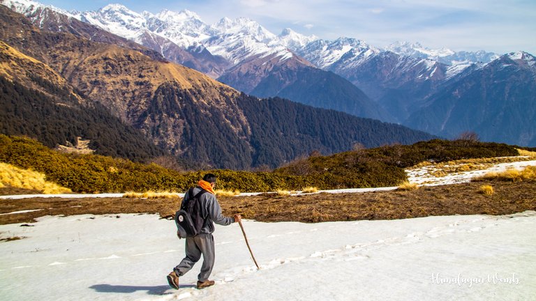
Go anywhere in the Indian Himalayas, it never fails to challenge your physical abilities. It has been two days since I visited Rudranath and just by staying here, the mountains have sucked all my energy. This place is above the tree line, now walking above the tree line always feels lack of oxygen, even doing daily chores has become challenging. So friends, today I take you on the return journey from Rudranath temple.

Delhi to Haridwar, Haridwar to Gopeshwar, Gopeshwar to Rudranath temple hike and today finally it is time to say goodbye to Rudranath temple and go back home. The Indian Himalayas have been given the status of God in our Hindu books. As soon as you enter the states of Uttarakhand and Himachal Pradesh, you see big boards on which it is written “Welcome to Devbhoomi”. Devbhoomi is a Hindi word which means the land of Gods.
It would not be wrong to call the Indian Himalayas the land of Gods, because there are so many temples here that even a lifetime would fall short. I am saying this because thousands of temples are built on top of mountains, some are situated above 5000 meters and the journey to them is extremely difficult. One such temple is situated in Himachal Pradesh, named 'Shrikhand Mahadev', which is situated at an altitude of 5125 meters. I am fortunate that I have visited Shrikhand Mahadev twice.
Yesterday evening at around 7 o'clock, I had just fallen asleep in my sleeping bag when someone knocked on the door loudly and came inside. I was scared by the noise of the door and started thinking that maybe a bear has come inside but the next moment the sound of a human voice brought peace to my beautiful heart. We had a conversation in which we came to know that this uncle is from the forest department and has come to the temple because the road will be repaired after winter, so he has to give the details of the broken road to the Gopeshwar office.
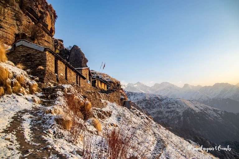
Uncle has brought a blanket with him in which he falls asleep while talking, I think what kind of job is this in which this man hiked about 16 km in a day and reached the temple directly. Well, I also fall asleep while thinking. The next morning we both wake up early and fold our hands in front of the closed temple and after taking the blessings of Lord Rudra, we lift our bags on our shoulders and start our return journey.
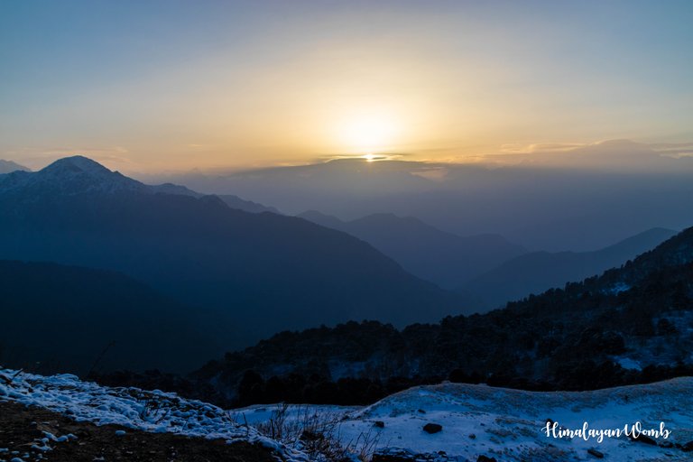
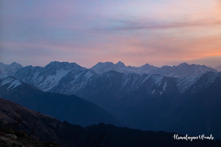
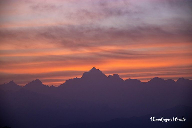
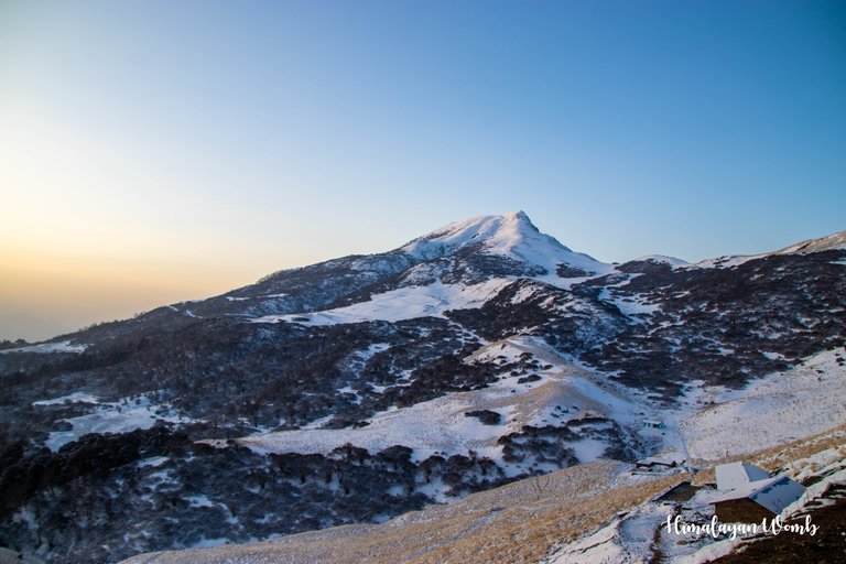
The Sun God rises from the east, on that side is my favorite mountain named 'Nanda Devi'. Everything has turned pink on the peaks of the snowy mountains. Dunagiri mountain whose height is 7066 meters is bathed in sunlight as if it will never leave the pink sheet. With folded hands in front of Nanda Devi, I think that I will always remember every second spent here.
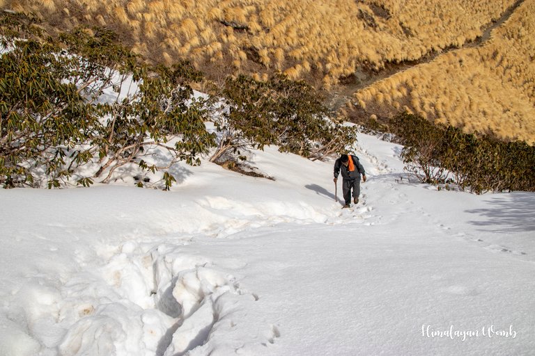
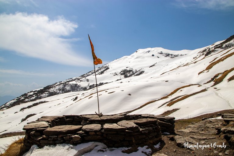
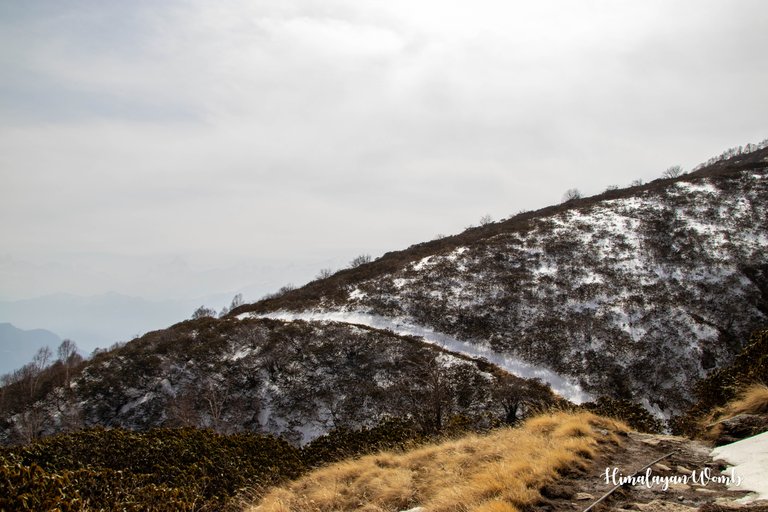
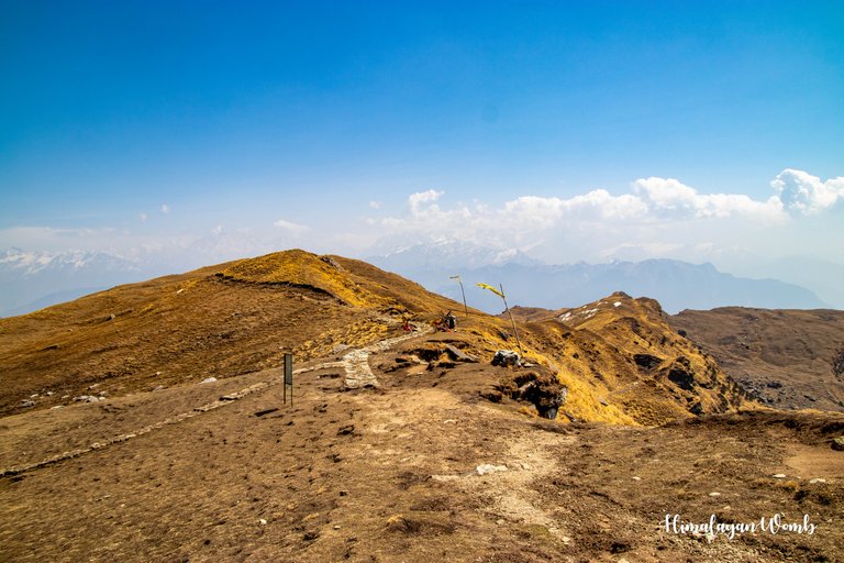
On going ahead from Rudranath temple, the travelers get to see Narad Lake and Saraswati Lake, there is a lot of snow on the path ahead, so neither I went ahead nor Uncle. The sun has spread its heat all over the Himalayas due to which the snow has become soft and is penetrating the shoes. We are walking cautiously on the snow and in the next 45 minutes we cross the Panch Ganga point which is 3700 meters high.
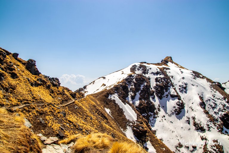
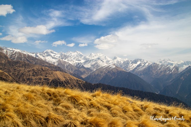
From Rudranath temple to Panar Bugyal, there is a height so our speed is very low, firstly the snow is stopping us and secondly the climb on which walking is becoming quite tricky. Naola pass is situated above Panch Ganga from where a walking path goes to Anasuiya temple. After reaching Pitradhar at 3750 meters, we take a breath and drink some water. I eat the chocolate I brought with me and also give some to uncle to eat which he happily eats.
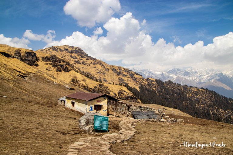
The last 2 km was quite a climb, you can imagine that it took us 2 hours to cover 2 km. We were not even able to tell whether we were walking or not. But we started at 8 in the morning and reached Panar Bugyal at 4 in the evening. Uncle has to leave early so he bids me goodbye and leaves. My plan is to stay here today. After taking off my bag, I take shelter in the hut present here and admire the surrounding views.
[//]:# (!worldmappin 30.46943 lat 79.34833 long Rudranath to Panar Bugyal Hike (Indian Himalayas) d3scr)
Disclaimer: This post is originally written in Hindi and I have used Google Translator to translate the Hindi text in English. All the photos have been clicked by me from Canon 77D and thumbnail photo edited in adobe photoshop.
Congratulations, your post has been added to WorldMapPin! 🎉
Did you know you have your own profile map?
And every post has their own map too!
Want to have your post on the map too?
some very beautiful pictures.
thank you for visiting here
You're welcome.
Looks like a very beautiful picture my friend
thank you friend, Himalaya is at its best
Hiya, @lauramica here, just swinging by to let you know that this post made it into our Honorable Mentions in Travel Digest #2351.
Your post has been manually curated by the @worldmappin team. If you like what we're doing, please drop by to check out all the rest of today's great posts and consider supporting other authors like yourself and us so we can keep the project going!
Become part of our travel community: