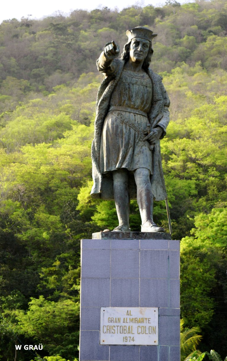
Hola mi gente bella de Hive, hoy vengo a hablarles de una de mis grandes pasiones - contar historias, y les hablaré de una historia real ocurrida en mi querida Venezuela en un pueblito llamado Macuro donde Cristóbal Colón pisó por primera vez tierra firme en el continente americano.
Hello my beautiful people of Hive, today I come to tell you about one of my great passions - storytelling, and I will tell you about a true story that happened in my beloved Venezuela in a small town called Macuro where Christopher Columbus first set foot on land on the American continent.
Cuando Cristóbal Colón pisó por primera vez tierra firme en el continente americano, no imaginó encontrarse con tan exhuberante belleza natural, a tal punto que creyó encontrarse en el paraíso terrenal, sí, estaba llegando a un lugar muy apacible, de aguas tranquilas, frondosa vegetación, caudalosos ríos y una luz tan hermosa y brillante que era capaz de iluminar hasta la más escondida de las hojas; no podría darle otro nombre más que "tierra de gracias".
When Christopher Columbus first set foot on land on the American continent, he never imagined he would find such exuberant natural beauty, to such an extent that he thought he was in paradise on earth, yes, he was arriving at a very peaceful place, with calm waters, lush vegetation, flowing rivers and a light so beautiful and bright that it was able to illuminate even the most hidden of leaves; he could not give it any other name than "land of grace".
(Plaza Cristóbal Colón - Macuro/Christopher Columbus Square - Macuro)
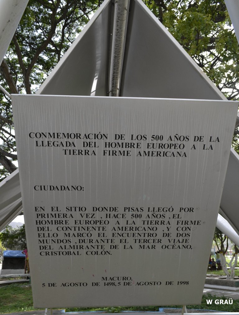
Al salir en busca de nuevas tierras, en el tercer viaje, Cristóbal Colón y su expedición partieron desde el puerto de Sanlúcar de Barrameda-España, el 30 de mayo de 1948, con el firme propósito de encontrar al nuevo mundo, es así como al llegar a las Islas Canarias, decide dividir la expedición y envía la mitad a la Española (actual Haití) y el restante dirigida por él, toma la vía meridional en busca del Ecuador. Por esta vía llega a la isla de Cabo Verde y luego desciende hasta llegar a la isla de Trinidad el 31 de julio de 1498. Desde allí divisa el delta del Orinoco y entra el 2 de agosto al golfo de Paria por "la boca de la serpiente", y el 5 de agosto de 1498 desembarca en puerto de Macuro, lo que significa el primer desembarco del europeo en tierra firme, en lo que es hoy territorio venezolano.
On leaving in search of new lands, on the third voyage, Christopher Columbus and his expedition set sail from the port of Sanlúcar de Barrameda-Spain, on May 30, 1948, with the firm purpose of finding the new world. Upon reaching the Canary Islands, he decided to divide the expedition and sent half of it to Hispaniola (now Haiti) and the other half, led by him, took the southern route in search of the Ecuador. By this route he reached the island of Cape Verde and then descended to the island of Trinidad on July 31, 1498. From there he sighted the Orinoco delta and on August 2 he entered the Gulf of Paria through "the mouth of the serpent", and on August 5, 1498 he disembarked in the port of Macuro, which was the first landing of the European on dry land, in what is today Venezuelan territory.
El nombre de Macuro, en el vocablo indígena significa "hombre malo", termino que era repetido por los indígenas al ver a los expedicionarios en sus tierras.
Macuro como pueblo fue fundado en 1737, con una población de 297 habitantes, y entre 1782-1784 recibió el nombre de San Carlos Borromeo de Macuro. Este asentamiento hasta las primeras décadas del siglo XX, conservó su actividad agrícola centrada en la producción de cacao, algodón y caña de azúcar, lo que dió orígen posteriormente a la construcción del puerto Cristóbal Colón, que tendría funciones de comercio de importación, exportación y de cabotaje; a partir de este momento se construyeron y establecieron nuevas instituciones ligadas al puerto y ubicadas en las inmediaciones de la Plaza Colón.
Estás actividades mantuvieron su vigencia y prosperidad hasta 1935, momento en el cual se paralizaron todas las actividades económicas; posteriormente se eliminó la aduana y se trasladó el puerto y sus funciones a la población de Güiria.
The name Macuro, in the indigenous word means "bad man", a term that was repeated by the natives when they saw the expeditionaries in their lands.
Macuro as a town was founded in 1737, with a population of 297 inhabitants, and between 1782-1784 it received the name of San Carlos Borromeo de Macuro. Until the first decades of the 20th century, this settlement maintained its agricultural activity centered on the production of cocoa, cotton and sugar cane, which later gave rise to the construction of the Cristobal Colon port, which would have import, export and cabotage trade functions; from this moment on, new institutions were built and established linked to the port and located in the vicinity of the Plaza Colon.
These activities remained in force and prosperous until 1935, when all economic activities were paralyzed; later the customs office was eliminated and the port and its functions were transferred to the town of Güiria.
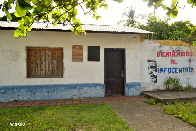
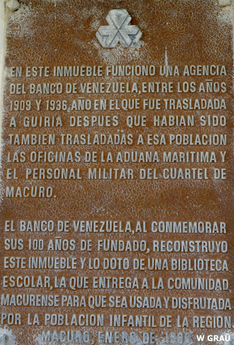
(Agencia del Banco de Venezuela 1909-1936/Banco de Venezuela Agency 1909-1936)
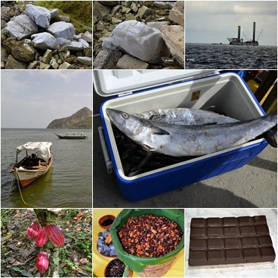
En la actualidad Macuro conforma un centro poblado de pescadores, cuya actividad comercial está centrada en el cultivo de café, cacao, naranja y aguacate, cuenta también con un yacimiento de yeso a cielo abierto, el cual fue explotado durante un tiempo por una empresa cementera venezolana, pero que actualmente no está en funcionamiento; en sus costas limítrofes con la isla de Trinidad, se realiza la exploración y explotación de gas y petróleo.
At present Macuro is a fishing village whose commercial activity is centered on the cultivation of coffee, cocoa, oranges and avocado. It also has an open pit gypsum deposit, which was exploited for a time by a Venezuelan cement company, but is not currently in operation; on its coasts bordering the island of Trinidad, gas and oil exploration and exploitation is being carried out.
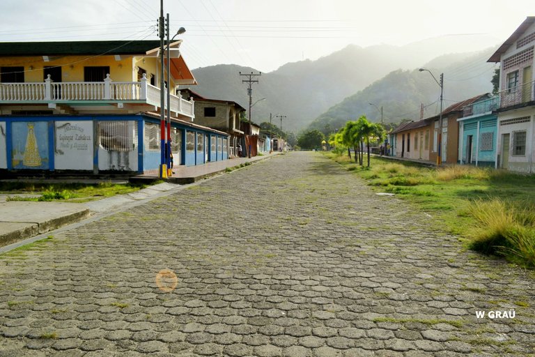
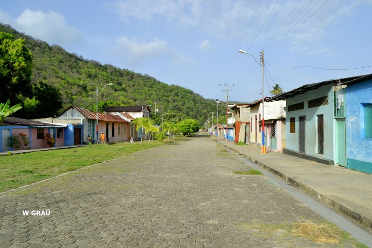
Su morfología urbana está constituida por un conjunto de calles rectas, en la que destaca la calle Bolívar, eje principal donde se ubica la iglesia, los servicios básicos del centro poblado y la Plaza Bolívar; existen allí diversos sectores de viviendas, con representaciones propias de la arquitectura popular caribeña, introducida a través de los nexos comerciales con las Antillas. Sus casas están organizadas en forma de L, con un patio interno destinado al huerto familiar; sus fachadas son coloridas y sencillas, con elementos decorativos labrados a manera de finos encajes. Los techos inclinados cubiertos con planchas de zinc, con prominentes aleros.
Its urban morphology is constituted by a group of straight streets, in which Bolívar Street stands out, the main axis where the church, the basic services of the town center and Bolívar Square are located; there are diverse sectors of houses, with representations of the Caribbean popular architecture, introduced through the commercial links with the Antilles. Their houses are organized in the shape of L, with an internal patio destined to the family orchard; their facades are colorful and simple, with decorative elements carved in the manner of fine lace. The sloping roofs are covered with zinc sheets, with prominent eaves.
(Calle Bolivar - Macuro/Bolivar Street - Macuro)
(Construcción con influencia antillana/Antillean influenced construction)
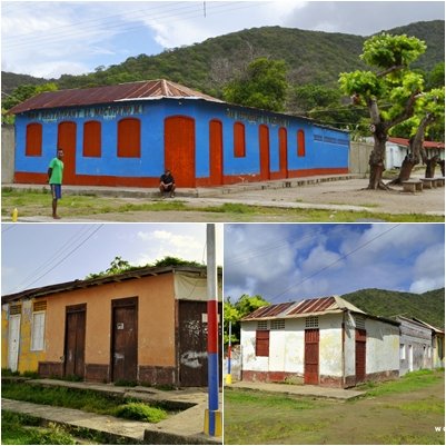
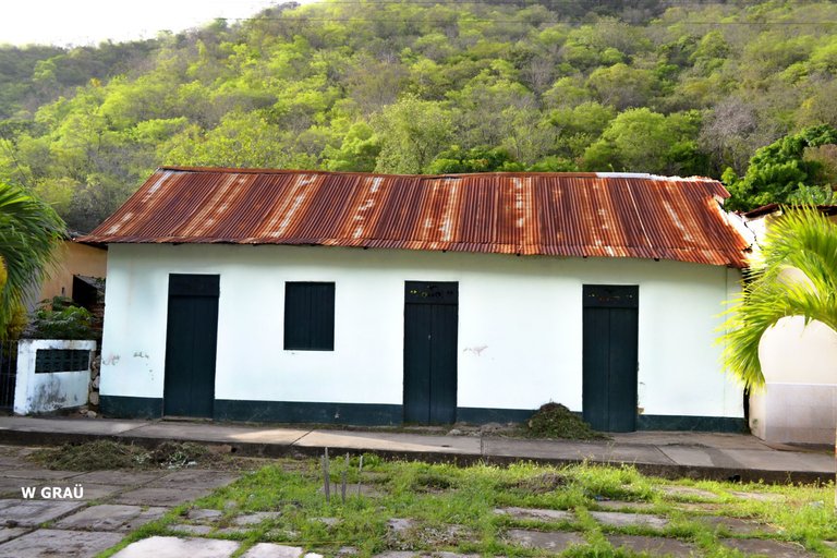
En este pueblo existen 2 casas que son catalogadas como ejemplos significativos de lo que fueron los "alojamientos de esclavos" de las plantaciones de caña de azúcar de las islas caribeñas, unas barracas largas con piezas pequeñas y una sola puerta.
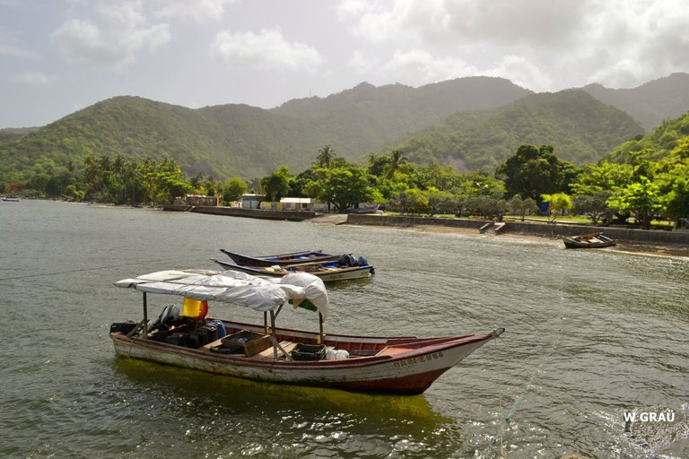
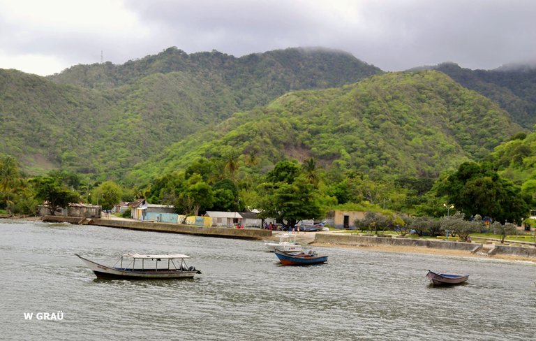
Este pueblo costero de exhuberante belleza, aún cuando ha transcurrido más de 500 años desde la llegada de los europeos, sigue estando prácticamente aislados del resto del mundo, e incluso de las comunidades vecinas y por consiguiente del resto del país (Venezuela), ya que sólo se puede acceder a éste por vía marítima, pues no hay carretera, ni otras vías de acceso.
In this town there are 2 houses that are catalogued as significant examples of what were the "slave quarters" of the sugar cane plantations of the Caribbean islands, long barracks with small rooms and a single door.
This coastal town of exuberant beauty, even though more than 500 years have passed since the arrival of the Europeans, is still practically isolated from the rest of the world, and even from the neighboring communities and therefore from the rest of the country (Venezuela), since it can only be accessed by sea, since there is no road or other access routes.
(Calle Bolivar - Macuro/Bolivar Street - Macuro)
(Pueblo de Macuro/Town of Macuro)
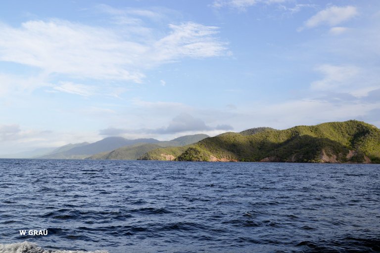
(Costa de Macuro/Macuro Coast)
Fuente bibliografica:
- Historia global de venezuela - desde los origenes hasta la actualidad (S.XXI). 2006
- Sucre 1 - Cuaderno del patrimonio cultural. 2000
Fotografia:
- Wuilfredo Grau
Herramientas:
- Fotografias tomadas con: Cámara Nikon D3100
- traductor: DeepL
Congratulations @fotomania! You have completed the following achievement on the Hive blockchain and have been rewarded with new badge(s):
Your next target is to reach 100 upvotes.
You can view your badges on your board and compare yourself to others in the Ranking
If you no longer want to receive notifications, reply to this comment with the word
STOPCheck out the last post from @hivebuzz:
Support the HiveBuzz project. Vote for our proposal!