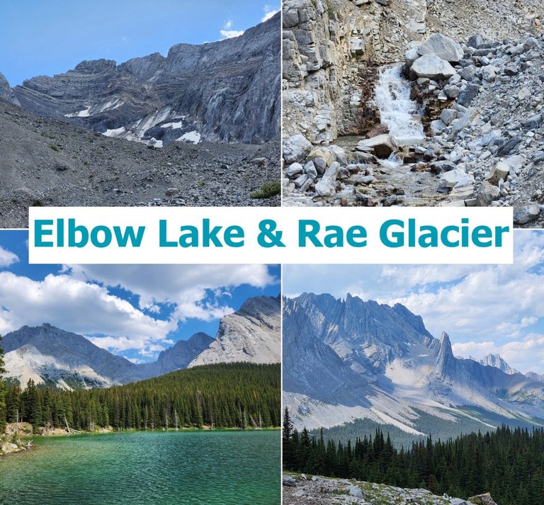
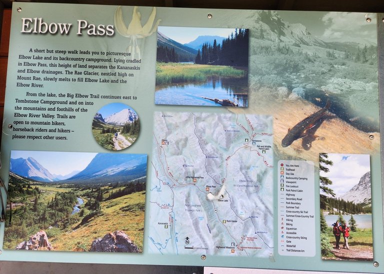
One of the more impressive of the Summer Hikes we went on was up to the Rae Glacier. Our adventure starts off high in the Elbow Pass at over two-thousand meters in Kananaskis Provincial Park. We pass Elbow lake and made our way a few hundred meters up the slopes of Mount Rae to a Glacier which is the source of the Elbow River.
This is a view back towards the Elbow Pass from the Rae Glacier. This little stream is the origin of the Elbow River, which meets the Bow River near the site of the Fort Calgary, about 100 kilometers to the East. It was a hot Saturday afternoon in late July but up at 2400 meters by the glacier it was light jacket weather.
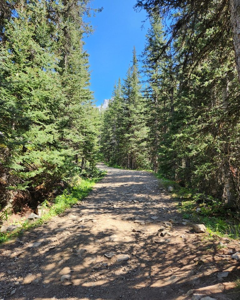
The trail from the parking lot up to the lake is wide and heavily travelled. It's a mix use trail, popular for horseback riders so watch your step! The hike up to the lake is simple, it's about 1.5 kilometers and is a great family friendly walk.
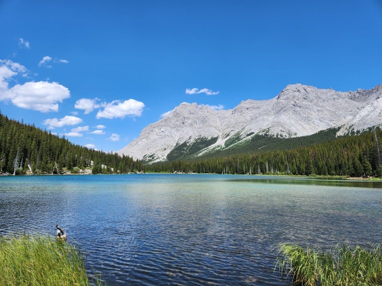
The lake itself isn't as beautiful as some in the area. There is a backcountry campground on the southern shore and some brave people were swimming. The frigid alpine waters are always cold and even on a hot day they are not that inviting.
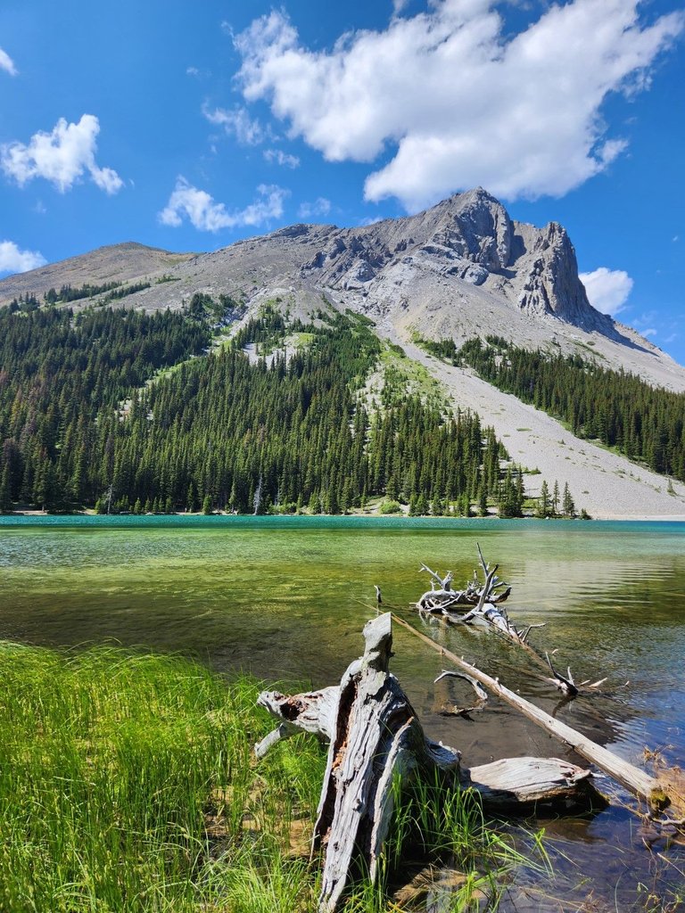
The view from the south shore just past the campground is much nicer. Elpoca mountain is one of my favourites and it was bathed in the afternoon sun. From this angle Elbow Lake looks more appealing.
Once you pass the lake, the trail splits in two. If you are continuing through the pass the trail would be better on the North side of the lake. If you are going up to the Glacier, once you pass the lake on the South end, the trail veers off to the right and up the slope of Mount Rae.
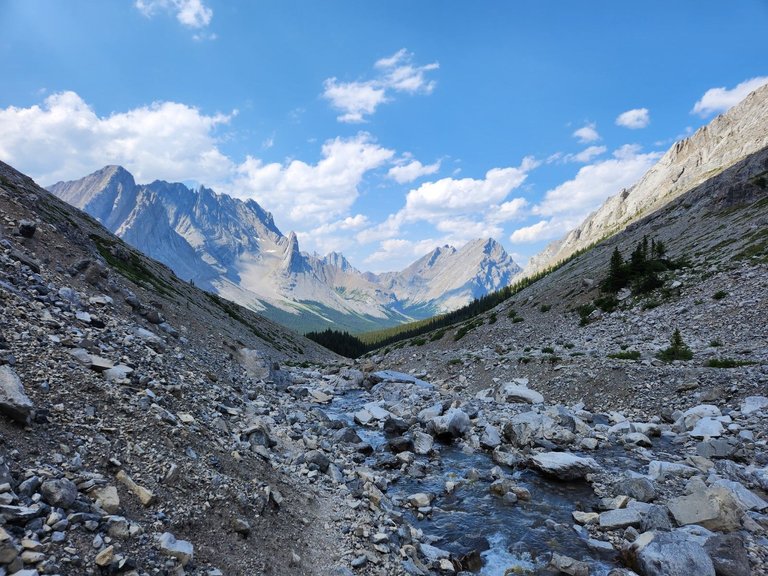
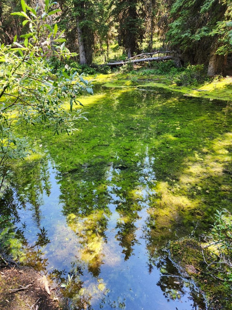
After a short walk through the forest, the trail connects to the stream from the melting glacier. In some places the trail isn't so visible because of all the rocks, so just follow the stream. You can't get lost.
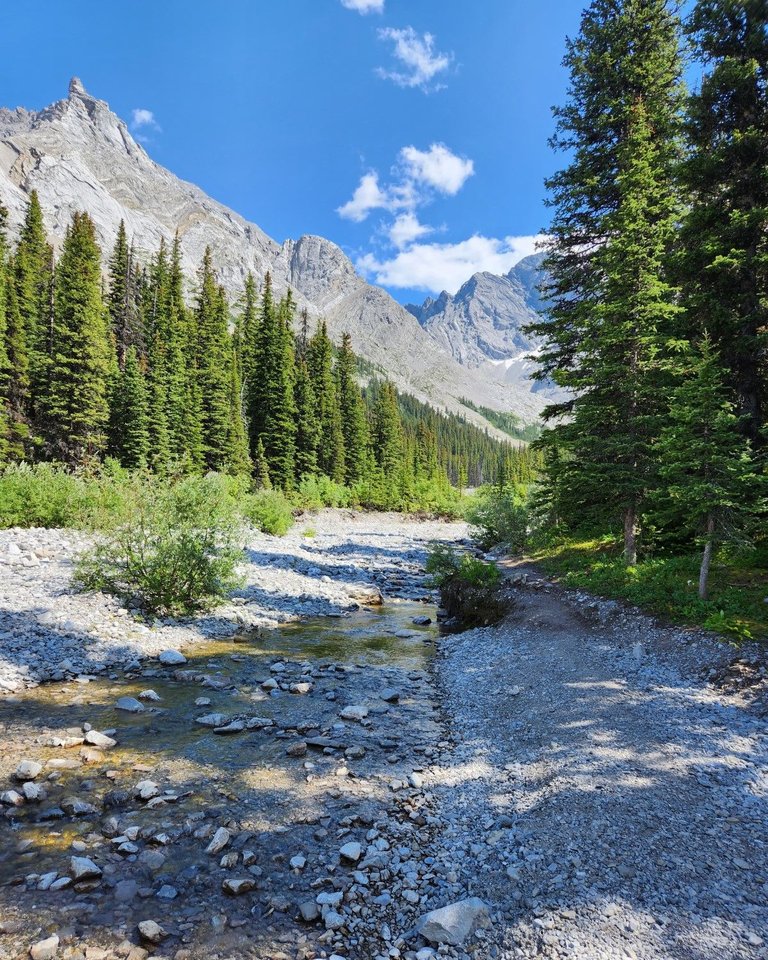
We crossed the stream a couple of times as it often disappears below the stones. Eventually you take the path to the West of the stream and leave it for a bit along a trail into the forest.
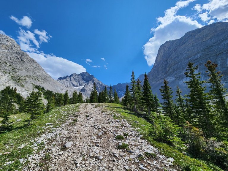
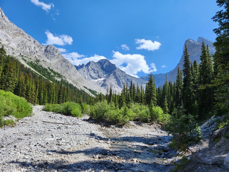
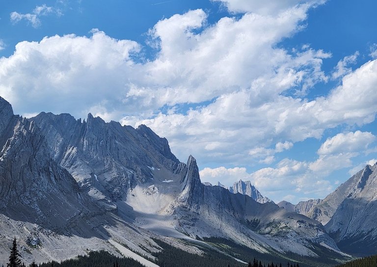
Once you get up and over the last hump, the view of the glacier becomes impressive. The view in every direction is incredible, you are surrounded by 3000 meter high peaks.
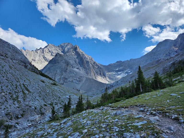
From this point you can get as close to the glacier as you like. One thing we learnt was even though the map shows that you are at the glacier, it appears that you are not. The map is correct though, the glacier is just under the stones and isn't visible from the surface.
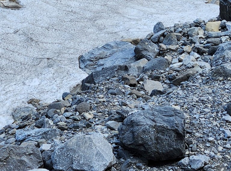
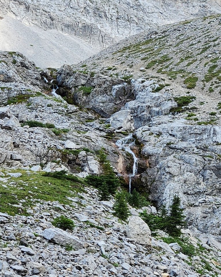
I just wanted to touch some snow at the height of the Summer so we turned around once we found this little patch. Water was cascading down from the peaks and glaciers around us and we stayed for a few moments to take it all in.
The walk back is always easier. There was some mountain peak, or craig in the middle of the photo below that looked like something out of Lord of the Rings. It would be the perfect spot to build a mountain fortress.
We headed back down along the stream towards Elbow Lake then on to our car. Since we wanted to walk around the entire lake we found an under-used trail connecting to the main trail along the North Shore of the lake. Then we followed the horse trail back to the parking lot.
For a time they weren't encouraging people to walk up to the Glacier, maybe it was bears or maybe the trail needed healing. Nonetheless we enjoyed this hike and it's one that is definitely worth repeating. Thanks for reading.
All photos taken on an S22 or iPhone 13 pro.
I did this one in September and the weather was outstanding! I did make it to that ridge near the top area, but the trail turned into more of a scramble. Totally worth it, but a little above my comfort zone.
We went about as far as the little waterfall in the cover image. As soon as hands become necessary and rocks start moving, it's no longer a hike. It's just about at the limit of a decent day trip, next year we might go camping down there to get in some more time.
For about the last 30 minutes of that hike I kept thinking that I ought to turn back, but kept it going anyway for some reason. Got an ever so slight toenail injury on the way down from that ridge.
Travel Digest #2101.
Become part of our travel community:
- Join our Discord
Hiya, @livinguktaiwan here, just swinging by to let you know that this post made it into our Honorable Mentions in Your post has been manually curated by the @pinmapple team. If you like what we're doing, please drop by to check out all the rest of today's great posts and consider supporting other authors like yourself and us so we can keep the project going!Thank you kindly
Congratulations, your post has been added to Pinmapple! 🎉🥳🍍
Did you know you have your own profile map?
And every post has their own map too!
Want to have your post on the map too?
Congratulations @crypticat! You have completed the following achievement on the Hive blockchain And have been rewarded with New badge(s)
Your next target is to reach 80000 upvotes.
You can view your badges on your board and compare yourself to others in the Ranking
If you no longer want to receive notifications, reply to this comment with the word
STOPCheck out our last posts: