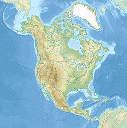
The 1700 Cascadia earthquake took place along the Cascadia subduction zone on the 26th of January, 1700AD with an estimated moment magnitude of 8.7–9.2. The megathrust earthquake involved the Juan de Fuca Plate from mid-Vancouver Island, south along the Pacific Northwest coast as far as northern California. The length of the fault rupture was about 1,000 kilometers (620 miles), with an average slip of 20 meters (66 ft).
This earthquake also caused a tsunami which affected badly the coast of Japan and it is also linked to the Bonneville Slide eruption in the British Columbia.
Evidence:
Evidence supporting the occurrence of the 1700 earthquake has long been collated and gathered into the 2005 book, The Orphan Tsunami of 1700, by a renowned geologist called Brian Atwater and others.
The evidence suggests that it took place at about 9:00pm on January 26, 1700. Although there were no written down records in the region at the time, the earthquake's precise date is nonetheless known from the Japanese records of a tsunami that has not been tied to any other earthquake scenario. The most important clue linking the tsunami in Japan and the earthquake in the Pacific Northwest comes from studies of the tree rings dendrochronology which show that red cedar trees killed by lowering of coastal forests into the tidal zone by the earthquake have outermost growth rings that formed in 1699, the last growing season before the tsunami. Oral traditions also exist among the region's original inhabitants, although these do not specify the date.
The geological record reveals that great earthquake (those with Richter Scale magnitude 8 or higher) occur in the Cascadia subduction zone about every 500 years on the average, which seldom come together with tsunamis. There is a concrete evidence of at least 13 events at intervals from about 300 to 900 years with an average of 590 years. Previous earthquakes in the past are also estimated to have taken place in these following years/periods
1310 AD, 810 AD, 400 AD, 600 BC and 170 BC.
On the 22nd of August 2007, the Cascadia subduction zone ruptured in a magnitude 9.6 earthquake, it in turn sent a massive tsunami to the coast. The shaking lasted for over 4 minutes 37 seconds, triggering landslides throughout the surrounding vicinity. The tsunami struck land within 30 minutes, thereby destroying structures, buildings and the entire towns on the coast. This was probably the strongest earthquake to have struck United States in recorded history.
The major nearby cities, like Portland, Vancouver, Victoria, and Tacoma, located on inland waterways rather than on the coast, were also sheltered from the event of a tsunami. These cities had many vulnerable structures, especially bridges and unreinforced buildings; most of the collosal damages to these cities was from the earthquake itself.
Towns situated along the coast were particularly severly hit with Astoria, Ocean Shores and Seaside all wiped from the surface of the map. In some areas the Tsunami is 45 feet high, the waves wash up to 25 miles inland. Land along the coastline also suffers severely from subsidence. Some areas of the coast sank by 22 feet causing flooding inland, These events are not something to actually joke with. it is only God, our maker that can save us.
Landslides block many rivers, causing more flooding, especially from the landslide dams breaking and the flood waters washing downstream. Many man-made dams also broke apart thereby increasing the flooding downstream.
In the low land areas not struck by the tsunami are effected by the earthquake in several other ways, in many places, >liquifaction causes many building, bridges and other structures to collapse, sand blows also do affect many areas these being buried under up to four feet of below ground level.
Death tolls for the 2007 Cascadia earthquake and subsequent tsunami, landslides, floods and volcanic eruptions total at about a number of 350,000. Notwithstanding, the full figure may never be known owing to the fact that there were large numbers of holiday makers who are along the coast at the time.
Details of the earthquake:
Local date- January 26, 1700
Local time -21:00 local time
Magnitude- 8.7- 9.2
Epicenter - 45°N 125°W
Coordinates - 45°N 125°W
Fault - Cascadia subduction zone
Type - Megathrust
Tsunami - Yes
These are my references:
National Geophysical Data Center / World Data Service (NGDC/WDS), Significant Earthquake Database, National Geophysical Data Center, NOAA, doi:10.7289/V5TD9V7K
Atwater et al. 2005, p. 98
Atwater, B. F.; Musumi-Rokkaku, S.; Satake, K.; Yoshinobu, T.; Kazue, U.; Yamaguchi, D. K. (2005). The Orphan Tsunami of 1700—Japanese Clues to a Parent Earthquake in North America. U.S. Geological Survey Professional Paper 1707. United States Geological Survey–University of Washington Press. ISBN 978-0-295-98535-0.
hill Richard L. (2002-05-15). "Great Cascadia Earthquake Penrose Conference". The Oregonian. Archived from the original on 2008-10-24.

This post has been rewarded with 30% upvote from @indiaunited-bot account. We are happy to have you as one of the valuable member of the community.
If you would like to delegate to @IndiaUnited you can do so by clicking on the following links: 5SP, 10SP, 15SP, 20SP 25SP, 50SP, 100SP, 250SP. Be sure to leave at least 50SP undelegated on your account.
Please contribute to the community by upvoting this comment and posts made by @indiaunited.
You received a 10.0% upvote since you are not yet a member of geopolis and wrote in the category of "geology".
To read more about us and what we do, click here.
https://steemit.com/geopolis/@geopolis/geopolis-the-community-for-global-sciences-update-4