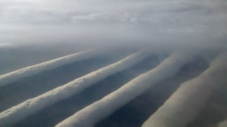
No one can deny how beautiful and terrifying Mother Nature is. It is capable of creating the most beautiful flower, as it is also capable of creating the most fearsome and dangerous beast. Meteorological phenomena are his greatest masterpiece and the one with the greatest destructive power. From tornadoes to hurricanes, also rays and typhoons ... they are all fascinating.

Morning glory are incredibly rare clouds, so much so that we still do not know how they are formed.
it is a rare meteorological phenomenon that can be observed in September and October in the southern Gulf of Carpentaria, in the northern part of Australia. A cloud morning glory is a cloud in the shape of a roll that can reach up to 1000 km long, 1 to 2 km high and can travel at speeds of up to 60 km / h. Morning glory is often accompanied by sudden gusts of wind and intense low-level shear, a rapid increase in the vertical displacement of air parcels and a strong pressure that comes to the surface. At the front of the cloud there are strong vertical movements that transport air through the cloud and create the appearance of a roll, while the air in the middle and back of the cloud becomes turbulent and sinks. The cloud can also be described as a solitary wave or a soliton, which is a wave that has a single ridge and moves without changing speed or shape.
Although it has been studied in depth, the morning glory cloud phenomenon is still not clearly understood. Regardless of the complexity behind the nature of this atmospheric phenomenon, some conclusions have been reached about the causes that give rise to the cloud. Through research, it is believed that one of the main causes of most morning glory events is due to the mesoscale circulations associated with the sea breezes that develop in the peninsula and the gulf. On a large scale, morning glory clouds are generally associated with the frontal systems that cross the center of Australia and with the high pressures in the north of this country.

FOLLOW ME: @RONNYR